Category:Maps of Charente-Maritime
Jump to navigation
Jump to search
Departments of Metropolitan France: Ain [01] · Aisne [02] · Allier [03] · Alpes-de-Haute-Provence [04] · Hautes-Alpes [05] · Alpes-Maritimes [06] · Ardèche [07] · Ardennes [08] · Ariège [09] · Aube [10] · Aude [11] · Aveyron [12] · Bouches-du-Rhône [13] · Calvados [14] · Cantal [15] · Charente [16] · Charente-Maritime [17] · Cher [18] · Corrèze [19] · Corse-du-Sud [2A]† · Haute-Corse [2B]† · Côte-d’Or [21] · Côtes-d'Armor [22] · Creuse [23] · Dordogne [24] · Doubs [25] · Drôme [26] · Eure [27] · Eure-et-Loir [28] · Finistère [29] · Gard [30] · Haute-Garonne [31] · Gers [32] · Gironde [33] · Hérault [34] · Ille-et-Vilaine [35] · Indre [36] · Indre-et-Loire [37] · Isère [38] · Jura [39] · Landes [40] · Loir-et-Cher [41] · Loire [42] · Haute-Loire [43] · Loire-Atlantique [44] · Loiret [45] · Lot [46] · Lot-et-Garonne [47] · Lozère [48] · Maine-et-Loire [49] · Manche [50] · Marne [51] · Haute-Marne [52] · Mayenne [53] · Meurthe-et-Moselle [54] · Meuse [55] · Morbihan [56] · Moselle [57] · Nièvre [58] · Nord [59] · Oise [60] · Orne [61] · Pas-de-Calais [62] · Puy-de-Dôme [63] · Pyrénées-Atlantiques [64] · Hautes-Pyrénées [65] · Pyrénées-Orientales [66] · Bas-Rhin [67] · Haut-Rhin [68] · departmental district of the Rhône [69] · Rhône [69D]‡ · Metropolis of Lyon [69M]‡ · Haute-Saône [70] · Saône-et-Loire [71] · Sarthe [72] · Savoie [73] · Haute-Savoie [74] · Paris [75] · Seine-Maritime [76] · Seine-et-Marne [77] · Yvelines [78] · Deux-Sèvres [79] · Somme [80] · Tarn [81] · Tarn-et-Garonne [82] · Var [83] · Vaucluse [84] · Vendée [85] · Vienne [86] · Haute-Vienne [87] · Vosges [88] · Yonne [89] · Territoire de Belfort [90] · Essonne [91] · Hauts-de-Seine [92] · Seine-Saint-Denis [93] · Val-de-Marne [94] · Val-d'Oise [95]
Overseas departments and regions: Guadeloupe [971] · Martinique [972] · French Guiana [973] · Réunion [974] · Mayotte [976]
Overseas collectivities: Saint Pierre and Miquelon [975] · Saint Barthélemy [977] · Saint-Martin [978] · Wallis and Futuna [986] · French Polynesia [987] · French Southern and Antarctic Lands [984]+
Sui generis territories: New Caledonia [988] · Clipperton Island [989]+
Use the appropriate category for maps showing all or a large part of Charente-Maritime. See subcategories for smaller areas:
| If the map shows | Category to use |
|---|---|
| Charente-Maritime on a recently created map | Category:Maps of Charente-Maritime or its subcategories |
| Charente-Maritime on a map created more than 70 years ago | Category:Old maps of Charente-Maritime or its subcategories |
| the history of Charente-Maritime on a recently created map | Category:Maps of the history of Charente-Maritime or its subcategories |
| the history of Charente-Maritime on a map created more than 70 years ago | Category:Old maps of the history of Charente-Maritime or its subcategories |
Wikimedia category | |||||
| Upload media | |||||
| Instance of | |||||
|---|---|---|---|---|---|
| Category combines topics | |||||
| Charente-Maritime | |||||
French department | |||||
| Instance of | |||||
| Named after | |||||
| Location |
| ||||
| Capital |
| ||||
| Head of government | |||||
| Inception |
| ||||
| Highest point | |||||
| Population |
| ||||
| Area |
| ||||
| official website | |||||
 | |||||
Subcategories
This category has the following 23 subcategories, out of 23 total.
*
D
G
H
L
M
O
R
T
Media in category "Maps of Charente-Maritime"
The following 52 files are in this category, out of 52 total.
-
17-Bassins DCE.jpg 3,507 × 2,480; 948 KB
-
17-Charente-Maritime-Sage.png 3,507 × 2,480; 1.51 MB
-
17-Pres2022-T1-1er.png 3,519 × 3,197; 2.27 MB
-
17-Pres2022-T1-abst.png 3,519 × 3,197; 2.23 MB
-
17-Pres2022-Tour2.png 4,692 × 4,263; 6.68 MB
-
17-SAGE.jpg 3,507 × 2,480; 763 KB
-
17-TRI.jpg 3,507 × 2,480; 527 KB
-
Admiralty Chart No 2910 Entrance to the Gironde River, Published 1897.jpg 16,230 × 11,119; 43.5 MB
-
Admiralty Chart No 2916 La Gironde Royan to Bordeaux, Published 1954.jpg 11,167 × 16,273; 49.96 MB
-
Aménagement de la Sèvre Niortaise et du Marais Poitevin en 1818 par Mesnager.jpg 10,063 × 5,683; 94.48 MB
-
Baie de Bonne-Anse.png 499 × 600; 173 KB
-
Basque Roads.svg 715 × 907; 437 KB
-
Blank Map of Charente-Maritime Department, France, with Communes.svg 1,000 × 1,170; 191 KB
-
Brouage-Charente-Maritime.png 1,182 × 1,503; 536 KB
-
Canto08.png 584 × 729; 60 KB
-
Carte de Charente-Inférieure.jpg 632 × 472; 97 KB
-
Carte de l'Aunis.svg 1,000 × 767; 231 KB
-
Carte de la Saintonge.svg 1,381 × 1,673; 440 KB
-
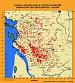
Carte des découvertes archéologiques de Jacques Dassié.jpg 2,698 × 2,999; 1.4 MB
-
Carte zones tarifaires Les Mouettes.svg 512 × 603; 184 KB
-
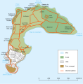
Carte Île-d'Aix.svg 736 × 747; 72 KB
-
Carteroute17.jpg 502 × 515; 132 KB
-
Charente-Maritime - Principaux axes routiers.svg 3,463 × 3,477; 185 KB
-
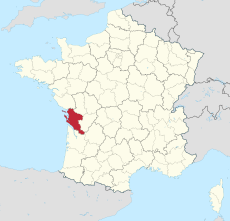
Charente-Maritime department location map.svg 942 × 1,132; 425 KB
-
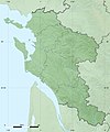
Charente-Maritime department relief location map.jpg 942 × 1,132; 282 KB
-
Charente-Maritime et provinces.svg 1,000 × 1,170; 446 KB
-
Charente-Maritime-marans.svg 942 × 1,132; 1.17 MB
-
Chart of the Road of Basque 1757.jpg 1,626 × 2,337; 551 KB
-
Doyenné de Royan.jpg 521 × 486; 86 KB
-
Eoliennes Coivert carte 1.jpg 1,654 × 848; 995 KB
-
FR Ile d Oleron.PNG 650 × 582; 17 KB
-
FR Ile de Aix.PNG 650 × 582; 17 KB
-
Iledere-ars.gif 300 × 183; 3 KB
-
Iledere-lacouarde.gif 300 × 183; 3 KB
-
Iledere-laflotte.gif 300 × 183; 3 KB
-
Iledere-lebois.gif 300 × 183; 3 KB
-
Iledere-lesportes.gif 300 × 183; 3 KB
-
Iledere-loix.gif 300 × 183; 3 KB
-
Iledere-rivedoux.gif 300 × 183; 3 KB
-
Iledere-saintclement.gif 300 × 183; 3 KB
-
Iledere-saintmarie.gif 300 × 183; 3 KB
-
Iledere-saintmartin.gif 300 × 183; 3 KB
-
Implantation géographique de Cardiosaintonge.JPEG 1,680 × 1,050; 125 KB
-
La Rochelle dot.png 1,804 × 1,689; 164 KB
-
Laredoutederivedoux.jpg 391 × 581; 43 KB
-
Map FR-A 05.jpg 179 × 179; 35 KB
-
Notre Dame de l'Estuaire.JPG 275 × 267; 33 KB
-
Pertuis d'Antioche - Charente-Maritime.png 499 × 600; 172 KB
-
Pertuis de Maumusson - Charente-Maritime.png 499 × 600; 173 KB
-
Rochefort radars.png 624 × 599; 861 KB
-
Sainte-Marie en Saintonge.JPG 317 × 240; 33 KB
-
Voies navigables region Centre ouest.jpg 704 × 541; 91 KB


