Category:Maps of counties of Northern Ireland
Jump to navigation
Jump to search
Subcategories
This category has the following 3 subcategories, out of 3 total.
Media in category "Maps of counties of Northern Ireland"
The following 32 files are in this category, out of 32 total.
-
County Antrim copy.png 741 × 611; 87 KB
-
County Armagh.png 741 × 611; 104 KB
-
County Down.png 741 × 611; 105 KB
-
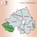
County Fermanagh.png 741 × 611; 104 KB
-
County Londonderry.png 741 × 611; 87 KB
-
County Tyrone.png 741 × 611; 87 KB
-
Island of Ireland location map Antrim.svg 931 × 701; 826 KB
-
Island of Ireland location map Armagh.svg 934 × 717; 828 KB
-
Island of Ireland location map Down.svg 931 × 701; 826 KB
-
Island of Ireland location map Fermanagh.svg 931 × 701; 819 KB
-
Island of Ireland location map Londonderry.svg 931 × 701; 826 KB
-
Island of Ireland location map Tyrone with Lake Torrent.png 1,194 × 899; 244 KB
-
Island of Ireland location map Tyrone.svg 931 × 701; 826 KB
-
IveaghOld.png 727 × 599; 109 KB
-
Location map Northern Ireland County Armagh.png 603 × 788; 393 KB
-
Location map Northern Ireland County Down.png 639 × 764; 381 KB
-
Location map Northern Ireland County Fermanagh.png 764 × 678; 298 KB
-
Location map Northern Ireland County Londonderry.png 610 × 640; 341 KB
-
Location map Northern Ireland County Tyrone.png 1,093 × 825; 565 KB
-
Map of Ireland.jpg 2,937 × 3,480; 2.54 MB
-
Map showing the traditional, geographical county of County Antrim, Northern Ireland.png 4,967 × 4,967; 3.34 MB
-
Map showing the traditional, geographical county of County Armagh, Northern Ireland.png 4,967 × 4,967; 3.19 MB
-
Map showing the traditional, geographical county of County Down, Northern Ireland.png 4,967 × 4,967; 3.19 MB
-
Map showing the traditional, geographical county of County Fermanagh, Northern Ireland.png 4,967 × 4,967; 3.26 MB
-
Map showing the traditional, geographical county of County Londonderry, Northern Ireland.png 4,967 × 4,967; 3.26 MB
-
Map showing the traditional, geographical county of County Tyrone, Northern Ireland.png 4,967 × 4,967; 3.18 MB
-
NIShape blue.png 532 × 405; 5 KB
-
Northern Ireland - Counties mk.png 1,677 × 1,426; 287 KB
-
Northern Ireland - Counties ru.png 1,677 × 1,426; 238 KB
-
Northern Ireland - Counties-HE.png 1,677 × 1,426; 265 KB
-
Northern Ireland - Counties.png 1,677 × 1,426; 229 KB
-
NorthernIrelandCoutiesNumbered.png 584 × 445; 7 KB


