Category:Counties of Northern Ireland
Jump to navigation
Jump to search
principal geographic division of Northern Ireland | |||||
| Upload media | |||||
| Subclass of | |||||
|---|---|---|---|---|---|
| Location | Northern Ireland | ||||
| Inception |
| ||||
| End time |
| ||||
| |||||
The counties of Northern Ireland existed as first-level local government divisions of Northern Ireland from its creation in 1921 until 1972, when they were replaced by 26 districts (later reduced to 11 in 2015). Northern Ireland consisted in six of the nine counties of the historical province of Ulster: Antrim, Armagh, Down, Fermanagh, Londonderry and Tyrone. Today the former counties exist only for historical and cultural purposes.
Counties of the Republic of Ireland: Carlow · Cavan · Clare · Cork(1) · Donegal · Dún Laoghaire-Rathdown(2) · Fingal(2) · Galway(3) · Kerry · Kildare · Kilkenny · Laois · Leitrim · Limerick · Longford · Louth · Mayo · Meath · Monaghan · Offaly · Roscommon · Sligo · South Dublin(2) · Tipperary(4) · Waterford · Westmeath · Wexford · Wicklow – Separate cities: Cork(1) · Dublin(2) · Galway(3) – Former counties: Dublin(2) · South Tipperary(4) Former counties of Northern Ireland: Antrim · Armagh · Down · Fermanagh · Londonderry · Tyrone
Subcategories
This category has the following 12 subcategories, out of 12 total.
*
A
D
F
L
T
Pages in category "Counties of Northern Ireland"
This category contains only the following page.
Media in category "Counties of Northern Ireland"
The following 7 files are in this category, out of 7 total.
-
Map showing the traditional, geographical counties of Northern Ireland.png 4,967 × 4,967; 3.75 MB
-
Map showing the traditional, geographical county of County Antrim, Northern Ireland.png 4,967 × 4,967; 3.34 MB
-
Map showing the traditional, geographical county of County Armagh, Northern Ireland.png 4,967 × 4,967; 3.19 MB
-
Map showing the traditional, geographical county of County Down, Northern Ireland.png 4,967 × 4,967; 3.19 MB
-
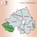
Map showing the traditional, geographical county of County Fermanagh, Northern Ireland.png 4,967 × 4,967; 3.26 MB
-
Map showing the traditional, geographical county of County Londonderry, Northern Ireland.png 4,967 × 4,967; 3.26 MB
-
Map showing the traditional, geographical county of County Tyrone, Northern Ireland.png 4,967 × 4,967; 3.18 MB


