Category:Maps of cities in South Africa
Jump to navigation
Jump to search
Countries of Africa: Algeria · Benin · Burkina Faso · Democratic Republic of the Congo · Egypt‡ · The Gambia · Kenya · Morocco · Namibia · South Africa · Sudan · Tanzania · Tunisia
‡: partly located in Africa
‡: partly located in Africa
Subcategories
This category has the following 10 subcategories, out of 10 total.
*
B
- Maps of Bloemfontein (2 F)
C
D
- Maps of Durban (28 F)
J
P
- Maps of Pietermaritzburg (6 F)
- Maps of Polokwane (2 F)
- Maps of Port Elizabeth (9 F)
Media in category "Maps of cities in South Africa"
The following 11 files are in this category, out of 11 total.
-
Ekurhuleni 2001 dominant language map.svg 778 × 1,011; 1.17 MB
-
Ekurhuleni 2001 dominant population group map.svg 778 × 1,011; 1.17 MB
-
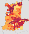
Ekurhuleni 2001 population density map.svg 778 × 1,011; 2.12 MB
-
Ekurhuleni 2011 population density map.svg 762 × 984; 492 KB
-
Nelson Mandela Bay 2001 dominant language map.svg 991 × 793; 614 KB
-
Nelson Mandela Bay 2001 dominant population group map.svg 991 × 793; 614 KB
-
Nelson Mandela Bay 2001 population density map.svg 991 × 793; 1.15 MB
-
Nelson Mandela Bay 2011 population density map.svg 913 × 822; 157 KB
-
Tshwane 2001 dominant language map.svg 821 × 958; 1.42 MB
-
Tshwane 2001 dominant population group map.svg 821 × 958; 1.42 MB
-
Tshwane 2001 population density map.svg 821 × 958; 2.41 MB


