Category:Maps of Durban
Jump to navigation
Jump to search
Wikimedia category | |||||
| Upload media | |||||
| Instance of | |||||
|---|---|---|---|---|---|
| Category combines topics | |||||
| Durban | |||||
city in KwaZulu-Natal, South Africa | |||||
| Instance of | |||||
| Named after |
| ||||
| Location |
| ||||
| Inception |
| ||||
| Population |
| ||||
| Area |
| ||||
| Elevation above sea level |
| ||||
| Different from | |||||
| official website | |||||
 | |||||
Media in category "Maps of Durban"
The following 28 files are in this category, out of 28 total.
-
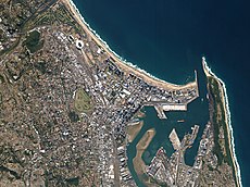
Durban, South Africa by Planet Labs.jpg 3,462 × 2,596; 3.18 MB
-
(1850) Scetch Map of the Natal Colony (compiled from scetches by Dr. Stranger).jpg 2,386 × 1,743; 2.78 MB
-
Map of the Colony of Natal, South Africa.jpg 2,324 × 3,023; 3.27 MB
-
Plan of Port Natal.jpg 1,323 × 1,934; 630 KB
-
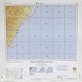
1965 Durban area map South Africa by US Army.jpg 4,696 × 4,716; 3.59 MB
-
Admiralty Chart No 577 Approaches to Durban, Published 1939.jpg 11,063 × 8,137; 19.6 MB
-
Admiralty Chart No 577 Approaches to Durban, Published 1960, Large Corrrections 1965.jpg 8,260 × 11,239; 9.71 MB
-
Admiralty Chart No 64 Port Natal, Published 1856.jpg 15,186 × 10,140; 17.99 MB
-
Admiralty Chart No 643 Durban, Published 1924.jpg 16,400 × 11,133; 46.48 MB
-
Durban Tracks.png 1,361 × 786; 820 KB
-
Durban trsp.gif 266 × 190; 12 KB
-
Durban.png 768 × 768; 690 KB
-
Ethekwini 2001 dominant language map.svg 805 × 977; 3.18 MB
-
Ethekwini 2001 dominant population group map.svg 805 × 977; 3.18 MB
-
Ethekwini 2001 population density map.svg 805 × 977; 5.66 MB
-
EThekwini 2011 LGE PR result by ward.svg 643 × 893; 534 KB
-
EThekwini 2011 LGE ward winners.svg 643 × 893; 534 KB
-
Ethekwini 2011 population density map.svg 742 × 1,011; 652 KB
-
EThekwini electoral wards 2006 blank.svg 805 × 977; 242 KB
-
EThekwini electoral wards 2011 blank.svg 643 × 893; 531 KB
-
EThekwini municipal election 2006 councillor party by ward.svg 805 × 977; 249 KB
-
EThekwini municipal election 2006 PR winner by ward.svg 805 × 977; 249 KB
-
JCW-Map-Natal-Durban.png 298 × 315; 10 KB
-
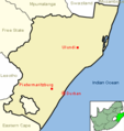
KwaZulu-Natal Municipalities showing eThekwini.png 1,147 × 862; 19 KB
-
Map of KwaZulu-Natal with Ethekwini highlighted (2006).svg 712 × 805; 659 KB
-
Natal province - descriptive guide and official hand-book (1911) (14573413680).jpg 3,982 × 3,056; 1.02 MB


