Category:Maps of cantons of Orne
Jump to navigation
Jump to search
Departments of Metropolitan France: Ain [01] · Aisne [02] · Allier [03] · Alpes-de-Haute-Provence [04] · Hautes-Alpes [05] · Alpes-Maritimes [06] · Ardèche [07] · Ardennes [08] · Ariège [09] · Aube [10] · Aude [11] · Aveyron [12] · Bouches-du-Rhône [13] · Calvados [14] · Cantal [15] · Charente [16] · Charente-Maritime [17] · Cher [18] · Corrèze [19] · Corse-du-Sud [2A]† · Haute-Corse [2B]† · Côte-d’Or [21] · Côtes-d'Armor [22] · Creuse [23] · Dordogne [24] · Doubs [25] · Drôme [26] · Eure [27] · Eure-et-Loir [28] · Finistère [29] · Gard [30] · Haute-Garonne [31] · Gers [32] · Gironde [33] · Hérault [34] · Ille-et-Vilaine [35] · Indre [36] · Indre-et-Loire [37] · Isère [38] · Jura [39] · Landes [40] · Loir-et-Cher [41] · Loire [42] · Haute-Loire [43] · Loire-Atlantique [44] · Loiret [45] · Lot [46] · Lot-et-Garonne [47] · Lozère [48] · Maine-et-Loire [49] · Manche [50] · Marne [51] · Haute-Marne [52] · Mayenne [53] · Meurthe-et-Moselle [54] · Meuse [55] · Morbihan [56] · Moselle [57] · Nièvre [58] · Nord [59] · Oise [60] · Orne [61] · Pas-de-Calais [62] · Puy-de-Dôme [63] · Pyrénées-Atlantiques [64] · Hautes-Pyrénées [65] · Pyrénées-Orientales [66] · Bas-Rhin [67] · Haut-Rhin [68] · departmental district of the Rhône [69] · Haute-Saône [70] · Saône-et-Loire [71] · Sarthe [72] · Savoie [73] · Haute-Savoie [74] · Seine-Maritime [76] · Seine-et-Marne [77] · Yvelines [78] · Deux-Sèvres [79] · Somme [80] · Tarn [81] · Tarn-et-Garonne [82] · Var [83] · Vaucluse [84] · Vendée [85] · Vienne [86] · Haute-Vienne [87] · Vosges [88] · Yonne [89] · Territoire de Belfort [90] · Essonne [91] · Hauts-de-Seine [92] · Seine-Saint-Denis [93] · Val-de-Marne [94] · Val-d'Oise [95]
Overseas departments and regions: Guadeloupe [971] · Martinique [972] · French Guiana [973] · Mayotte [976]
Overseas departments and regions: Guadeloupe [971] · Martinique [972] · French Guiana [973] · Mayotte [976]
Subcategories
This category has the following 3 subcategories, out of 3 total.
*
Media in category "Maps of cantons of Orne"
The following 65 files are in this category, out of 65 total.
-
Cantons de l'Orne 2015.svg 964 × 634; 1.15 MB
-
Cantons de l'Orne 2021.svg 800 × 526; 114 KB
-
Département Orne Arrondissement Kantone 2019.png 2,499 × 1,739; 932 KB
-
Département Orne Kantone 2019.png 2,499 × 1,739; 903 KB
-
MapCanton2012-6101-Alençon2.jpg 625 × 655; 60 KB
-
MapCanton2012-6102-Alençon1.jpg 1,086 × 958; 258 KB
-
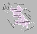
MapCanton2012-6103-ArgentanEst.jpg 601 × 552; 79 KB
-
MapCanton2012-6104-AthisDeLOrne.jpg 856 × 838; 247 KB
-
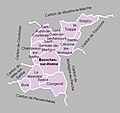
MapCanton2012-6105-BazochesSurHoëne.jpg 914 × 860; 211 KB
-
MapCanton2012-6106-Bellême.jpg 886 × 1,049; 238 KB
-
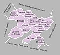
MapCanton2012-6107-Briouze.jpg 898 × 821; 239 KB
-
MapCanton2012-6108-Carrouges.jpg 1,574 × 870; 396 KB
-
MapCanton2012-6109-Courtomer.jpg 935 × 763; 217 KB
-
MapCanton2012-6110-Domfront.jpg 1,173 × 1,294; 271 KB
-
MapCanton2012-6111-Écouché.jpg 926 × 910; 207 KB
-
MapCanton2012-6112-Exmes.jpg 1,066 × 812; 206 KB
-
MapCanton2012-6113-LaFertéFrênel.jpg 1,109 × 957; 276 KB
-
MapCanton2012-6114-LaFertéMacé.jpg 825 × 1,033; 202 KB
-
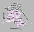
MapCanton2012-6115-FlersNord.jpg 721 × 660; 132 KB
-
MapCanton2012-6116-Gacé.jpg 832 × 846; 191 KB
-
MapCanton2012-6117-JuvignySousAndaine.jpg 905 × 736; 195 KB
-
MapCanton2012-6118-LAigleEst.jpg 752 × 867; 193 KB
-
MapCanton2012-6119-LongnyAuPerche.jpg 1,081 × 856; 235 KB
-
MapCanton2012-6120-LeMêleSurSarthe.jpg 1,020 × 732; 226 KB
-
MapCanton2012-6121-LeMerlerault.jpg 1,152 × 611; 196 KB
-
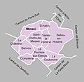
MapCanton2012-6122-Messei.jpg 803 × 782; 172 KB
-
MapCanton2012-6123-MortagneAuPerche.jpg 828 × 930; 236 KB
-
MapCanton2012-6124-Mortrée.jpg 1,171 × 728; 227 KB
-
MapCanton2012-6125-MoulinsLaMarche.jpg 1,015 × 789; 237 KB
-
MapCanton2012-6126-Nocé.jpg 847 × 933; 212 KB
-
MapCanton2012-6127-Passais.jpg 888 × 895; 198 KB
-
MapCanton2012-6128-Pervenchères.jpg 1,051 × 894; 244 KB
-
MapCanton2012-6129-PutangesPontÉcrepin.jpg 1,124 × 759; 309 KB
-
MapCanton2012-6130-Rémalard.jpg 1,167 × 921; 261 KB
-
MapCanton2012-6131-Sées.jpg 1,083 × 832; 224 KB
-
MapCanton2012-6132-LeTheil.jpg 1,160 × 806; 222 KB
-
MapCanton2012-6133-Tinchebray.jpg 1,032 × 926; 266 KB
-
MapCanton2012-6134-Tourouvre.jpg 1,107 × 890; 255 KB
-
MapCanton2012-6135-Trun.jpg 1,104 × 802; 303 KB
-
MapCanton2012-6136-Vimoutiers.jpg 1,296 × 747; 299 KB
-
MapCanton2012-6137-LAigleOuest.jpg 665 × 644; 107 KB
-
MapCanton2012-6138-Alençon3.jpg 818 × 722; 155 KB
-
MapCanton2012-6139-ArgentanOuest.jpg 745 × 693; 133 KB
-
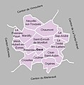
MapCanton2012-6140-FlersSud.jpg 912 × 590; 136 KB
-
Orne - Canton Alençon-1 2015.svg 964 × 634; 1.15 MB
-
Orne - Canton Alençon-2 2015.svg 964 × 634; 1.15 MB
-
Orne - Canton Argentan-1 2015.svg 964 × 634; 1.15 MB
-
Orne - Canton Argentan-2 2015.svg 964 × 634; 1.15 MB
-
Orne - Canton Athis-de-l'Orne 2015.svg 964 × 634; 1.15 MB
-
Orne - Canton Bagnoles-de-l'Orne 2015.svg 964 × 634; 1.15 MB
-
Orne - Canton Bretoncelles 2015.svg 964 × 634; 1.15 MB
-
Orne - Canton Ceton 2015.svg 964 × 634; 1.15 MB
-
Orne - Canton Damigny 2015.svg 964 × 634; 1.15 MB
-
Orne - Canton Domfront 2015.svg 964 × 634; 1.15 MB
-
Orne - Canton Flers-1 2015.svg 964 × 634; 1.15 MB
-
Orne - Canton Flers-2 2015.svg 964 × 634; 1.15 MB
-
Orne - Canton L'Aigle 2015.svg 964 × 634; 1.15 MB
-
Orne - Canton La Ferté-Macé 2015.svg 964 × 634; 1.15 MB
-
Orne - Canton Magny-le-Désert 2015.svg 964 × 634; 1.15 MB
-
Orne - Canton Mortagne-au-Perche 2015.svg 964 × 634; 1.15 MB
-
Orne - Canton Radon 2015.svg 964 × 634; 1.15 MB
-
Orne - Canton Rai 2015.svg 964 × 634; 1.15 MB
-
Orne - Canton Sées 2015.svg 964 × 634; 1.15 MB
-
Orne - Canton Tourouvre 2015.svg 964 × 634; 1.15 MB
-
Orne - Canton Vimoutiers 2015.svg 964 × 634; 1.15 MB


