Category:Maps of cantons of Mayenne
Jump to navigation
Jump to search
Departments of Metropolitan France: Ain [01] · Aisne [02] · Allier [03] · Alpes-de-Haute-Provence [04] · Hautes-Alpes [05] · Alpes-Maritimes [06] · Ardèche [07] · Ardennes [08] · Ariège [09] · Aube [10] · Aude [11] · Aveyron [12] · Bouches-du-Rhône [13] · Calvados [14] · Cantal [15] · Charente [16] · Charente-Maritime [17] · Cher [18] · Corrèze [19] · Corse-du-Sud [2A]† · Haute-Corse [2B]† · Côte-d’Or [21] · Côtes-d'Armor [22] · Creuse [23] · Dordogne [24] · Doubs [25] · Drôme [26] · Eure [27] · Eure-et-Loir [28] · Finistère [29] · Gard [30] · Haute-Garonne [31] · Gers [32] · Gironde [33] · Hérault [34] · Ille-et-Vilaine [35] · Indre [36] · Indre-et-Loire [37] · Isère [38] · Jura [39] · Landes [40] · Loir-et-Cher [41] · Loire [42] · Haute-Loire [43] · Loire-Atlantique [44] · Loiret [45] · Lot [46] · Lot-et-Garonne [47] · Lozère [48] · Maine-et-Loire [49] · Manche [50] · Marne [51] · Haute-Marne [52] · Mayenne [53] · Meurthe-et-Moselle [54] · Meuse [55] · Morbihan [56] · Moselle [57] · Nièvre [58] · Nord [59] · Oise [60] · Orne [61] · Pas-de-Calais [62] · Puy-de-Dôme [63] · Pyrénées-Atlantiques [64] · Hautes-Pyrénées [65] · Pyrénées-Orientales [66] · Bas-Rhin [67] · Haut-Rhin [68] · departmental district of the Rhône [69] · Haute-Saône [70] · Saône-et-Loire [71] · Sarthe [72] · Savoie [73] · Haute-Savoie [74] · Seine-Maritime [76] · Seine-et-Marne [77] · Yvelines [78] · Deux-Sèvres [79] · Somme [80] · Tarn [81] · Tarn-et-Garonne [82] · Var [83] · Vaucluse [84] · Vendée [85] · Vienne [86] · Haute-Vienne [87] · Vosges [88] · Yonne [89] · Territoire de Belfort [90] · Essonne [91] · Hauts-de-Seine [92] · Seine-Saint-Denis [93] · Val-de-Marne [94] · Val-d'Oise [95]
Overseas departments and regions: Guadeloupe [971] · Martinique [972] · French Guiana [973] · Mayotte [976]
Overseas departments and regions: Guadeloupe [971] · Martinique [972] · French Guiana [973] · Mayotte [976]
Subcategories
This category has the following 4 subcategories, out of 4 total.
*
Media in category "Maps of cantons of Mayenne"
The following 53 files are in this category, out of 53 total.
-
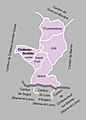
 Cantons de la Mayenne 2015.svg 961 × 1,013; 24 KB
-
 Cantons de la Mayenne 2021.svg 569 × 600; 93 KB
-
 Département Mayenne Arrondissement Kantone 2021.png 2,500 × 2,135; 893 KB
-
 Département Mayenne Kantone 2021.png 2,500 × 2,135; 869 KB
-
 MapCanton2012-5301-AmbrièresLesVallées.jpg 1,055 × 961; 204 KB
-
 MapCanton2012-5302-Argentré.jpg 855 × 1,092; 201 KB
-
 MapCanton2012-5303-Bais.jpg 1,411 × 747; 202 KB
-
 MapCanton2012-5304-Bierné.jpg 1,144 × 877; 215 KB
-
 MapCanton2012-5305-Chailland.jpg 1,365 × 912; 244 KB
-
 MapCanton2012-5306-ChâteauGontierOuest.jpg 755 × 1,148; 207 KB
-
 MapCanton2012-5307-CosséLeVivien.jpg 1,523 × 809; 246 KB
-
 MapCanton2012-5308-Couptrain.jpg 1,000 × 994; 214 KB
-
 MapCanton2012-5309-Craon.jpg 1,025 × 912; 229 KB
-
 MapCanton2012-5310-Ernée.jpg 1,049 × 761; 157 KB
-
 MapCanton2012-5311-Évron.jpg 1,208 × 757; 204 KB
-
 MapCanton2012-5312-Gorron.jpg 961 × 934; 192 KB
-
 MapCanton2012-5313-GrezEnBouère.jpg 1,282 × 816; 244 KB
-
 MapCanton2012-5314-LeHorps.jpg 1,085 × 807; 173 KB
-
 MapCanton2012-5315-Landivy.jpg 1,061 × 956; 235 KB
-
 MapCanton2012-5316-LassayLesChâteaux.jpg 883 × 713; 161 KB
-
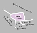
 MapCanton2012-5317-LavalNordEst.jpg 987 × 867; 172 KB
-
 MapCanton2012-5318-LavalOuest.jpg 554 × 488; 56 KB
-
 MapCanton2012-5319-Loiron.jpg 956 × 1,140; 274 KB
-
 MapCanton2012-5320-MayenneEst.jpg 1,141 × 1,099; 249 KB
-
 MapCanton2012-5321-MayenneOuest.jpg 846 × 1,066; 183 KB
-
 MapCanton2012-5322-MeslayDuMaine.jpg 1,397 × 758; 285 KB
-
 MapCanton2012-5323-Montsûrs.jpg 630 × 999; 176 KB
-
 MapCanton2012-5324-PréEnPail.jpg 957 × 825; 169 KB
-
 MapCanton2012-5325-SaintAignanSurRoë.jpg 933 × 931; 214 KB
-
 MapCanton2012-5326-SainteSuzanne.jpg 1,180 × 835; 204 KB
-
 MapCanton2012-5327-VillainesLaJuhel.jpg 1,094 × 1,002; 214 KB
-
 MapCanton2012-5328-LavalEst.jpg 760 × 1,075; 172 KB
-
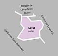 MapCanton2012-5329-LavalSudOuest.jpg 638 × 621; 59 KB
-
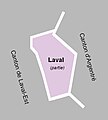 MapCanton2012-5330-LavalSaintNicolas.jpg 477 × 529; 43 KB
-
 MapCanton2012-5331-ChâteauGontierEst.jpg 730 × 1,022; 159 KB
-
 MapCanton2012-5332-SaintBerthevin.jpg 874 × 953; 184 KB
-
 Mayenne - Canton Azé 2015.svg 961 × 1,013; 25 KB
-
 Mayenne - Canton Bonchamp-lès-Laval 2015.svg 961 × 1,013; 25 KB
-
 Mayenne - Canton Château-Gontier 2015.svg 961 × 1,013; 25 KB
-
 Mayenne - Canton Cossé-le-Vivien 2015.svg 961 × 1,013; 25 KB
-
 Mayenne - Canton Ernée 2015.svg 961 × 1,013; 25 KB
-
 Mayenne - Canton Gorron 2015.svg 961 × 1,013; 25 KB
-
 Mayenne - Canton L'Huisserie 2015.svg 961 × 1,013; 25 KB
-
 Mayenne - Canton Lassay-les-Châteaux 2015.svg 961 × 1,013; 25 KB
-
 Mayenne - Canton Laval-1 2015.svg 961 × 1,013; 25 KB
-
 Mayenne - Canton Laval-2 2015.svg 961 × 1,013; 25 KB
-
 Mayenne - Canton Laval-3 2015.svg 961 × 1,013; 25 KB
-
 Mayenne - Canton Loiron 2015.svg 961 × 1,013; 25 KB
-
 Mayenne - Canton Mayenne 2015.svg 961 × 1,013; 25 KB
-
 Mayenne - Canton Meslay-du-Maine 2015.svg 961 × 1,013; 25 KB
-
 Mayenne - Canton Saint-Berthevin 2015.svg 961 × 1,013; 25 KB
-
 Mayenne - Canton Villaines-la-Juhel 2015.svg 961 × 1,013; 25 KB
-
 Mayenne - Canton Évron 2015.svg 961 × 1,013; 25 KB


