Category:Maps of archaeological sites in Germany
Jump to navigation
Jump to search
Media in category "Maps of archaeological sites in Germany"
The following 14 files are in this category, out of 14 total.
-
Alte Schanz Zorn.JPG 285 × 153; 17 KB
-
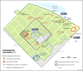
Archäologischer Park Xanten DE.png 1,960 × 1,700; 625 KB
-
Befundplan Biesenheim.jpg 925 × 845; 90 KB
-
Befundplan Kastell Isny.jpg 2,505 × 1,137; 194 KB
-
Heidelberg in römischer Zeit.png 725 × 476; 23 KB
-
Heuneburg map.png 767 × 770; 397 KB
-
Image-Roman Cologne, reconstruction2 praetorium.jpg 1,322 × 717; 148 KB
-
Isis-sanctuaire-Mayence sans-legende.png 1,070 × 696; 77 KB
-
Karte Danewerk.jpg 1,015 × 816; 288 KB
-
Parco archeologico di Xanten.png 637 × 490; 101 KB
-
Roman Cologne, reconstruction.JPG 2,053 × 1,113; 783 KB
-
Wegeführung auf dem Kapellenberg.JPG 2,736 × 3,648; 3.45 MB
-
Übersicht Ringwall Kapellenberg.JPG 2,736 × 3,648; 3.57 MB


