Category:Archaeological maps of Europe
Jump to navigation
Jump to search
Archaeological maps of Europe.
Subcategories
This category has the following 19 subcategories, out of 19 total.
*
A
F
G
I
R
S
T
U
Media in category "Archaeological maps of Europe"
The following 14 files are in this category, out of 14 total.
-
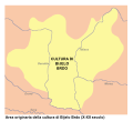
Bijelo Brdo Culture-it.svg 760 × 684; 92 KB
-
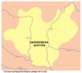
Bijelo brdo culture01.png 1,048 × 937; 47 KB
-
Bijelo brdo culture02.png 1,048 × 937; 47 KB
-
Corpus der römischen Funde im europäischen Barbaricum. Polen 4. Lubliner Land (map 1 to 450,000).jpg 9,921 × 14,409; 15.71 MB
-
Corpus der römischen Funde im europäischen Barbaricum. Polen 4. Lubliner Land (verso).pdf 2,479 × 3,602; 1.59 MB
-
Distribution of pictographs in Sweden.jpg 332 × 750; 128 KB
-
Línea de rotura histórica en Europa.png 1,817 × 1,120; 122 KB
-
Mapa paleolitických nalezist.jpg 636 × 587; 106 KB
-
OldestCitiesContinuouslyInhabitedInEuropeToPresentDay.svg 1,356 × 1,171; 1.46 MB
-
Rota do âmbar.jpg 411 × 599; 69 KB
-
Treasure from Stary Dzedzin.png 873 × 598; 1.07 MB


