Category:Maps of Westchester County, New York
Jump to navigation
Jump to search
Counties of New York (state): Albany · Allegany · Bronx · Broome · Cattaraugus · Cayuga · Chautauqua · Chemung · Chenango · Clinton · Columbia · Cortland · Delaware · Dutchess · Erie · Essex · Franklin · Fulton · Genesee · Greene · Hamilton · Herkimer · Jefferson · Kings · Lewis · Livingston · Madison · Monroe · Montgomery · Nassau · New York · Niagara · Oneida · Onondaga · Ontario · Orange · Orleans · Oswego · Otsego · Putnam · Queens · Rensselaer · Richmond · Rockland · Saratoga · Schenectady · Schoharie · Schuyler · Seneca · St. Lawrence · Steuben · Suffolk · Sullivan · Tioga · Tompkins · Ulster · Warren · Washington · Wayne · Westchester · Wyoming · Yates
Wikimedia category | |||||
| Upload media | |||||
| Instance of | |||||
|---|---|---|---|---|---|
| Category combines topics | |||||
| Westchester County | |||||
county in the State of New York, United States; Connector between New York City/Long Island and the rest of New York | |||||
| Instance of | |||||
| Named after | |||||
| Location | New York | ||||
| Capital | |||||
| Head of government |
| ||||
| Inception |
| ||||
| Population |
| ||||
| Area |
| ||||
| Elevation above sea level |
| ||||
| Different from | |||||
| official website | |||||
 | |||||
Subcategories
This category has the following 6 subcategories, out of 6 total.
Media in category "Maps of Westchester County, New York"
The following 42 files are in this category, out of 42 total.
-
Area code 914.png 400 × 465; 33 KB
-
Bedford Road Historic District map.svg 749 × 361; 64 KB
-
Index NYPL2055645.tiff 5,381 × 7,175, 2 pages; 110.73 MB
-
Index NYPL2055949.tiff 5,394 × 7,192, 2 pages; 111.25 MB
-
Map of New Rochelle, New York communities.png 942 × 1,789; 173 KB
-
Map of New York highlighting Westchester County.svg 1,100 × 838; 66 KB
-
MountVernonNeighborhood.PNG 323 × 382; 18 KB
-
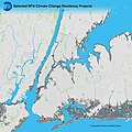
MTA Resiliency Projects Map (33441628404).jpg 1,910 × 1,910; 2.16 MB
-
New Rochelle Containment Area March 2020.svg 835 × 741; 189 KB
-
New York's 16th congressional district (new version) (since 2025).svg 1,600 × 1,069; 1.54 MB
-
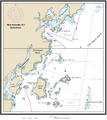
NOAA Chart 12366 (2008).jpg 9,398 × 8,843; 12.63 MB
-
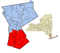
Northern & Southern Westchester map.svg 512 × 454; 111 KB
-
Northern-southern Westchester proposed boundary for NRHP lists.PNG 884 × 1,031; 198 KB
-
NRHA 1.png 2,202 × 2,478; 2.02 MB
-
NTSB Valhalla train crash Brody route map.png 779 × 522; 339 KB
-
NYStateMap.PNG 426 × 333; 23 KB
-
NYStateMap2.PNG 422 × 332; 11 KB
-
Peekskill NY.png 422 × 359; 6 KB
-
Philipsburg manor map.png 1,000 × 1,392; 525 KB
-
PoughkeepsieMap.tif 921 × 708; 2.49 MB
-
New York State Senate District 34 (2012).png 2,740 × 2,480; 547 KB
-
New York State Senate District 35 (2012).png 3,259 × 2,492; 398 KB
-
New York State Senate District 36 (2012).png 2,740 × 2,480; 537 KB
-
New York State Senate District 37 (2012).png 3,259 × 2,492; 399 KB
-
New York State Senate District 38 (2012).png 3,259 × 2,492; 398 KB
-
New York State Senate District 40 (2012).png 3,259 × 2,492; 400 KB
-
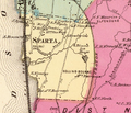
Sparta-Ossining-New-York-1868.png 971 × 830; 1.37 MB
-
Town Hall, Salem Center, Westchester County, NY HABS NY,60-SAL,1- (sheet 0 of 7).tif 9,312 × 7,584; 191 KB
-
Westchester County map.jpg 542 × 619; 215 KB
-
Westchester EmploymentSites.PNG 884 × 1,074; 182 KB
-
Westchester Income Map2.PNG 3,307 × 3,659; 947 KB
-
Westchester Minority Map.PNG 1,066 × 1,188; 140 KB
-
Westchester Municipalities (updated).png 884 × 1,031; 208 KB
-
Westchester Municipalities.PNG 884 × 1,031; 160 KB
-
Westchester Parks.PNG 884 × 1,080; 258 KB
-
Westchester Population.PNG 884 × 1,031; 236 KB
-
Westchester School Districts.PNG 884 × 1,074; 196 KB
-
White Plains NY Locator Map.png 1,024 × 909; 233 KB

