
Category:Maps of Otsego County, New York
Counties of New York (state): Albany · Allegany · Bronx · Broome · Cattaraugus · Cayuga · Chautauqua · Chemung · Chenango · Clinton · Columbia · Cortland · Delaware · Dutchess · Erie · Essex · Franklin · Fulton · Genesee · Greene · Hamilton · Herkimer · Jefferson · Kings · Lewis · Livingston · Madison · Monroe · Montgomery · Nassau · New York · Niagara · Oneida · Onondaga · Ontario · Orange · Orleans · Oswego · Otsego · Putnam · Queens · Rensselaer · Richmond · Rockland · Saratoga · Schenectady · Schoharie · Schuyler · Seneca · St. Lawrence · Steuben · Suffolk · Sullivan · Tioga · Tompkins · Ulster · Warren · Washington · Wayne · Westchester · Wyoming · Yates
Wikimedia category | |||||
| Upload media | |||||
| Instance of | |||||
|---|---|---|---|---|---|
| Category combines topics | |||||
| Otsego County | |||||
county in New York, United States   | |||||
| Instance of | |||||
| Location | New York | ||||
| Capital | |||||
| Inception |
| ||||
| Population |
| ||||
| Area |
| ||||
| Different from | |||||
| official website | |||||
 | |||||
Media in category "Maps of Otsego County, New York"
The following 30 files are in this category, out of 30 total.
-
 Atlas of Otsego Co., New York. NYPL1602736.tiff 5,428 × 7,230; 112.28 MB
-
 George Croghan's Otsego Patents.png 1,358 × 1,152; 567 KB
-
 Map of New York highlighting Otsego County.svg 1,100 × 838; 66 KB
-
 Otsego County 1791.png 1,138 × 1,563; 727 KB
-
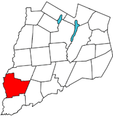
 Otsego County outline map Burlington red.png 180 × 191; 19 KB
-
 Otsego County outline map Butternuts red.png 180 × 191; 19 KB
-
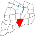
 Otsego County outline map Cherry Valley red.png 180 × 191; 19 KB
-
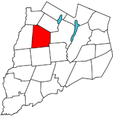
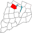
 Otsego County outline map Decatur red.png 180 × 183; 19 KB
-
 Otsego County outline map Edmeston red.png 180 × 191; 19 KB
-
 Otsego County outline map Exeter red.png 180 × 191; 19 KB
-
 Otsego County outline map Hartwick red.png 180 × 191; 19 KB
-
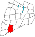
 Otsego County outline map Laurens red.png 180 × 191; 19 KB
-
 Otsego County outline map Maryland red.png 180 × 191; 19 KB
-
 Otsego County outline map Middlefield red.png 180 × 191; 18 KB
-
 Otsego County outline map Milford red.png 180 × 191; 19 KB
-
 Otsego County outline map Morris red.png 180 × 183; 19 KB
-
 Otsego County outline map New Lisbon red.png 180 × 191; 19 KB
-
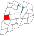
 Otsego County outline map Oneonta red.png 180 × 191; 19 KB
-
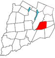
 Otsego County outline map Otego red.png 180 × 191; 19 KB
-
 Otsego County outline map Otsego red.png 180 × 191; 19 KB
-
 Otsego County outline map Pittsfield red.png 180 × 191; 19 KB
-
 Otsego County outline map Plainfield red.png 180 × 191; 19 KB
-
 Otsego County outline map Richfield red.png 180 × 191; 18 KB
-
 Otsego County outline map Roseboom red.png 180 × 191; 19 KB
-
 Otsego County outline map Springfield red.png 180 × 191; 18 KB
-
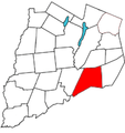
 Otsego County outline map Unadilla red.png 180 × 183; 19 KB
-
 Otsego County outline map Westford red.png 180 × 191; 19 KB
-
 Otsego Town of Burlington.png 745 × 786; 255 KB
-
 New York State Senate District 51 (2012).png 3,259 × 2,492; 405 KB
-
 Simeon DeWitt Otsego County NY c.1792.png 729 × 1,044; 431 KB


.png)
