Category:Maps of Werther (Westfalen)
Jump to navigation
Jump to search
Kreis Gütersloh  Borgholzhausen · Gütersloh · Halle · Harsewinkel · Herzebrock-Clarholz · Langenberg · Rheda-Wiedenbrück · Rietberg · Schloß Holte-Stukenbrock · Steinhagen · Verl · Versmold · Werther ·
| NO WIKIDATA ID FOUND! Search for Maps of Werther (Westfalen) on Wikidata | |
| Upload media |
Media in category "Maps of Werther (Westfalen)"
The following 16 files are in this category, out of 16 total.
-
Admin Amt Werther GT.svg 416 × 312; 98 KB
-
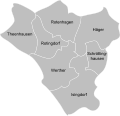
Admin Werther Westfalen GT.svg 589 × 569; 104 KB
-
Lage der Stadt Werther (Westf.) in Deutschland.png 188 × 235; 5 KB
-
Lage Werther im Kreis Gütersloh.png 438 × 435; 22 KB
-
North rhine w gt Werther.png 827 × 827; 308 KB
-
Ortsteile Werther (Westf.) - Häger.svg 589 × 569; 104 KB
-
Ortsteile Werther (Westf.) - Isingdorf.svg 589 × 569; 104 KB
-
Ortsteile Werther (Westf.) - Rotenhagen.svg 589 × 569; 104 KB
-
Ortsteile Werther (Westf.) - Rotingdorf.svg 589 × 569; 104 KB
-
Ortsteile Werther (Westf.) - Schröttinghausen.svg 589 × 569; 104 KB
-
Ortsteile Werther (Westf.) - Theenhausen.svg 589 × 569; 104 KB
-
Ortsteile Werther (Westf.) - Werther.svg 589 × 569; 104 KB
-
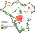
Werther (Westf.) - land utilization.svg 860 × 807; 277 KB
-
Werther (Westf.) in GT.svg 485 × 470; 301 KB
-
Werther geothermische Karte.png 760 × 597; 49 KB
-
Werther Nutzung.png 860 × 807; 143 KB


