Category:Maps of Halle (Westfalen)
Jump to navigation
Jump to search
Kreis Gütersloh  Borgholzhausen · Gütersloh · Halle · Harsewinkel · Herzebrock-Clarholz · Langenberg · Rheda-Wiedenbrück · Rietberg · Schloß Holte-Stukenbrock · Steinhagen · Verl · Versmold · Werther ·
| NO WIKIDATA ID FOUND! Search for Maps of Halle (Westfalen) on Wikidata | |
| Upload media |
Subcategories
This category has only the following subcategory.
Media in category "Maps of Halle (Westfalen)"
The following 41 files are in this category, out of 41 total.
-
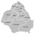
Admin Halle Westfalen GT.svg 1,260 × 1,273; 168 KB
-
Amt Halle Map.svg 724 × 688; 188 KB
-
Borgholzhausen - NSG Ravensberg - Barenberg - Map.svg 753 × 331; 95 KB
-
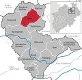
Halle (Westf.) in GT.svg 485 × 470; 301 KB
-
Halle (Westfalen) - land utilization.svg 1,020 × 915; 541 KB
-
Halle (Westfalen) - nature reserves.svg 910 × 835; 506 KB
-
Halle (Westfalen) - NSG Barrelpäule - Map.png 1,306 × 895; 432 KB
-
Halle (Westfalen) - NSG Barrelpäule - Map.svg 566 × 333; 58 KB
-
Halle (Westfalen) - NSG Feuchtwiesen Hörste - Map.png 1,249 × 925; 818 KB
-
Halle (Westfalen) - NSG Feuchtwiesen Hörste - Map.svg 842 × 546; 309 KB
-
Halle (Westfalen) - NSG Gartnischberg - Map.png 946 × 1,073; 639 KB
-
Halle (Westfalen) - NSG Gartnischberg - Map.svg 443 × 477; 223 KB
-
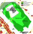
Halle (Westfalen) - NSG Großer Berg - Hellberg - Map.png 680 × 601; 274 KB
-
Halle (Westfalen) - NSG Großer Berg - Hellberg - Map.svg 491 × 506; 106 KB
-
Halle (Westfalen) - NSG Hesselner Berge - Map.png 873 × 693; 381 KB
-
Halle (Westfalen) - NSG Knüll - Storkenberg - Map.png 716 × 539; 257 KB
-
Halle (Westfalen) - NSG Knüll - Storkenberg - Map.svg 636 × 493; 89 KB
-
Halle (Westfalen) - NSG Steinbruch Schneiker - Map.png 697 × 697; 236 KB
-
Halle (Westfalen) - NSG Tatenhauser Wald - Map.png 597 × 508; 286 KB
-
Halle (Westfalen) - NSG Tatenhauser Wald - Map.svg 800 × 600; 548 KB
-
Halle (Westfalen) - Steinbruch Schneiker - Map.svg 1,003 × 958; 356 KB
-
Halle - Geothermal Yield.svg 470 × 362; 376 KB
-
Halle Schloss Tatenhausen Lageplan.png 1,144 × 858; 119 KB
-
Halle Stadtplan 1784.jpg 1,950 × 1,400; 611 KB
-
Halle Stockkaempen Lageplan.png 730 × 784; 210 KB
-
Halle-(Westf.) - nature reserves.png 1,050 × 959; 1.11 MB
-
Halle-phys-1.png 724 × 616; 61 KB
-
Lage der Stadt Halle (Westf.) in Deutschland.png 188 × 235; 5 KB
-
Lage Halle Westf im Kreis Gütersloh.png 438 × 435; 18 KB
-
North rhine w gt Halle.png 838 × 838; 322 KB
-
Ortsteile Halle (Westfalen) - Ascheloh.svg 1,260 × 1,273; 169 KB
-
Ortsteile Halle (Westfalen) - Bokel.svg 1,260 × 1,273; 168 KB
-
Ortsteile Halle (Westfalen) - Eggeberg.svg 1,260 × 1,273; 169 KB
-
Ortsteile Halle (Westfalen) - Gartnisch.svg 1,260 × 1,273; 169 KB
-
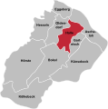
Ortsteile Halle (Westfalen) - Halle.svg 1,260 × 1,273; 169 KB
-
Ortsteile Halle (Westfalen) - Hesseln.svg 1,260 × 1,273; 168 KB
-
Ortsteile Halle (Westfalen) - Hörste.svg 1,260 × 1,273; 168 KB
-
Ortsteile Halle (Westfalen) - Kölkebeck.svg 1,260 × 1,273; 168 KB
-
Ortsteile Halle (Westfalen) - Künsebeck.svg 1,260 × 1,273; 168 KB
-
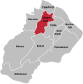
Ortsteile Halle (Westfalen) - Oldendorf.svg 1,260 × 1,273; 169 KB
-
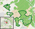
Steinhagen (Westfalen) - NSG Feuchtwiese Vennheide - Map.svg 524 × 340; 69 KB

