Category:Maps of Székely Land
Jump to navigation
Jump to search
Wikimedia category | |||||
| Upload media | |||||
| Instance of | |||||
|---|---|---|---|---|---|
| Category combines topics | |||||
| Székely Land | |||||
historical region in Transylvania | |||||
| Instance of | |||||
| Part of | |||||
| Location | Transylvania | ||||
 | |||||
Subcategories
This category has the following 2 subcategories, out of 2 total.
*
- Maps of the Székelys (4 F)
F
Pages in category "Maps of Székely Land"
This category contains only the following page.
Media in category "Maps of Székely Land"
The following 52 files are in this category, out of 52 total.
-
1878. Geologische Karte des Szeklerlandes - von Dr Franz Herbich - btv1b530230822.jpg 7,706 × 8,965; 9.2 MB
-
Aranyos map.PNG 1,139 × 920; 79 KB
-
Aranyos seat's in Alba and Cluj county.png 1,000 × 1,697; 296 KB
-
Aranyos seat's parts Alba county.png 1,000 × 987; 27 KB
-
Aranyos seat's parts Cluj county.png 944 × 827; 180 KB
-
Bardóc-Miklósvárszék.png 1,183 × 1,091; 105 KB
-
Csíkszék.png 1,183 × 1,091; 105 KB
-
East-hungary16th.PNG 310 × 260; 37 KB
-
EU location ROM Szekelyfold.png 1,600 × 1,200; 919 KB
-
Greater austria.png 1,500 × 1,280; 45 KB
-
Gyergyószék.png 1,183 × 1,091; 105 KB
-
Gyimesfelsőlok map.png 364 × 386; 39 KB
-
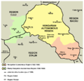
Hungarian autonomous province01.png 443 × 371; 5 KB
-
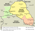
Hungarian autonomous province02 (hun).svg 710 × 647; 73 KB
-
Hungarian autonomous province02.png 751 × 727; 60 KB
-
Magyar Autonomous Region.png 619 × 599; 103 KB
-
Hungary 13th cent corrected.png 1,757 × 1,307; 458 KB
-
Hungary 13th cent.png 1,757 × 1,307; 451 KB
-
Hungary 13th century hu.svg 1,757 × 1,307; 557 KB
-
Hungary 13th century.png 1,757 × 1,307; 356 KB
-
Kézdiszék.png 1,183 × 1,091; 106 KB
-
Marosszék.png 1,183 × 1,091; 106 KB
-
Mures (Maros) county ethnic.PNG 643 × 1,137; 55 KB
-
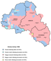
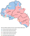
Mures Harghita and Covasna ethnic map(1992) BG.png 655 × 600; 78 KB
-
Orbaiszék.png 1,183 × 1,091; 106 KB
-
Sepsiszék.png 1,183 × 1,091; 106 KB
-
Szekely Land issues final (hun).svg 1,100 × 1,488; 407 KB
-
Szekely Land issues final.svg 1,100 × 1,488; 1.06 MB
-
Szekely Land issues.svg 1,100 × 1,488; 1.06 MB
-
Szekely03 map1992hun.png 1,152 × 1,365; 45 KB
-
Szekely03 map2002hun.png 1,152 × 1,365; 47 KB
-
Szekely03 original map.png 1,152 × 1,365; 99 KB
-
Szekely03-nl.png 1,152 × 1,365; 95 KB
-
Szekely03.png 1,152 × 1,365; 100 KB
-
Szekely04.png 1,152 × 1,365; 79 KB
-
Szeklerland-Josephinische Landesaufnahme 1769-1773.jpg 1,950 × 1,700; 1.21 MB
-
Szeklerland-planned seats-blank.png 1,182 × 1,090; 149 KB
-
Szeklerland-planned seats.png 1,412 × 1,155; 508 KB
-
Székely counties 2.PNG 1,431 × 1,396; 56 KB
-
Székely counties 3.PNG 1,431 × 1,396; 57 KB
-
Székely counties towns.PNG 1,431 × 1,396; 66 KB
-
Székely Counties(hun).png 1,431 × 1,396; 57 KB
-
Székely Counties.PNG 1,431 × 1,396; 59 KB
-
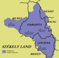
Székely Land blank map.png 370 × 397; 12 KB
-
Székely Land location.png 250 × 115; 7 KB
-
Székely Seats no county 1.PNG 1,431 × 1,396; 100 KB
-
Székely Seats no county.PNG 1,431 × 1,396; 100 KB
-
Székelyderzs.png 371 × 399; 19 KB
-
Székelyföld.png 303 × 225; 17 KB
-
Tört Székelyföld(hun).png 1,482 × 1,026; 152 KB
-
Tört Székelyföld.png 1,482 × 1,026; 188 KB
-
Udvarhelyszék.png 1,183 × 1,091; 106 KB


