Category:Maps of Swabia (Bavaria)
Jump to navigation
Jump to search
Deutsch: Karten und Pläne des Regierungsbezirks Schwaben
Subcategories
This category has the following 17 subcategories, out of 17 total.
Media in category "Maps of Swabia (Bavaria)"
The following 21 files are in this category, out of 21 total.
-
 Gemeindekarte Affing.png 1,166 × 872; 174 KB
-
 Günzburg.jpg 883 × 368; 133 KB
-
 Imperial Abbeys and Cities in Southeastern Swabia.jpg 1,600 × 1,200; 669 KB
-
 Karte Bahnhof Burgau.jpg 581 × 1,183; 105 KB
-
 Karte Oberallgäu.jpg 4,120 × 6,030; 16.86 MB
-
 Karte Regierungsbezirk Schwaben.jpg 5,320 × 7,920; 28.48 MB
-
 Kempten, Leutkirch, Waldburg an other states in southeastern Swabia.jpg 925 × 819; 232 KB
-
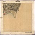 Lindau 2-Blatt 852.jpg 1,256 × 1,260; 362 KB
-
 Lindau-St Lin 1822 l11.jpg 2,500 × 2,440; 2.71 MB
-
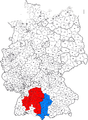
 Locator map RB Schwaben in Bavaria.svg 867 × 855; 1,010 KB
-
 Locator map Schwaben in Germany.svg 1,075 × 1,273; 581 KB
-
 Mindelheim map Coxe.jpg 1,996 × 1,632; 2.9 MB
-
 Modern Swabia-division map.PNG 1,351 × 1,844; 496 KB
-
 Regierungsbezirk Schwaben 1970.png 773 × 797; 24 KB
-
 Regierungsbezirk Schwaben.svg 773 × 797; 496 KB
-
 Regional key map of 097 in Germany.svg 867 × 855; 1,012 KB
-
 Southeastern corner of Swabia c. 1800.jpg 2,816 × 2,112; 2.02 MB
-
 Topografische Karte Allgäu.jpg 7,850 × 8,200; 42.3 MB
-
 Waltenhofen.jpg 1,848 × 844; 555 KB
-
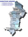 Баварская Швабия.png 533 × 712; 57 KB
-
 Расположение провинции Швабия на карте Германской империи.svg 2,621 × 2,224; 503 KB


