Category:Maps of Shanxi
Jump to navigation
Jump to search
- Provinces of the People's Republic of China
- Anhui
- Fujian
- Gansu
- Guangdong
- Guizhou
- Hainan
- Hebei
- Heilongjiang
- Henan
- Hubei
- Hunan
- Jiangsu
- Jiangxi
- Jilin
- Liaoning
- Qinghai
- Shaanxi
- Shandong
- Shanxi
- Sichuan
- Yunnan
- Zhejiang
- Autonomous regions
- Guangxi
- Inner Mongolia
- Ningxia
- Tibet Autonomous Region
- Xinjiang
- Special administrative regions
- Hong Kong
- Macau
Wikimedia category | |||||
| Upload media | |||||
| Instance of | |||||
|---|---|---|---|---|---|
| Category combines topics | |||||
| Shanxi | |||||
province of central China with its capital at Taoyuan, the supposed original home of the prehistoric Huaxia | |||||
| Instance of | |||||
| Location | PRC | ||||
| Capital | |||||
| Legislative body |
| ||||
| Head of government |
| ||||
| Party chief representative |
| ||||
| Highest point | |||||
| Population |
| ||||
| Area |
| ||||
| Replaces |
| ||||
| Different from | |||||
| official website | |||||
 | |||||
Subcategories
This category has the following 4 subcategories, out of 4 total.
Media in category "Maps of Shanxi"
The following 12 files are in this category, out of 12 total.
-
Administrative Division Shanxi.svg 840 × 1,500; 825 KB
-
G18 map.svg 512 × 422; 157 KB
-
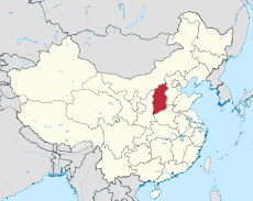
Location map China Shanxi.png 568 × 912; 116 KB
-
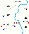
Niangziguanlocation.jpg 607 × 705; 50 KB
-
North Shanxi Autonomous Government Map, 1937.png 1,006 × 1,006; 1.94 MB
-
Qing Dynasty Shanxi.GIF 616 × 1,088; 143 KB
-
Shanxi Expressway Network Route Map.jpg 3,426 × 5,023; 4.76 MB
-
Shanxi Shadow.png 78 × 171; 728 bytes
-
Shanxi-icon-blue.jpg 498 × 1,000; 68 KB
-
Shanxi-icon-red.jpg 498 × 1,000; 70 KB
-
Shanxi-icon.jpg 498 × 1,000; 66 KB
-
Taiyuan map 1954.jpg 711 × 755; 164 KB


