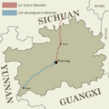
Category:Maps of Guizhou
Jump to navigation
Jump to search
- Provinces of the People's Republic of China
- Anhui
- Fujian
- Gansu
- Guangdong
- Guizhou
- Hainan
- Hebei
- Heilongjiang
- Henan
- Hubei
- Hunan
- Jiangsu
- Jiangxi
- Jilin
- Liaoning
- Qinghai
- Shaanxi
- Shandong
- Shanxi
- Sichuan
- Yunnan
- Zhejiang
- Autonomous regions
- Guangxi
- Inner Mongolia
- Ningxia
- Tibet Autonomous Region
- Xinjiang
- Special administrative regions
- Hong Kong
- Macau
中文(简体):贵州的地图
Wikimedia category | |||||
| Upload media | |||||
| Instance of | |||||
|---|---|---|---|---|---|
| Category combines topics | |||||
| Guizhou | |||||
landlocked province of the People's Republic of China | |||||
| Instance of | |||||
| Location | PRC | ||||
| Capital | |||||
| Legislative body | |||||
| Head of government |
| ||||
| Party chief representative |
| ||||
| Highest point |
| ||||
| Population |
| ||||
| Area |
| ||||
| Replaces |
| ||||
| Different from | |||||
| official website | |||||
 | |||||
Subcategories
This category has the following 3 subcategories, out of 3 total.
Media in category "Maps of Guizhou"
The following 26 files are in this category, out of 26 total.
-
00SChina.png 369 × 391; 26 KB
-
STANFORD(1917) p57 PLATE17. KWEICHOW (14597174929).jpg 3,744 × 2,370; 1.99 MB
-
Administrative Division Guizhou No Point.svg 1,161 × 1,000; 1.23 MB
-
Administrative Division Guizhou.svg 1,161 × 1,000; 1.25 MB
-
Autonomy territories in Guizhou.png 579 × 500; 64 KB
-
Autonomy territories in Townsips map Guizhou.PNG 2,261 × 1,947; 838 KB
-
Duyun Lage.jpg 379 × 295; 30 KB
-
Ethnic minorities areas in Guizhou-zh.png 579 × 500; 69 KB
-
Ethnic minorities areas in Guizhou.png 579 × 500; 27 KB
-
Ethnic townships in Bijie.png 752 × 606; 92 KB
-
Ethnic townships in Yunnan, Sichuan, Guizhou.png 935 × 660; 91 KB
-
Four Tusi of Guizhou in Yuan Dynasty.png 1,903 × 1,879; 426 KB
-
Guiyang in Guizhou.png 987 × 879; 70 KB
-
Guizhou Expressway Network Map 2009-2030.jpg 4,951 × 3,704; 7.27 MB
-
Guizhou map.png 597 × 597; 58 KB
-
Guizhou Shadow.png 140 × 124; 888 bytes
-
Jianhe County(剑河县)administrative area.jpg 1,672 × 1,006; 1 MB
-
Map Guizhou adm.png 1,020 × 897; 279 KB
-
Map of Gubin River Drainage Area.png 1,023 × 1,726; 158 KB
-
Map of Shuidong River Drainage Area.png 1,017 × 1,337; 92 KB
-
Minjiu Incident Troop Approximations.png 597 × 597; 66 KB
-
Townsips map guizhou.PNG 2,261 × 1,947; 812 KB
-
Ziqi.png 1,275 × 899; 70 KB
-
【3】李藍分區.png 579 × 500; 99 KB
-
貴州省志方言志分區.png 579 × 500; 67 KB
-
黃雪貞版貴州方言分區.png 579 × 500; 99 KB


