Category:Maps of Saint Vincent and the Grenadines
Jump to navigation
Jump to search
Countries of North America: Antigua and Barbuda · The Bahamas · Barbados · Belize · Canada · Costa Rica · Cuba · Dominica · Dominican Republic · El Salvador · Grenada · Guatemala · Haiti · Honduras · Jamaica · Mexico · Nicaragua · Panama · Saint Kitts and Nevis · Saint Lucia · Saint Vincent and the Grenadines · Trinidad and Tobago‡ · United States of America‡
Other territories: Anguilla · Bermuda · British Virgin Islands · Cayman Islands · Florida Keys · Greenland · Guadeloupe · Martinique · Montserrat · Puerto Rico · Saint Barthélemy · Saint-Martin · Saint Pierre and Miquelon · Turks and Caicos Islands · United States Virgin Islands
‡: partly located in North America
Maps of Saint Vincent and the Grenadines.
Wikimedia category | |||||
| Upload media | |||||
| Instance of | |||||
|---|---|---|---|---|---|
| Category combines topics | |||||
 | |||||
Subcategories
This category has the following 14 subcategories, out of 14 total.
*
O
S
Pages in category "Maps of Saint Vincent and the Grenadines"
The following 2 pages are in this category, out of 2 total.
Media in category "Maps of Saint Vincent and the Grenadines"
The following 66 files are in this category, out of 66 total.
-
Flag map of Saint Vincent and the Grenadines.svg 450 × 1,135; 107 KB
-
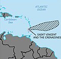
Caribbean - Grenadines.PNG 929 × 606; 48 KB
-
Caribbean - Saint Vincent.PNG 929 × 606; 48 KB
-
ECDM 20160929 TC Caribbean.pdf 1,625 × 1,125; 710 KB
-
ECDM 20190827 Caribbean TC DORIAN.pdf 1,625 × 1,125; 674 KB
-
ECDM 20200724 TC GONZALO.pdf 1,625 × 1,125; 854 KB
-
ECDM 20210409 Soufriere Volcano(1).jpg 2,367 × 2,064; 1.22 MB
-
ECDM 20210702 TC ELSA.pdf 1,625 × 1,125; 378 KB
-
ECDM 20210706 TC ELSA update.pdf 1,625 × 1,125; 1.01 MB
-
ECDM 20240712 BERYL UCPM.pdf 1,625 × 1,125; 528 KB
-
ECDM 20240820 BERYL wrap-up.pdf 1,625 × 1,125; 501 KB
-
Flag-map of Saint Vincent and the Grenadines.png 274 × 591; 12 KB
-
FLII StVincentGrenadines.png 553 × 779; 47 KB
-
Germany Saint Vincent and the Grenadines Locator.png 777 × 628; 20 KB
-
Karibik 19.png 1,353 × 767; 650 KB
-
Karibik 20.png 1,355 × 765; 321 KB
-
Karibik 23.png 1,351 × 813; 320 KB
-
Karibik 24.png 1,344 × 810; 440 KB
-
Karibik St Vincent und die Grenadinen Position.png 1,024 × 636; 15 KB
-
Kingstown.png 302 × 343; 9 KB
-
La Soufriere Ash Plume.jpg 532 × 511; 70 KB
-
La Soufriere Delineation Map.jpg 4,677 × 6,623; 3.17 MB
-
La Soufriere Pyroclastic Flow Danger.jpg 840 × 1,172; 205 KB
-
La Soufriere Reference Map, v2.jpg 4,678 × 6,622; 2.73 MB
-
LocationBequia.PNG 250 × 115; 4 KB
-
LocationCanouan.PNG 250 × 115; 4 KB
-
LocationSaintVincentAndTheGrenadines.png 250 × 115; 5 KB
-
Map of Bequia.png 551 × 629; 24 KB
-
Mustique Island NGA chart.png 1,600 × 817; 1.17 MB
-
Parishes in SVG.png 252 × 531; 8 KB
-
PAT - Saint Vincent and Grenadines.gif 765 × 1,120; 51 KB
-
Saint Vincent and the Grenadines - DPLA - af96499f7996eed2dca0f32fc5b31247.jpg 2,552 × 3,276; 4.25 MB
-
Saint Vincent and the Grenadines CIA map PL.jpg 351 × 377; 19 KB
-
Saint Vincent and the Grenadines OnEarth WMS (Bequia to Battowia).png 600 × 450; 316 KB
-
Saint Vincent and the Grenadines OnEarth WMS.png 1,215 × 2,869; 3.87 MB
-
Saint Vincent and the Grenadines, La Soufrière volcano activity.pdf 1,625 × 1,125; 492 KB
-
Saint Vincent and the Grenadines-CIA WFB Map.png 328 × 352; 10 KB
-
Saint Vincent OnEarth WMS.png 1,215 × 1,215; 2.22 MB
-
Saint Vincent parishes numbered.png 200 × 308; 6 KB
-
Saint Vincent Regions map.png 1,863 × 3,134; 839 KB
-
Saint Vincent-Charlotte.png 100 × 154; 2 KB
-
Saint Vincent-Saint Andrew.png 100 × 154; 2 KB
-
Saint Vincent-Saint David.png 100 × 154; 2 KB
-
Saint Vincent-Saint George.png 100 × 154; 2 KB
-
Saint Vincent-Saint Patrick.png 100 × 154; 2 KB
-
SaintVincentAndTheGrenadines2021OSM.png 2,565 × 5,373; 1.31 MB
-
St. Vincent and the Grenadines - mk.png 252 × 531; 12 KB
-
Stvinc.JPG 1,417 × 1,760; 750 KB
-
SVG Charlotte.png 252 × 531; 3 KB
-
SVG Grenadines.png 252 × 531; 3 KB
-
SVG Parishes.png 252 × 531; 8 KB
-
SVG Saint Andrew.png 252 × 531; 3 KB
-
SVG Saint David.png 252 × 531; 3 KB
-
SVG Saint George.png 252 × 531; 3 KB
-
SVG Saint Patrick.png 252 × 531; 3 KB
-
SVG-Chateaubelair.png 253 × 531; 4 KB
-
SVG-Georgetown.png 253 × 531; 4 KB
-
SVG-Kingstown.png 253 × 531; 4 KB
-
SVG-Layou.png 253 × 531; 4 KB
-
SVG-Port Elizabeth.png 253 × 531; 4 KB
-
UNOSAT A3 Natural Portrait Light VO20210409VCT StVincentIslandOverview.jpg 3,480 × 4,150; 2.48 MB
-
Vc-map.png 330 × 355; 8 KB
-
أبرشيات سانت فينسيت والغرينادين.svg 744 × 1,052; 21 KB


