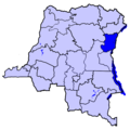
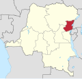
Category:Maps of North Kivu
Jump to navigation
Jump to search
Media in category "Maps of North Kivu"
The following 15 files are in this category, out of 15 total.
-
1982 Goma map Zaire txu-oclc-71754688.jpg 7,000 × 6,447; 14.09 MB
-
Armed groups in North Kivu (development October 2020 to June 2022).png 1,273 × 747; 304 KB
-
Armed groups in North Kivu (June 2022).png 604 × 742; 57 KB
-
Armed groups in North Kivu (October 2020).png 678 × 801; 71 KB
-
CD-Goma.png 594 × 569; 8 KB
-
DCongoNordKivu.png 600 × 600; 87 KB
-
DCongoNorthKivu.png 200 × 197; 16 KB
-
Democratic Republic of Congo – North Kivu Base Map.png 1,111 × 699; 306 KB
-
Democratic Republic of the Congo (26 provinces) - Nord-Kivu & Ituri.svg 1,240 × 1,181; 819 KB
-
Democratic Republic of the Congo (26 provinces) - Nord-Kivu.svg 1,240 × 1,181; 819 KB
-
ECHO DRC North Kivu Editable A4 Landscape.pdf 1,754 × 1,239; 324 KB
-
Kivuconflict.png 1,115 × 1,702; 230 KB
-
Nord-Kivu 2006.png 200 × 202; 23 KB
-
Nord-Kivu in Democratic Republic of the Congo.svg 1,150 × 1,095; 348 KB
-
Osso locator map.png 621 × 453; 52 KB


