Category:Maps of Kivu
Jump to navigation
Jump to search
Subcategories
This category has the following 2 subcategories, out of 2 total.
N
- Maps of North Kivu (15 F)
S
- Maps of Sud-Kivu (10 F)
Media in category "Maps of Kivu"
The following 8 files are in this category, out of 8 total.
-
1951 population map Atlas General du Congo 624.jpg 9,813 × 11,421; 7.97 MB
-
East Congo conflict map.svg 1,150 × 1,095; 977 KB
-
Kivu conflict map 2.svg 1,150 × 1,095; 977 KB
-
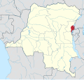
Kivu in Democratic Republic of the Congo.svg 1,150 × 1,095; 330 KB
-
Kivuconflict.png 1,115 × 1,702; 230 KB
-
Mai-Mai Kyandenga in North Kivu.png 687 × 636; 18 KB
-
Region of Kivu.png 2,000 × 2,022; 401 KB
-
Residential Area in South Kivi.PNG 904 × 452; 528 KB


