Category:Maps of Nazi Germany
Jump to navigation
Jump to search
Use the appropriate category for maps showing all or a large part of Germany. See subcategories for smaller areas:
| If the map shows | Category to use |
|---|---|
| Germany on a recently created map | Category:Maps of Germany or its subcategories |
| Germany on a map created more than 70 years ago | Category:Old maps of Germany or its subcategories |
| the history of Germany on a recently created map | Category:Maps of the history of Germany or its subcategories |
| the history of Germany on a map created more than 70 years ago | Category:Old maps of the history of Germany or its subcategories |
Wikimedia category | |||||
| Upload media | |||||
| Instance of | |||||
|---|---|---|---|---|---|
| Category combines topics | |||||
| Nazi Germany | |||||
Germany from 1933 to 1945 while under control of the Nazi Party | |||||
| Instance of |
| ||||
| Facet of | |||||
| Name in native language |
| ||||
| Location |
| ||||
| Capital | |||||
| Basic form of government |
| ||||
| Legislative body | |||||
| Official language | |||||
| Anthem | |||||
| Currency | |||||
| Head of state |
| ||||
| Inception |
| ||||
| Dissolved, abolished or demolished date |
| ||||
| Population |
| ||||
| Area |
| ||||
| Replaces |
| ||||
| Replaced by | |||||
| Said to be the same as | Third Reich, Greater German Reich | ||||
 | |||||
Subcategories
This category has the following 8 subcategories, out of 8 total.
Media in category "Maps of Nazi Germany"
The following 106 files are in this category, out of 106 total.
-
Flag map of Germany (1933).svg 1,048 × 846; 39 KB
-
Flag map of Germany (1935).svg 1,051 × 850; 31 KB
-
Flag map of Germany (1938).svg 1,052 × 974; 27 KB
-
Flag map of Germany (1939).svg 1,047 × 996; 26 KB
-
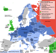
Flag map of Germany (1943).svg 1,306 × 1,063; 31 KB
-
1939Deguo.png 998 × 896; 127 KB
-
Areas annexed by Nazi Germany.png 1,111 × 745; 154 KB
-
Baltic Sea Borderlines 1939 blank.png 1,516 × 1,178; 35 KB
-
Baltic Sea Borderlines 1939 german.png 1,516 × 1,178; 66 KB
-
Braunschweig 1932-1945.png 5,155 × 4,000; 2.47 MB
-
Czechoslovakia Poland Border adjustments 1919-1945 ES.svg 1,000 × 404; 52 KB
-
Czechoslovakia Poland Border adjustments 1919-1945 hu.svg 1,000 × 404; 122 KB
-
Czechoslovakia Poland Border adjustments 1919-1945-pt.svg 1,000 × 404; 52 KB
-
Czechoslovakia Poland Border adjustments 1919-1945.svg 1,000 × 404; 121 KB
-
Danzig 1939.png 695 × 597; 77 KB
-
Danzig 1939 EN.svg 696 × 599; 32 KB
-
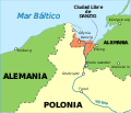
Danzig 1939 ES.svg 696 × 599; 43 KB
-
Deployment He 115.png 1,181 × 1,181; 137 KB
-
Der deutsche staat seit 1867.gif 1,052 × 673; 656 KB
-
Deutschesreich1939 (cropped to Czechoslovakia).png 632 × 357; 92 KB
-
Deutschesreich1939.png 1,032 × 810; 262 KB
-
Deutschesreich1939fr.jpg 1,032 × 810; 240 KB
-
Deutschland1871-1991.png 683 × 498; 12 KB
-
Deutschland1939.png 322 × 276; 10 KB
-
Druhá Československá republika 1938 podkarp. rus.png 1,660 × 942; 260 KB
-
Druhá Československá republika 1938.png 2,300 × 1,064; 455 KB
-
Duitsland31081939.png 998 × 896; 151 KB
-
Dystrykt galicja 1.png 2,020 × 2,556; 2.03 MB
-
Dystrykt krakowski 1.png 2,026 × 2,596; 2.1 MB
-
Europa (1939).png 1,660 × 942; 216 KB
-
Europa-GDR-1942.png 600 × 512; 23 KB
-
Europa1937-1939.png 1,200 × 1,024; 67 KB
-
Europa31-08-1939.png 600 × 512; 23 KB
-
Europe before Operation Barbarossa, 1941 (in German)-es.png 958 × 998; 182 KB
-
Europe before Operation Barbarossa, 1941 (in German).png 958 × 998; 142 KB
-
Europe before Operation Barbarossa, 1941 (in hu).png 1,200 × 1,250; 518 KB
-
FLAG MAP OF 3RD REICH.png 506 × 384; 32 KB
-
Flag Map of Nazi Occupied Europe(No Gore).png 986 × 998; 193 KB
-
Gau Oberschlesien-Ostoberschlesien.png 1,222 × 1,693; 3.02 MB
-
Gau Oberschlesien.png 1,222 × 1,693; 3.08 MB
-
Gauhauptstadtplanungen.svg 800 × 600; 102 KB
-
Gauligas 1933.png 715 × 599; 145 KB
-
Generalplan Ost map.tiff 1,166 × 787; 2.63 MB
-
German Borders 1939.png 322 × 276; 43 KB
-
German Empire 1937 adm location map.svg 1,425 × 1,133; 763 KB
-
German Reich 1937 adm location map (Dutch title).png 746 × 593; 189 KB
-
Germanbordershr.JPG 679 × 495; 65 KB
-
GouwHalleMerseburg.png 365 × 300; 43 KB
-
Greater German Reich in 1942.png 1,829 × 1,647; 104 KB
-
Karte des „Großdeutschen Reiches“ 1943.png 2,497 × 2,092; 453 KB
-
Karte Sportgaue im Dritten Reich.png 773 × 648; 38 KB
-
KarteDesGrossdeutschenReichesJan1944OhneOrtsnamen.png 15,750 × 11,500; 5.36 MB
-
Location map of Gau Westmark.svg 1,038 × 767; 514 KB
-
Location map of Sportgau Südwest.svg 283 × 195; 183 KB
-
Léto 1938 podkarp. rus.png 1,660 × 942; 220 KB
-
Map of Baden (1806-1945)-Kaiserstuhl (2).jpg 413 × 610; 57 KB
-
Map of Baden (1806-1945)-Kaiserstuhl (2).png 413 × 610; 142 KB
-
Map of Baden (1819-1945).png 1,954 × 2,881; 151 KB
-
Map of The Third Reich.png 450 × 456; 45 KB
-
Massacre of Katyn.png 3,320 × 2,118; 851 KB
-
Military Administration in the Soviet Union (1942).svg 203 × 177; 670 KB
-
Nazi Germany Flag map(1942).png 3,464 × 1,948; 551 KB
-
Nazi Germany-es.png 1,200 × 932; 273 KB
-
Nazi Germany-it.svg 1,135 × 881; 276 KB
-
Nazi Germany-pt.svg 1,419 × 1,101; 370 KB
-
Nazi Germany.png 1,200 × 932; 263 KB
-
Nazi Germany.svg 1,419 × 1,101; 367 KB
-
Nsdap gaue english.png 8,881 × 5,622; 1.88 MB
-
Nsdap gaue.png 8,881 × 5,622; 1.87 MB
-
Occupation of Poland 1939 (b&w).png 2,481 × 3,355; 1.71 MB
-
Occupation of Poland 1939-es.svg 743 × 889; 709 KB
-
Occupation of Poland 1939.png 2,479 × 3,354; 849 KB
-
Occupation of Poland 1941-es.svg 743 × 884; 638 KB
-
Occupation of Poland 1941.png 2,487 × 3,307; 967 KB
-
Okreg bialystok 1942.png 2,092 × 2,505; 1.73 MB
-
Ordensstaat Burgund.png 246 × 280; 6 KB
-
Partition of Czechoslovakia (1938) hu.svg 587 × 511; 54 KB
-
Partition of Czechoslovakia (1938).png 440 × 383; 27 KB
-
Podział Czechosłowacji (1938).png 439 × 382; 30 KB
-
Polska 1939-1941.png 2,482 × 3,373; 915 KB
-
Polska okupacja 1944.png 2,043 × 2,717; 2.61 MB
-
Prusy wschodnie 1939.png 2,014 × 2,511; 1.62 MB
-
Prusy zachodnie 1939.png 2,014 × 2,511; 1.65 MB
-
Regierungsbezirk Kattowitz (1943).png 585 × 782; 863 KB
-
SegundaRepúblicaChecoslovaca19381939-2-pt.svg 2,875 × 1,330; 106 KB
-
SegundaRepúblicaChecoslovaca19381939-2.svg 2,875 × 1,330; 313 KB
-
SegundaRepúblicaChecoslovaca19381939-pt.svg 2,875 × 1,330; 154 KB
-
SegundaRepúblicaChecoslovaca19381939.svg 2,875 × 1,330; 511 KB
-
Silhouette of Third Reich.svg 900 × 683; 43 KB
-
Slovakia borderPoland uk.png 1,252 × 847; 140 KB
-
Slovakia borderPoland.png 1,000 × 404; 46 KB
-
SS-Oberabschnitt.jpg 668 × 600; 81 KB
-
Territoriale Veränderungen nach dem Polenfeldzug 1939.png 2,092 × 2,505; 2.42 MB
-
The german state since 1867.gif 1,052 × 673; 642 KB
-
ThirdReich1942world.png 1,425 × 625; 67 KB
-
ViennaAwards.gif 635 × 405; 11 KB
-
Weimar Republic (1918-1933); Nazi Germany (1933-1938).png 2,560 × 2,035; 969 KB
-
Österreich 09041938.jpg 1,416 × 1,156; 680 KB


