Category:Locator maps of Nazi Germany
Jump to navigation
Jump to search
Subcategories
This category has the following 2 subcategories, out of 2 total.
Media in category "Locator maps of Nazi Germany"
The following 31 files are in this category, out of 31 total.
-
Grossdeutschland.PNG 250 × 115; 6 KB
-
Axis Occupation of Europe (1942).svg 450 × 456; 483 KB
-
District of Brussels.svg 450 × 456; 509 KB
-
General Government (1942).svg 450 × 456; 500 KB
-
German Reich (1939).svg 450 × 456; 453 KB
-
German Reich 1942 (11–19 November).svg 450 × 456; 586 KB
-
German Reich 1942 (Extended).svg 512 × 431; 7.11 MB
-
German Reich 1942 (no occupations).svg 450 × 456; 500 KB
-
German Reich 1942 (Orthographic Projection).svg 512 × 512; 5.81 MB
-
German Reich 1942 Greatest Extend, end of 1942.png 900 × 912; 194 KB
-
German Reich 1942.png 450 × 456; 65 KB
-
German Reich 1942.svg 450 × 456; 489 KB
-
Germany March - September 1939.svg 450 × 456; 518 KB
-
Greater German Reich (1942).svg 450 × 456; 594 KB
-
Greater Germanic Reich.png 950 × 785; 129 KB
-
Greater Germanic Reich.svg 680 × 520; 745 KB
-
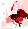
Holocaust Jewish death toll %.svg 2,000 × 2,027; 983 KB
-
Holocaustdeathtoll%.png 2,457 × 2,049; 1.29 MB
-
LocationFrance after WWII ocupacion Germany.png 250 × 115; 6 KB
-
LocationThirdReich.png 450 × 456; 44 KB
-
Nazi Germany 1942 location map (Dutch title).png 800 × 683; 178 KB
-
Nazi Germany 1942 location map.svg 800 × 683; 678 KB
-
Protectorate of Bohemia and Moravia (1939).svg 450 × 456; 472 KB
-
Protectorate of Bohemia and Moravia (1942).svg 450 × 456; 500 KB
-
Reichsgau Flandern.svg 450 × 456; 509 KB
-
Reichsgau Wallonien.svg 450 × 456; 509 KB
-
Reichskommissariat Niederlande (1942).svg 450 × 456; 500 KB
-
Reichskommissariat Norwegen (1942).svg 450 × 456; 500 KB
-
Reichskommissariat Ostland (1942).svg 450 × 456; 506 KB
-
Reichskommissariat Ukraine (1942).svg 450 × 456; 480 KB
-
Third Reich (orthographic projection).svg 550 × 550; 661 KB


