Category:Maps of Monterey County, California
Jump to navigation
Jump to search
English: Maps of Monterey County, California
Counties of California: Alameda · Alpine · Amador · Butte · Calaveras · Colusa · Contra Costa · Del Norte · El Dorado · Fresno · Glenn · Humboldt · Imperial · Inyo · Kern · Kings · Lake · Lassen · Los Angeles · Madera · Marin · Mariposa · Mendocino · Merced · Modoc · Mono · Monterey · Napa · Nevada · Orange · Placer · Plumas · Riverside · Sacramento · San Benito · San Bernardino · San Diego · San Joaquin · San Luis Obispo · San Mateo · Santa Barbara · Santa Clara · Santa Cruz · Shasta · Sierra · Siskiyou · Solano · Sonoma · Stanislaus ·Sutter · Tehama · Trinity · Tulare · Tuolumne · Ventura · Yolo · Yuba – Consolidated city-county: San Francisco
Wikimedia category | |||||
| Upload media | |||||
| Instance of | |||||
|---|---|---|---|---|---|
| Category combines topics | |||||
| Monterey County | |||||
county in California, United States | |||||
| Instance of | |||||
| Named after | |||||
| Location | California, Pacific States Region | ||||
| Capital | |||||
| Inception |
| ||||
| Population |
| ||||
| Area |
| ||||
| official website | |||||
 | |||||
- See also wikipedia article (English text): Monterey County, California.
Subcategories
This category has the following 2 subcategories, out of 2 total.
Media in category "Maps of Monterey County, California"
The following 66 files are in this category, out of 66 total.
-
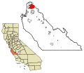
California map showing Monterey County.png 200 × 231; 22 KB
-
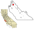
Map of California highlighting Monterey County.svg 916 × 1,054; 151 KB
-
93920 ZCTA 2000 Census.png 575 × 425; 27 KB
-
Admiralty Chart No 778 Conception Point to Point Pinos, Published 1899, Corrections Copyright 1960.jpg 11,042 × 16,228; 45.61 MB
-
American FactFinder - Results - Google Chrome 2016-03-15 17.52.05.png 882 × 701; 255 KB
-
BigSurMap.png 536 × 707; 91 KB
-
BigSurMap3.png 536 × 707; 94 KB
-
CA 20 certified.pdf 1,275 × 1,650; 999 KB
-
CA-17th.png 658 × 399; 37 KB
-
California US Congressional District 20 (since 2013).tif 2,016 × 998; 2.67 MB
-
Carmel River Watershed Map National Marine Fisheries Service 2013.png 1,115 × 859; 1.32 MB
-
Carmelito plot map 1890.png 1,081 × 755; 313 KB
-
Costa Central de Califòrnia.png 2,000 × 2,361; 305 KB
-
Cupressus macrocarpa range map 4.png 3,871 × 2,910; 397 KB
-
CVPSouthernCanalsUSBR.jpg 1,224 × 1,584; 1.58 MB
-
Parkfield earthquake activity map.gif 568 × 637; 47 KB
-
Fort ord.gif 422 × 359; 14 KB
-
Gilroy to Salinas via San Juan 1916 Uc1.31175009013577-seq 153.jpg 1,399 × 3,113; 907 KB
-
Map of Rancho Los Laureles.png 1,340 × 1,266; 3.21 MB
-
Map of the county of Monterey, California.tif 15,888 × 13,333; 606.09 MB
-
Median Household Income by Census Block Group.png 842 × 688; 281 KB
-
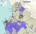
Monterey County Populated Area Median Household Income 2013.png 1,126 × 1,069; 1.51 MB
-
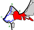
Monterey Peninsula highlighting Monterey and 17 Mile Drive.png 399 × 348; 20 KB
-
Official map of Monterey County, California, 1898.tif 21,789 × 17,985; 1.09 GB
-
Old Coast Road, Central California.png 3,435 × 4,885; 29.78 MB
-
Old map of Monterey Peninsula California pre-1902.jpg 1,693 × 3,089; 954 KB
-
Rancho San Jose y Sur Chiquito 1898.png 1,294 × 2,401; 5.84 MB
-
Salinas Median Household Income 2013.png 963 × 922; 835 KB
-
Salinas River Map.jpg 695 × 710; 208 KB
-
Salinas-Poverty.png 502 × 610; 297 KB
-
SanArdoOilFieldMap.jpg 3,300 × 2,550; 1.01 MB
-
Share Affluent Households Monterey County.png 1,108 × 699; 261 KB
-
California SD-17 (2011).svg 1,450 × 1,680; 55 KB


