Category:Maps of Mesopotamia
Jump to navigation
Jump to search
Wikimedia category | |||||
| Upload media | |||||
| Instance of | |||||
|---|---|---|---|---|---|
| Category combines topics | |||||
| Mesopotamia | |||||
historical region within the Tigris–Euphrates river system | |||||
| Instance of |
| ||||
| Location |
| ||||
| Different from | |||||
| Said to be the same as | Beth Nahrain | ||||
 | |||||
Subcategories
This category has the following 15 subcategories, out of 15 total.
A
- Maps of the Akkadian Empire (30 F)
B
C
- Maps of Chaldea (23 F)
E
- Maps of Elam (87 F)
- Maps of Eshnunna (3 F)
M
- Maps of Mari (25 F)
- Maps of Mitanni (36 F)
O
P
Q
- Maps of Qatna (13 F)
S
U
Y
- Maps of Yamhad (15 F)
Media in category "Maps of Mesopotamia"
The following 57 files are in this category, out of 57 total.
-
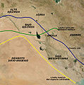
Agrimeso.es.jpg 577 × 580; 74 KB
-
Agrimeso.JPG 577 × 580; 57 KB
-
Assyria and Babylonia at Today Iraq.svg 1,241 × 1,264; 2.14 MB
-
Atlas of ancient and classical geography (1909) (14595714849).jpg 1,678 × 3,497; 913 KB
-
Babilon. A New Mappe Of The Romane Empire (cropped).jpg 2,556 × 1,803; 1.07 MB
-
Basse Mesopotamie 1mil.png 625 × 476; 296 KB
-
Basse Mesopotamie PB.PNG 440 × 393; 157 KB
-
BC1781 Mesopotamia map.png 617 × 421; 21 KB
-
Brue, Adrien Hubert, Asie-Mineure, Armenie, Syrie, Mesopotamie, Caucase. 1839. (C).jpg 2,012 × 1,968; 1.19 MB
-
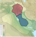
East Upper Mesopotamia topographic map-blank.svg 912 × 635; 2.25 MB
-
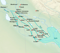
Folyamköz a sumer-korban.png 2,000 × 1,839; 207 KB
-
Gibson - Late Abbasid Map of Kish Area.png 902 × 681; 177 KB
-
Iraq archaeological map - Babylon.jpg 597 × 800; 178 KB
-
Karte Charakene.png 1,769 × 1,414; 1.92 MB
-
Karte Mesopotamien.png 1,126 × 795; 957 KB
-
Magan-map.png 894 × 627; 73 KB
-
Map of Southern Mesopotamia.png 1,026 × 736; 899 KB
-
Map Of United Confedration Of Ellipi Clans.png 839 × 745; 870 KB
-
Marwanids dynasty.jpg 375 × 279; 59 KB
-
Marwanids dynasty1.svg 973 × 693; 483 KB
-
Mesap be.png 1,000 × 856; 70 KB
-
Mesopotamia (Imperium Romanum).png 2,495 × 1,775; 53 KB
-
Mesopotamia (orthographic projection).svg 680 × 680; 250 KB
-
Mesopotamia agriculture limits-en.svg 2,363 × 1,766; 315 KB
-
Mesopotamia agriculture limits-es.svg 2,363 × 1,766; 314 KB
-
Mesopotamia agriculture limits-fr.svg 2,363 × 1,766; 314 KB
-
Mesopotamia location map with rivers.svg 802 × 601; 86 KB
-
Mesopotamia map bn.svg 3,281 × 2,318; 369 KB
-
Mesopotamia with Modern Borders-syc.svg 3,281 × 2,318; 1.91 MB
-
Mesopotamia-HE.png 450 × 364; 198 KB
-
Mesopotamia.PNG 450 × 364; 198 KB
-
MesopotamiaMap.gif 388 × 344; 12 KB
-
Mesopotamian Arabic map.png 4,485 × 3,428; 1.18 MB
-
Mésopotamie Isin-Larsa.svg 404 × 595; 450 KB
-
N-Mesopotamia and Syria Arabic.svg 3,281 × 2,318; 337 KB
-
N-Mesopotamia and Syria Dutch.svg 3,281 × 2,318; 325 KB
-
N-Mesopotamia and Syria english.svg 3,281 × 2,318; 242 KB
-
N-Mesopotamia and Syria es.svg 3,500 × 2,473; 853 KB
-
N-Mesopotamia and Syria german.svg 3,281 × 2,318; 323 KB
-
N-Mesopotamia and Syria Kurdish.svg 3,281 × 2,318; 236 KB
-
N-Mesopotamia and Syria portuguese.svg 3,281 × 2,318; 323 KB
-
N-Mesopotamia and Syria Portuguese.svg 3,281 × 2,318; 326 KB
-
N-Mesopotamia and Syria sl.svg 3,281 × 2,318; 324 KB
-
N-Mesopotamia and Syria ua.svg 3,281 × 2,318; 391 KB
-
N-Mesopotamia and Syria.he.svg 3,281 × 2,318; 323 KB
-
NC Iran sites.jpg 2,400 × 1,320; 868 KB
-
Neosfield.JPG 803 × 488; 64 KB
-
Physical map of Levant and Iraq.svg 1,147 × 515; 5.28 MB
-
Qadisiyah-mohammad adil.PNG 717 × 540; 38 KB
-
Relief map Greece, Anatolia, Egypt and Mesopotamia.png 1,405 × 948; 1.87 MB
-
Sealand Dutch.svg 1,100 × 846; 338 KB
-
Spread of Oecumene Mesopotamia.jpg 219 × 185; 21 KB
-
Syrie amorrite.svg 997 × 667; 1.09 MB
-
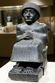
University of Pennsylvania Museum of Archeology and Anthropology 2022 05.jpg 3,024 × 4,032; 2.99 MB
-
Xanedanamerwaniyan.svg 973 × 693; 474 KB
-
Міжрэчча-3-2-тсчгдз-да-н-э.svg 629 × 553; 263 KB
