Category:Maps of Assyria
Jump to navigation
Jump to search
Wikimedia category | |||||
| Upload media | |||||
| Instance of | |||||
|---|---|---|---|---|---|
| Category combines topics | |||||
| Assyrian Empire | |||||
major Mesopotamian East Semitic kingdom | |||||
| Instance of |
| ||||
| Capital |
| ||||
| Official language | |||||
| Inception |
| ||||
| Dissolved, abolished or demolished date |
| ||||
| Replaces | |||||
 | |||||
Subcategories
This category has only the following subcategory.
N
Media in category "Maps of Assyria"
The following 134 files are in this category, out of 134 total.
-
14 century BC Eastern ca.svg 1,001 × 557; 92 KB
-
14 century BC Eastern Mediterranean and the Middle East.png 1,041 × 578; 579 KB
-
14 century BC Eastern-ar.svg 1,001 × 557; 883 KB
-
14 century BC Eastern-es.svg 1,001 × 557; 367 KB
-
14 century BC Eastern-pt.svg 1,001 × 557; 377 KB
-
14 century BC Eastern.El.png 1,034 × 574; 566 KB
-
Fenner, Rest. Persis, Parthia, Armenia. 1835 (H).jpg 546 × 516; 84 KB
-
A dictionary of the Bible.. (1887) (14594953738).jpg 1,448 × 1,460; 228 KB
-
A dictionary of the Bible.. (1887) (14595257738).jpg 3,328 × 2,116; 1,003 KB
-
Alter Orient 0900BC.svg 2,102 × 1,510; 4.93 MB
-
Alter Orient 1000BC.svg 2,102 × 1,510; 4.69 MB
-
Alter Orient 1100BC.svg 2,102 × 1,510; 4.79 MB
-
Alter Orient 1200BC-es.svg 2,102 × 1,510; 3.57 MB
-
Alter Orient 1200BC.svg 2,102 × 1,510; 4.71 MB
-
Alter Orient 1300BC.svg 2,102 × 1,510; 4.71 MB
-
Alter Orient 1600BC.svg 2,102 × 1,510; 5.06 MB
-
Alter Orient 1700BC-es.svg 2,102 × 1,510; 3.5 MB
-
Alter Orient 1700BC.svg 2,102 × 1,510; 4.69 MB
-
Alter Orient 1800BC.svg 2,102 × 1,510; 4.8 MB
-
Alter Orient 1900BC.svg 2,102 × 1,510; 4.91 MB
-
Alter Orient 2000BC.svg 2,102 × 1,510; 4.84 MB
-
Alter Orient 2100BC.svg 2,102 × 1,510; 4.84 MB
-
AlterOrient2 es.png 1,394 × 1,118; 1.93 MB
-
AlterOrient2.png 1,394 × 1,118; 1.67 MB
-
Amarnamap.png 782 × 607; 743 KB
-
AMBS by Karl von Spruner.jpg 1,000 × 1,215; 458 KB
-
Ancient Egypt and Mesopotam-es.png 1,200 × 1,473; 288 KB
-
Ancient Egypt and Mesopotamia c. 1450 BC af.png 1,200 × 1,473; 264 KB
-
Ancient Egypt and Mesopotamia c. 1450 BC.png 1,200 × 1,473; 259 KB
-
Ancient Near East 0800BC.svg 2,102 × 1,510; 4.81 MB
-
Ancient Near East 0900BC.svg 2,102 × 1,510; 4.92 MB
-
Ancient Near East 1000BC.svg 2,102 × 1,510; 4.69 MB
-
Ancient Near East 1100BC.svg 2,102 × 1,510; 4.78 MB
-
Ancient Near East 1300BC.svg 2,102 × 1,510; 4.71 MB
-
Ancient Near East 1600BC.svg 2,102 × 1,510; 5.04 MB
-
Ancient Near East 1700BC.svg 2,102 × 1,510; 4.69 MB
-
Ancient Near East 1800BC.svg 2,102 × 1,510; 4.79 MB
-
Ancient Near East 1900BC.svg 2,102 × 1,510; 4.89 MB
-
Ancient Near East 2000BC.svg 2,102 × 1,510; 4.83 MB
-
Ancient Near East 2100BC.svg 2,102 × 1,510; 4.83 MB
-
Ancient Upper Mesopotamia.png 2,865 × 2,280; 1.53 MB
-
Antoine Philippe Houze . L'Empire des Perses. 1844 (L).jpg 1,081 × 1,222; 193 KB
-
Armenia by William Hughes, 1871.jpg 2,048 × 1,653; 855 KB
-
Ashur klj.gif 300 × 355; 61 KB
-
Ashurreshishi.png 890 × 1,000; 228 KB
-
Asia minor-Shepherd 1923 Mesopotamia.jpg 839 × 624; 73 KB
-
Assur UKR.png 1,000 × 836; 45 KB
-
Assur.JPG 816 × 452; 81 KB
-
Assy1.JPG 714 × 501; 62 KB
-
Assy2.JPG 714 × 501; 65 KB
-
Assyria 1130-606 BC.png 718 × 653; 1,005 KB
-
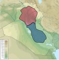
Assyria and Babylonia at Today Iraq.svg 1,241 × 1,264; 2.14 MB
-
Assyria Bul Map.png 4,810 × 3,696; 782 KB
-
Assyria Map.jpg 351 × 377; 29 KB
-
Assyria map.png 838 × 599; 31 KB
-
Assyria World War 1 relief Arabic.png 1,920 × 1,358; 860 KB
-
Assyria World War 1 relief English.png 3,507 × 2,480; 751 KB
-
Assyria ܐܫܘܪ܀.jpg 720 × 960; 302 KB
-
AssyriaEastLands ru.svg 1,800 × 1,756; 2.03 MB
-
Assyrian autonomy map 2003.jpg 655 × 452; 70 KB
-
Assyrian genocide map-pt.svg 1,062 × 806; 88 KB
-
Assyrian genocide map.svg 1,062 × 806; 83 KB
-
Assyrian population changes.png 4,972 × 2,517; 381 KB
-
Asyria.svg 1,366 × 762; 617 KB
-
BC1781 Mesopotamia map.png 617 × 421; 21 KB
-
Brue, Adrien Hubert, Asie-Mineure, Armenie, Syrie, Mesopotamie, Caucase. 1839. (C).jpg 2,012 × 1,968; 1.19 MB
-
Butler Obris Veteribus Notus A.jpg 783 × 581; 174 KB
-
Butler syria.jpg 3,076 × 2,061; 1.8 MB
-
C+B-Assyria-DetailedMap.JPG 1,897 × 1,350; 757 KB
-
Campagne militari di Iblul-Il.svg 1,326 × 842; 1.79 MB
-
Encyclopaedia Biblica map of Syria, Mesopotamia, Babylonia, and Assyria.jpg 2,383 × 1,703; 1.59 MB
-
Fotothek df tg 0005111 Geographie ^ Karte.jpg 800 × 672; 302 KB
-
Gurgum 12 század.jpg 944 × 665; 159 KB
-
Gurgum.svg 2,714 × 1,740; 836 KB
-
GénocideSimele.png 698 × 617; 70 KB
-
Główne miasta Asyrii.png 1,366 × 762; 1.82 MB
-
Hayasa.tif 600 × 381; 670 KB
-
Hayassa-Hayasan.jpg 5,906 × 4,429; 3.22 MB
-
Heinrich Kiepert. Asia citerior.Assyria.jpg 1,216 × 2,246; 519 KB
-
Heinrich Kiepert. Imperia Persarum et Macedonum. 1903 (IE).jpg 1,677 × 993; 1.26 MB
-
Kummuh.svg 2,714 × 1,740; 817 KB
-
Map Amarna.png 583 × 599; 99 KB
-
Map of ancient Assyria, Description de L'Universe (Alain Manesson Mallet, 1719).jpg 1,040 × 1,243; 279 KB
-
Map of Assyria Paris Peace Conference 1919.jpg 960 × 910; 97 KB
-
Map of Assyrian populated areas.svg 3,435 × 2,434; 364 KB
-
Map of Babylonia and Assyria - from Myths of Babylonia and Assyria (page 26 crop).jpg 3,909 × 3,011; 1.9 MB
-
Mapa Mezopotámie.png 2,440 × 1,480; 1.42 MB
-
Mapaderienteproximo.svg 1,115 × 865; 11.13 MB
-
Mapaderienteproximosinrelieve.svg 1,115 × 865; 8.74 MB
-
Medio asirio-es.svg 2,495 × 1,982; 6.16 MB
-
Medio assyrien.svg 883 × 724; 1.08 MB
-
Mesopotamia 1200 BC.jpg 2,256 × 1,555; 933 KB
-
Moyen Orient 13e siècle-es.svg 1,885 × 1,354; 3.98 MB
-
Moyen Orient 13e siècle-pt.svg 1,885 × 1,354; 3.97 MB
-
Moyen Orient 13e siècle.png 1,885 × 1,354; 2.87 MB
-
Moyen Orient 13e siècle.svg 1,885 × 1,354; 4.03 MB
-
Médio-assyrien.png 883 × 724; 724 KB
-
Mésopotamie kassite.svg 404 × 595; 440 KB
-
N-Mesopotamia and Syria Dutch.svg 3,281 × 2,318; 325 KB
-
N-Mesopotamia and Syria Portuguese.svg 3,281 × 2,318; 326 KB
-
Near East 1400 BCE pt.svg 785 × 628; 346 KB
-
Neo-assyrian-empire-c-912---612-bce-13557.png 881 × 827; 509 KB
-
New assyria.png 2,375 × 3,090; 203 KB
-
Northern Mesopotamian vassal kingdoms AD 200.png 1,775 × 1,606; 2.11 MB
-
Oudheidmiddenoosten.svg 736 × 436; 654 KB
-
Philistäa zur Assyrerzeit.jpg 1,078 × 915; 158 KB
-
Robert de Vaugondy. Map of the Early Ages of the World. 1762.jpg 807 × 800; 231 KB
-
Samsi Addu-es.svg 1,718 × 1,348; 7.36 MB
-
Samsi Addu.PNG 996 × 785; 1.08 MB
-
Second Mariote kingdom.png 1,326 × 842; 1.29 MB
-
Shamshiadad.png 1,703 × 1,200; 554 KB
-
Shepherd-c-018-019 cropped Caucasus.JPG 727 × 570; 169 KB
-
Soulier, E.; Andriveau-Goujon, J. Anciens Empires Jusqua Alexandre. 1838 (C).jpg 1,455 × 1,355; 488 KB
-
Starověký-Blízký-východ.png 1,112 × 763; 607 KB
-
Teglatfalassar1.png 890 × 1,000; 246 KB
-
The ancient East (1914) (14594191287).jpg 2,464 × 1,566; 794 KB
-
The ancient world, from the earliest times to 800 A. D (1913) (14594463089).jpg 1,780 × 1,668; 834 KB
-
The Neo-Assyrian Empire.png 2,958 × 2,242; 7.03 MB
-
Third Mari.png 1,324 × 1,020; 1.39 MB
-
Tur Abdin-ar.svg 900 × 450; 333 KB
-
Tur Abdin.svg 900 × 450; 318 KB
-
Villes assyriennes-es.svg 2,011 × 1,449; 6.11 MB
-
Villes assyriennes.PNG 1,117 × 807; 1.3 MB


