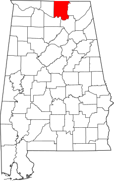
Category:Maps of Madison County, Alabama
Jump to navigation
Jump to search
Counties of Alabama: Autauga · Baldwin · Barbour · Bibb · Blount · Bullock · Butler · Calhoun · Chambers · Cherokee · Chilton · Choctaw · Clarke · Clay · Cleburne · Coffee · Colbert · Conecuh · Coosa · Covington · Crenshaw · Cullman · Dale · Dallas · DeKalb · Elmore · Escambia · Etowah · Fayette · Franklin · Geneva · Greene · Hale · Henry · Houston · Jackson · Jefferson · Lamar · Lauderdale · Lawrence · Lee · Limestone · Lowndes · Macon · Madison · Marengo · Marion · Marshall · Mobile · Monroe · Montgomery · Morgan · Perry · Pickens · Pike · Randolph · Russell · Shelby · St. Clair · Sumter · Talladega · Tallapoosa · Tuscaloosa · Walker · Washington · Wilcox · Winston
Wikimedia category | |||||
| Upload media | |||||
| Instance of | |||||
|---|---|---|---|---|---|
| Category combines topics | |||||
| Madison County | |||||
county in Alabama, United States | |||||
| Instance of | |||||
| Named after | |||||
| Location | Alabama | ||||
| Located in or next to body of water |
| ||||
| Capital | |||||
| Inception |
| ||||
| Population |
| ||||
| Area |
| ||||
| Different from | |||||
| official website | |||||
 | |||||
Subcategories
This category has the following 2 subcategories, out of 2 total.
H
Media in category "Maps of Madison County, Alabama"
The following 37 files are in this category, out of 37 total.
-
ALMap-doton-Gurley.PNG 193 × 300; 13 KB
-
ALMap-doton-Harvest.PNG 193 × 300; 13 KB
-
ALMap-doton-HazelGreen.PNG 193 × 300; 13 KB
-
ALMap-doton-Madison.PNG 193 × 300; 13 KB
-
ALMap-doton-Meridianville.PNG 193 × 300; 13 KB
-
ALMap-doton-MooresMill.PNG 193 × 300; 13 KB
-
ALMap-doton-NewHope.PNG 193 × 300; 13 KB
-
ALMap-doton-NewMarket.PNG 193 × 300; 13 KB
-
ALMap-doton-RedstoneArsenal.png 193 × 300; 13 KB
-
ALMap-doton-Triana.PNG 193 × 300; 13 KB
-
Huntsville, Alabama Metropolitan Statistical Area.svg 558 × 887; 141 KB
-
Huntsville-Decatur CSA.png 245 × 385; 18 KB
-
Huntsville-Decatur Metro area.gif 336 × 482; 6 KB
-
Huntsville-Decatur, Alabama Combined Statistical Area.svg 558 × 887; 158 KB
-
Madison County Alabama with Current Huntsville Corporate Limits Highlighted in Blue.png 2,880 × 2,016; 193 KB
-
Madison County boundary evolution.jpeg 2,163 × 2,290; 606 KB
-
Map of Alabama highlighting Madison County.svg 644 × 1,018; 77 KB


