Category:Maps of Long Island
Jump to navigation
Jump to search
Wikimedia category | |||||
| Upload media | |||||
| Instance of | |||||
|---|---|---|---|---|---|
| Category combines topics | |||||
| Long Island | |||||
island in New York, United States of America | |||||
| Instance of | |||||
| Part of | |||||
| Location | New York | ||||
| Located in or next to body of water | |||||
| Width |
| ||||
| Length |
| ||||
| Population |
| ||||
| Area |
| ||||
| Elevation above sea level |
| ||||
| Different from | |||||
 | |||||
Subcategories
This category has the following 6 subcategories, out of 6 total.
Media in category "Maps of Long Island"
The following 66 files are in this category, out of 66 total.
-
2012 NY-03 election results.svg 800 × 408; 36 KB
-
2022 New York's 2nd Congressional District election map by precinct.svg 800 × 324; 663 KB
-
2024 NY-02 election results.svg 800 × 425; 62 KB
-
Blank Map of Long Island.svg 798 × 318; 56 KB
-
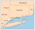
Ctpanhandle.png 300 × 254; 12 KB
-
DownState.png 674 × 585; 14 KB
-
Fire Island-NY-USA-Location Map of Fire Island National Seashore.gif 490 × 217; 30 KB
-
Fire Island-NY-USA-Location Map-01.gif 490 × 217; 27 KB
-
Fire Island-NY-USA-Location Map-01.svg 670 × 299; 215 KB
-
Fire Island-NY-USA-Location Map.jpg 300 × 220; 29 KB
-
Fishers Island Map.jpg 1,974 × 1,268; 480 KB
-
Garden City Mitchel Field Secondary Final.jpg 1,291 × 1,075; 234 KB
-
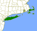
Green Map of Long Island 2000px.png 2,000 × 797; 69 KB
-
LIFortMap01.png 611 × 705; 240 KB
-
Location map Long Island.png 2,502 × 1,584; 2.23 MB
-
Location of Peconic County.svg 776 × 343; 106 KB
-
Long Island 1686.jpg 1,150 × 405; 246 KB
-
Long Island counties, Long Island, New York.png 255 × 140; 3 KB
-
Long Island Counties.gif 255 × 157; 4 KB
-
Long Island Flag Map.png 2,867 × 1,090; 343 KB
-
Long Island Landsat Mosaic.jpg 2,000 × 1,000; 344 KB
-
Long Island location map.svg 512 × 416; 237 KB
-
Long Island Mercator projection 1.png 534 × 302; 7 KB
-
Long Island Mercator projection 2.png 540 × 280; 10 KB
-
Long Island Sound - NARA - 12007681.jpg 11,444 × 8,160; 7.64 MB
-
Long Island statehood map.svg 776 × 343; 105 KB
-
Long Island US map.gif 422 × 359; 15 KB
-
Long Island-Congressional District 1(pre-2012).svg 798 × 318; 78 KB
-
Long Island—Congressional Districts 2012.svg 798 × 318; 163 KB
-
Long Island—Congressional Districts 2012—In Suffolk County.svg 798 × 318; 90 KB
-
Longisland.png 1,276 × 811; 524 KB
-
Longisland1.png 1,276 × 811; 523 KB
-
LongIsland2022OSM.png 6,666 × 3,048; 15.32 MB
-
Map of Long Island NY.png 2,500 × 994; 78 KB
-
Map of Long Island topography.jpg 750 × 398; 65 KB
-
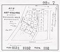
Map of the Art Village Situated at Shinnecock Hills.jpg 466 × 400; 47 KB
-
Map of the Boroughs of New York City and the counties of Long Island.png 3,076 × 1,285; 533 KB
-
Map of the southern part of Gardiners Island, also showing Cartwright Island.pdf 3,600 × 4,350; 14.46 MB
-
New York City and the Long Island.jpg 1,023 × 490; 102 KB
-
New york long island.jpg 1,000 × 501; 75 KB
-
New York's 1st congressional district (since 2025).svg 533 × 533; 627 KB
-
New York's 2nd congressional district (since 2025).svg 533 × 533; 627 KB
-
New York's 3rd congressional district (since 2025).svg 533 × 533; 627 KB
-
New York—Congressional District 1.svg 798 × 318; 109 KB
-
New York—Congressional District 2.svg 798 × 318; 111 KB
-
New York—Congressional District 3.svg 798 × 318; 112 KB
-
New York—Congressional District 4.svg 798 × 318; 111 KB
-
New York—Congressional District 5.svg 798 × 318; 111 KB
-
Outer Lands.png 422 × 359; 13 KB
-
New York State Senate District 2 (2012).png 3,259 × 2,503; 400 KB
-
New York State Senate District 3 (2012).png 3,259 × 2,492; 398 KB
-
New York State Senate District 4 (2012).png 3,259 × 2,492; 399 KB
-
New York State Senate District 5 (2012).png 3,259 × 2,492; 398 KB
-
New York State Senate District 7 (2012).png 3,259 × 2,492; 398 KB
-
New York State Senate District 8 (2012).png 3,259 × 2,492; 398 KB
-
New York State Senate District 9 (2012).png 3,259 × 2,492; 398 KB
-
Southern tip of Gardiners Island, Cartwright Shoals, Cartwright Island USGS.jpg 2,111 × 2,900; 165 KB
-
T4-li.jpg 11,669 × 9,008; 5.67 MB
-
The Hamptons.jpg 300 × 220; 31 KB
-
Tourists Map of Long Island Sound, 1868.jpg 3,976 × 1,876; 2.23 MB
-
Untitled - Advertising (NBY 3280).jpg 630 × 400; 73 KB
-
USA New York Tri State NYC area.svg 512 × 324; 531 KB
-
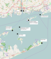
Wpdms ev26188 blockislandsound.jpg 326 × 222; 19 KB
-
Wpdms ev26188 fire island.jpg 300 × 220; 28 KB
-
Wpdms ev26188 gardiners island.jpg 300 × 220; 33 KB
-
Wpdms ev26188 great south bay.jpg 301 × 220; 28 KB


