Category:Long Island Rail Road maps
Jump to navigation
Jump to search

Media in category "Long Island Rail Road maps"
The following 83 files are in this category, out of 83 total.
-

-

-
-

-
 1878 Manhattan Beach Railway.jpg 557 × 951; 111 KB
-
 1882 map of Long Island Railroad.jpg 6,294 × 2,232; 4.15 MB
-

-

-

-
 Atlantic Branch Map.PNG 808 × 569; 78 KB
-
 Atlantic Branch Map.svg 808 × 569; 181 KB
-

-

-

-

-

-

-
 East Side Access.svg 546 × 396; 18 KB
-
 Flushing and North Side Railroad, with its leased branches (contd.).) NYPL1527261.tiff 5,428 × 7,230; 112.31 MB
-
 FNS back.jpg 2,544 × 3,048; 1.15 MB
-
 FNS front.jpg 2,560 × 3,056; 1.15 MB
-
 FNS map only.jpg 1,160 × 483; 124 KB
-
 Garden City Mitchel Field Secondary Final.jpg 1,291 × 1,075; 234 KB
-
 GCM Opening - 52649084066.jpg 4,922 × 3,481; 2.62 MB
-

-
 Jamaica stations 1873.jpg 3,004 × 948; 470 KB
-
 LIRR 1873 East New York station.jpg 1,930 × 1,530; 744 KB
-
 LIRR 1891 Bridge Street station.jpg 427 × 502; 84 KB
-
 LIRR 1891 City Line station.jpg 300 × 220; 26 KB
-
 LIRR 1891 Clarenceville station.jpg 292 × 248; 36 KB
-
 LIRR 1891 Corona station.jpg 433 × 411; 70 KB
-
 LIRR 1891 Creedmoor station.jpg 627 × 448; 76 KB
-
 LIRR 1891 Cypress Avenue station.jpg 187 × 248; 30 KB
-
 LIRR 1891 Dunton station.jpg 376 × 293; 43 KB
-
 LIRR 1891 Flushing Main Street station.jpg 603 × 489; 119 KB
-
 LIRR 1891 Flushing.jpg 1,840 × 2,008; 672 KB
-
 LIRR 1891 Fresh Pond Junction.jpg 295 × 442; 42 KB
-
 LIRR 1891 Fresh Pond station.jpg 502 × 408; 64 KB
-
 LIRR 1891 Hollis station.jpg 732 × 572; 113 KB
-
 LIRR 1891 Jamaica station.jpg 1,753 × 913; 321 KB
-
 LIRR 1891 Laurel Hill station.jpg 679 × 594; 114 KB
-
 LIRR 1891 Long Island City.jpg 2,524 × 1,536; 860 KB
-
 LIRR 1891 Maple Grove station.jpg 547 × 651; 75 KB
-
 LIRR 1891 Morris Park facility.jpg 3,332 × 1,644; 965 KB
-
 LIRR 1891 Morris Park station.jpg 368 × 312; 44 KB
-
 LIRR 1891 Murray Hill station.jpg 275 × 192; 34 KB
-
 LIRR 1891 Newtown station.jpg 254 × 274; 36 KB
-
 LIRR 1891 Ozone Park station.jpg 244 × 328; 43 KB
-
 LIRR 1891 Queens Village station.jpg 501 × 352; 67 KB
-
 LIRR 1891 Richmond Hill station.jpg 562 × 493; 87 KB
-
 LIRR 1891 Union Course station.jpg 523 × 435; 80 KB
-
 LIRR 1891 Winfield station.jpg 744 × 440; 112 KB
-
 LIRR 1891 Woodhaven Junction station.jpg 430 × 475; 77 KB
-
 LIRR 1891 Woodside station.jpg 550 × 448; 101 KB
-
 LIRR 1909 Bellaire station.jpg 524 × 756; 103 KB
-
 LIRR 1909 Hollis station.jpg 1,150 × 630; 198 KB
-
 LIRR 1909 Queens station.jpg 736 × 658; 135 KB
-
 LIRR 1909 Rockaway Junction station.jpg 1,316 × 932; 217 KB
-
 LIRR CTZ.svg 893 × 1,100; 76 KB
-
 LIRR Diesel Regions Map.jpg 7,800 × 4,800; 1.81 MB
-
 LIRR map 1876.svg 1,152 × 684; 532 KB
-
 LIRR map.svg 512 × 304; 370 KB
-
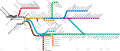 LIRR schematic.svg 3,985 × 1,687; 500 KB
-
 Long Island Rail Road Diagram.svg 512 × 287; 2.08 MB
-

-

-
 New York City Commuter Railroads Diagram.svg 512 × 399; 2.47 MB
-
 NYAR map.svg 512 × 304; 288 KB
-

-

-
 Port of Embarkation Hoboken (1917-1918).png 614 × 892; 169 KB
-

-
 Rockaway Branches.jpg 971 × 473; 144 KB
-
 Sanborn Fire Insurance Map from Jamaica, Queens County, New York. LOC sanborn06010 001-5.jpg 6,450 × 7,650; 3.46 MB
-
 Sanborn Fire Insurance Map from Jamaica, Queens County, New York. LOC sanborn06010 001-5.tif 6,450 × 7,650; 141.17 MB
-
 Sanborn Fire Insurance Map from Jamaica, Queens County, New York. LOC sanborn06010 002-9.tif 6,450 × 7,650; 141.17 MB
-

-
 Sanborn Fire Insurance Map from Jamaica, Queens County, New York. LOC sanborn06010 003-11.tif 6,450 × 7,650; 141.17 MB
-
 The Flushing and North Side Railroad, with its leased branches. NYPL1527260.tiff 5,428 × 7,230; 112.31 MB
-

-
 The Street railway journal (1903) (14758305321).jpg 1,306 × 3,674; 399 KB
-
 The street railway review (1891) (14757425094).jpg 1,694 × 1,504; 351 KB
-
 The Transportation system - New York City - Brooklyn and Manhattan(GN03662).jpg 2,448 × 3,264; 857 KB


_-_Queens_County_-_Queens_-_ED_41-1_to_2176_-_NARA_-_24519584_(page_8).jpg)
.jpg)


_(14755089431).jpg)
_(14755160801).jpg)
_(14757960362).jpg)
_(14758024062).jpg)
_(14758045692).jpg)
_(14778146273).jpg)


_(14595245600).jpg)


.png)


_(14573132588).jpg)
_(14757425094).jpg)
_(14758305321).jpg)
.jpg)