Category:Maps of Landkreis Göttingen
Jump to navigation
Jump to search

Wikimedia category | |||||
| Upload media | |||||
| Instance of | |||||
|---|---|---|---|---|---|
| Category combines topics | |||||
| Göttingen district | |||||
district in Lower Saxony, Germany | |||||
| Instance of |
| ||||
| Named after | |||||
| Location |
| ||||
| Capital | |||||
| Official language | |||||
| Head of government |
| ||||
| Inception |
| ||||
| Population |
| ||||
| Area |
| ||||
| Elevation above sea level |
| ||||
| Replaces | |||||
| Different from | |||||
| official website | |||||
 | |||||
Subcategories
This category has the following 14 subcategories, out of 14 total.
G
- Maps of Gleichen (11 F)
H
M
- Maps of Leinegraben (3 F)
O
- Maps of Osterode am Harz (4 F)
R
- Maps of Rhumspringe (4 F)
Media in category "Maps of Landkreis Göttingen"
The following 16 files are in this category, out of 16 total.
-
Bundestagswahlkreis 53-2013.svg 720 × 640; 61 KB
-
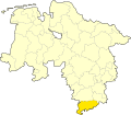
GÖ in Niedersachsen.svg 1,121 × 978; 147 KB
-
Göttingen in Hannover 1905.png 794 × 680; 23 KB
-
Heinrich-Karl-Wilhelm Berghaus. kartenausschnitte Harz-Thüringen-Hessen (6).jpg 2,044 × 1,947; 1.93 MB
-
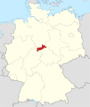
Lage des Landkreises Göttingen in Deutschland.GIF 176 × 234; 3 KB
-
Landkreis Göttingen FFH Gebiete.jpg 3,664 × 2,529; 1.42 MB
-
Locator map GÖ in Germany.svg 1,075 × 1,273; 535 KB
-
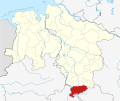
Locator map GÖ in Lower Saxony.svg 1,424 × 1,203; 322 KB
-
Lower saxony goe.png 280 × 245; 13 KB
-
Lower Saxony GÖ 2016.svg 1,424 × 1,203; 267 KB
-
Municipalities in GÖ-2016.svg 2,077 × 1,587; 904 KB
-
Reliefkarte MD (14).png 1,145 × 962; 1.74 MB
-
Sydow Wagners Methodischer Schulatlas 1904 Kopie (3).jpg 3,190 × 2,602; 2.58 MB
-
Topographischer Atlas des Königreichs Hannover und Herzogthums Braunschweig Nr (1).jpg 2,596 × 1,348; 1.48 MB


