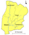
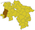
Category:Maps of Landkreis Emsland
Jump to navigation
Jump to search

Wikimedia category | |||||
| Upload media | |||||
| Instance of | |||||
|---|---|---|---|---|---|
| Category combines topics | |||||
| Emsland | |||||
German district (Landkreis) in Lower Saxony | |||||
| Instance of |
| ||||
| Named after | |||||
| Location | Lower Saxony, Germany | ||||
| Capital | |||||
| Legislative body | |||||
| Head of government |
| ||||
| Inception |
| ||||
| Population |
| ||||
| Area |
| ||||
| Elevation above sea level |
| ||||
| Replaces |
| ||||
| Different from | |||||
| official website | |||||
 | |||||
Subcategories
This category has the following 62 subcategories, out of 62 total.
A
- Maps of Andervenne (2 F)
B
- Maps of Bawinkel (1 F)
- Maps of Beesten (2 F)
- Maps of Bockhorst (6 F)
- Maps of Börger (2 F)
- Maps of Breddenberg (2 F)
D
- Maps of Dersum (2 F)
- Maps of Dohren (Emsland) (1 F)
- Maps of Dörpen (7 F)
E
- Maps of Emsbüren (5 F)
- Maps of Esterwegen (2 F)
F
- Maps of Freren (5 F)
- Maps of Fresenburg (3 F)
G
- Maps of Geeste (9 F)
- Maps of Gersten (2 F)
- Maps of Groß Berßen (2 F)
H
- Maps of Handrup (2 F)
- Maps of Haren (Ems) (8 F)
- Maps of Haselünne (9 F)
- Maps of Heede (Emsland) (4 F)
- Maps of Herzlake (3 F)
- Maps of Hilkenbrook (2 F)
- Maps of Hüven (3 F)
K
- Maps of Klein Berßen (2 F)
- Maps of Kluse (Emsland) (2 F)
L
- Maps of Lähden (3 F)
- Maps of Lahn (Hümmling) (2 F)
- Maps of Langen (Emsland) (2 F)
- Maps of Lathen (4 F)
- Maps of Lehe (Emsland) (5 F)
- Maps of Lorup (4 F)
- Maps of Lünne (2 F)
M
- Maps of Meppen (33 F)
- Maps of Messingen (2 F)
N
- Maps of Neubörger (2 F)
- Maps of Neulehe (2 F)
- Maps of Niederlangen (6 F)
O
- Maps of Oberlangen (2 F)
P
- Maps of Papenburg (23 F)
R
- Maps of Rastdorf (2 F)
- Maps of Renkenberge (2 F)
S
- Maps of Salzbergen (3 F)
- Maps of Schapen (2 F)
- Maps of Sögel (5 F)
- Maps of Spelle (2 F)
- Maps of Surwold (6 F)
- Maps of Sustrum (2 F)
T
- Maps of Thuine (2 F)
- Maps of Twist (Emsland) (5 F)
V
- Maps of Vrees (2 F)
W
- Maps of Walchum (2 F)
- Maps of Werlte (3 F)
- Maps of Werpeloh (3 F)
- Maps of Wettrup (3 F)
- Maps of Wippingen (2 F)
Pages in category "Maps of Landkreis Emsland"
This category contains only the following page.
Media in category "Maps of Landkreis Emsland"
The following 39 files are in this category, out of 39 total.
-
Die Gartenlaube (1893) b 627 2.jpg 1,000 × 443; 66 KB
-
EL 1977 Gemeinden.png 680 × 1,058; 17 KB
-
EL in Niedersachsen.svg 1,121 × 978; 147 KB
-
Ems Hase Kanal.png 793 × 1,123; 19 KB
-
Emsland gemeinden.png 793 × 1,123; 20 KB
-
Emsland Low Saxon.png 680 × 1,058; 42 KB
-
Friesische Strasse.png 227 × 945; 14 KB
-
Haren - Süd-Nord-Straße - Denkmal 07 ies.jpg 3,744 × 5,616; 13.72 MB
-
Haren - Süd-Nord-Straße - Denkmal 08 ies.jpg 3,744 × 5,616; 15.48 MB
-
Herzogtum Arenberg-Meppen.png 794 × 945; 21 KB
-
Huemmling 1932.png 794 × 907; 37 KB
-
Lage des Landkreises Emsland in Deutschland.GIF 176 × 234; 3 KB
-
Landkreis Emsland Verkehr.png 680 × 1,058; 37 KB
-
Landkreis Lingen vor 1974.png 794 × 869; 20 KB
-
Linksemsisches Kanlnetz.png 680 × 680; 17 KB
-
Locator map EL in Germany.svg 1,075 × 1,273; 535 KB
-
Locator map EL in Lower Saxony.svg 1,424 × 1,203; 322 KB
-
Lower saxony el.png 280 × 245; 13 KB
-
Meppen - Zum Paradies - Altes Versener Wehr 06 ies.jpg 5,616 × 3,744; 17.4 MB
-
Meppen-Haseluenner-Eisenbahn.png 1,096 × 378; 17 KB
-
Niedergrafschaft Lingen 1803.png 794 × 907; 17 KB
-
Niederstift Muenster.png 1,096 × 945; 27 KB
-
Papenburg - Oldenburger Straße - Emslandlager Aschendorfermoor 04 ies.jpg 3,188 × 4,305; 11.9 MB
-
S-G Lathen.png 756 × 453; 10 KB
-
Samtgemeinde Doerpen.png 756 × 605; 13 KB
-
Samtgemeinde Freren.png 794 × 831; 13 KB
-
Samtgemeinde Lengerich.png 794 × 605; 11 KB
-
Samtgemeinde Nordhuemmling.png 756 × 529; 9 KB
-
Samtgemeinde Soegel.png 794 × 907; 15 KB
-
Samtgemeinde Spelle.png 756 × 605; 10 KB
-
Samtgemeinde Werlte.png 794 × 1,020; 14 KB
-
SG Doerpen Emsland.png 680 × 1,058; 13 KB
-
SG Freren Emsland.png 680 × 1,058; 13 KB
-
SG Lathen Emsland.png 680 × 1,058; 13 KB
-
SG Lengerich Emsland.png 680 × 1,058; 13 KB
-
SG Nordhuemmling Emsland.png 680 × 1,058; 13 KB
-
SG Soegel Emsland.png 680 × 1,058; 14 KB
-
SG Spelle Emsland.png 680 × 1,058; 13 KB
-
SG Werlte Emsland.png 680 × 1,058; 13 KB


