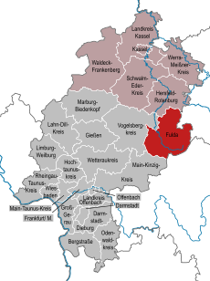
Category:Maps of Landkreis Fulda
Jump to navigation
Jump to search
Districts of Hesse:
Urban districts (cities):
Wikimedia category | |||||
| Upload media | |||||
| Instance of | |||||
|---|---|---|---|---|---|
| Category combines topics | |||||
| Fulda | |||||
district in Hesse, Germany | |||||
| Instance of | |||||
| Named after | |||||
| Location | Kassel Government Region, Hesse, Germany | ||||
| Capital | |||||
| Population |
| ||||
| Area |
| ||||
| Elevation above sea level |
| ||||
| official website | |||||
 | |||||
Subcategories
This category has the following 2 subcategories, out of 2 total.
M
Media in category "Maps of Landkreis Fulda"
The following 19 files are in this category, out of 19 total.
-
Biotopstruktur Dietershausen Giebelrain mg-k.jpg 798 × 825; 247 KB
-
Fulda-überregionale Straßenanbindung.png 526 × 606; 103 KB
-
Fulda-überregionale Straßenanbindung.svg 526 × 606; 57 KB
-
Hesse fd.png 174 × 245; 7 KB
-
Hessen FD.png 722 × 957; 88 KB
-
Karte Rotes Moor.png 1,607 × 2,344; 269 KB
-
Karte Tunnels im Landrücken.png 534 × 411; 375 KB
-
Kurhessen Kr Gersfeld.png 253 × 280; 44 KB
-
Kurhessen Kr Hünfeld.png 315 × 323; 62 KB
-
Lage des Landkreises Fulda in Deutschland.GIF 176 × 234; 3 KB
-
Lage von Tann (Rhön) im Biosphärenreservat.png 317 × 209; 33 KB
-
Landrückentunnel Map.png 1,078 × 1,015; 202 KB
-
Location Rhön.PNG 506 × 439; 40 KB
-
Locator map FD in Germany.svg 1,075 × 1,273; 498 KB
-
Locator map FD in Hesse.svg 868 × 1,164; 655 KB
-
Map of Hesse with districts (with numbers).svg 403 × 542; 77 KB
-
Oberhessen.png 742 × 738; 324 KB
-
Rhoenradweg2.jpg 1,297 × 1,975; 223 KB
-
Uebersichtskarte Rhoen Tann.jpg 800 × 971; 112 KB


