Category:Maps of Hesse
Appearance
Federal states of Germany:
Use the appropriate category for maps showing all or a large part of Hesse. See subcategories for smaller areas:
| If the map shows | Category to use |
|---|---|
| Hesse on a recently created map | Category:Maps of Hesse or its subcategories |
| Hesse on a map created more than 70 years ago | Category:Old maps of Hesse or its subcategories |
| the history of Hesse on a recently created map | Category:Maps of the history of Hesse or its subcategories |
| the history of Hesse on a map created more than 70 years ago | Category:Old maps of the history of Hesse or its subcategories |
Wikimedia category | |||||
| Upload media | |||||
| Instance of | |||||
|---|---|---|---|---|---|
| Category combines topics | |||||
| Hesse | |||||
state in the center of Germany | |||||
| Instance of | |||||
| Named after | |||||
| Location |
| ||||
| Capital | |||||
| Legislative body | |||||
| Highest judicial authority |
| ||||
| Official language | |||||
| Head of government |
| ||||
| Inception |
| ||||
| Highest point | |||||
| Population |
| ||||
| Area |
| ||||
| Elevation above sea level |
| ||||
| Budget |
| ||||
| Said to be the same as | Greater Hesse | ||||
| official website | |||||
 | |||||
Subcategories
This category has the following 56 subcategories, out of 56 total.
*
- Location maps of Hesse (6 F)
- Maps of lakes of Hesse (1 F)
- Maps of rivers of Hesse (10 F)
- Site plans of Hesse (1 F)
+
- Maps of Kellerwald (9 F)
- Maps of Reinhardswald (13 F)
- Maps of the Spessart (7 F)
- Maps of the Taunus (20 F)
B
D
F
G
H
K
L
- Maps of Lich (1 F)
M
O
R
S
W
Media in category "Maps of Hesse"
The following 87 files are in this category, out of 87 total.
-
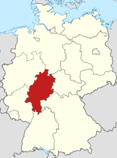
Knüll.png 188 × 235; 6 KB
-
101020 keb hessen karte.jpg 938 × 1,280; 278 KB
-
1822-1829 Kreis Salmünster.png 1,128 × 1,487; 1.28 MB
-
Altstrassen Hessen.svg 840 × 305; 18 KB
-
Amt fuer Bodenmanagement MR Grenzgangskarte BID 2012.pdf 1,754 × 2,481; 1.33 MB
-
Amt fuer Bodenmanagement MR Grenzgangskarte BID 2012a.png 3,366 × 4,865; 1.54 MB
-
BAB 67 AS Lorsch OSM map.svg 1,816 × 3,359; 4.42 MB
-
Bergstrasse-Karte.png 612 × 735; 188 KB
-
Biotopstruktur Dietershausen Giebelrain mg-k.jpg 798 × 825; 247 KB
-
Burganlage-dieburg-schema.png 1,594 × 1,642; 830 KB
-
Burgwald.png 1,200 × 1,514; 417 KB
-
Drehstromuebertragung Lauffen-Frankfurt.png 615 × 1,332; 1.31 MB
-
Ederradweg-landkarte.jpg 4,020 × 3,016; 2.97 MB
-
Ergänzte Uebersichtskarte Spessart.png 1,000 × 939; 1.25 MB
-
Fulda Gap Terrain Features.png 780 × 641; 607 KB
-
Fuldaha in Germania.png 1,138 × 1,174; 140 KB
-
Geo Taunus.jpg 1,398 × 689; 301 KB
-
Geologische Karte Dillmulde.png 2,892 × 2,565; 1.31 MB
-
Geologische Karte Lahnmulde.png 2,903 × 2,542; 1.5 MB
-
Geologische Karte Taunus.png 3,120 × 2,556; 1.75 MB
-
Gericht Katzenberg - Karte von Nikolaus Person, 1694.jpg 2,071 × 1,500; 593 KB
-
Germany topo Fulda Gap.jpg 578 × 444; 121 KB
-
Hesse state association.png 374 × 490; 16 KB
-
Hessen Altstrassen kurze und lange Hessen Karte.svg 548 × 544; 1.99 MB
-
Hessen Flughäfen und Landeplätze.png 1,130 × 1,500; 414 KB
-
Hessen karte.png 248 × 350; 9 KB
-
Hessen Kreise Namen.png 1,466 × 2,048; 5.72 MB
-
Karte der Ortsteile von Babenhausen (Hessen).png 1,100 × 1,017; 1.28 MB
-
Karte des Deutschen Reiches (5820384c).jpg 11,231 × 9,336; 49.06 MB
-
Karte des Spessarts.png 504 × 455; 467 KB
-
Karte Deutschland Taunus 2.png 188 × 235; 7 KB
-
Karte Limes-Radweg.png 1,465 × 875; 1.85 MB
-
Karte MTK.png 709 × 546; 385 KB
-
Karte Nordhessen.png 874 × 1,172; 129 KB
-
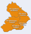
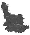
Karte PPWesthessen.gif 220 × 242; 6 KB
-
Karte Rothaarsteig.png 718 × 726; 214 KB
-
Karte Sendeanlagen in Mainflingen.png 1,404 × 1,141; 635 KB
-
Karte Taunus Deutschland.png 188 × 235; 7 KB
-
Keb-hessen 4bistuemer.jpg 700 × 950; 279 KB
-
Karte Stadtgebiet Kirchhain.png 4,108 × 3,970; 575 KB
-
Lagekarte NFV in Hessen.gif 600 × 800; 21 KB
-
Lahnverlauf.jpg 722 × 445; 382 KB
-
Landkarte hessen arfurt.jpg 180 × 226; 30 KB
-
Landkarte hessen arfurt2.jpg 180 × 226; 30 KB
-
Landkreis kassel.jpg 554 × 450; 88 KB
-
Linienplan BLE 2002.JPG 842 × 1,200; 238 KB
-
Linienplan BLE 2007.jpg 842 × 1,200; 241 KB
-
Linspherbach Großherzogthume Hessen.jpg 2,152 × 1,949; 5.98 MB
-
Lv hessen.gif 152 × 216; 2 KB
-
Marburg Kirchhain Map.png 978 × 981; 214 KB
-
Metropolregion FRM.jpg 2,156 × 2,155; 308 KB
-
ZMRN.png 1,920 × 1,359; 800 KB
-
Mittelhessen-Sportkarte.jpg 487 × 315; 40 KB
-
Naturraumkarte Rhoen.png 1,090 × 1,248; 2.25 MB
-
NaturraumLM Ausschnitt.png 1,714 × 1,992; 107 KB
-
NaturraumLM.png 3,900 × 2,250; 179 KB
-
Nidda Fluss Karte.png 738 × 719; 185 KB
-
Nidder Karte.png 740 × 734; 167 KB
-
Oberhessen kommunen.jpg 1,000 × 1,000; 33 KB
-
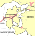
OberlaudenbachKarte.png 707 × 747; 19 KB
-
Osthessen.jpg 350 × 431; 157 KB
-
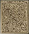
Partie septentrionale du landgraviat de Hesse-Cassel 1761.jpg 1,024 × 1,199; 376 KB
-
Physische Uebersichtkarte Rhoen.png 417 × 365; 303 KB
-
Plan Kühkopf-Knoblochsaue.png 953 × 1,052; 141 KB
-
Polizeipräsidium Frankfurt (Karte).png 1,000 × 1,004; 134 KB
-
Polizeipräsidium Mittelhessen (Karte).svg 443 × 312; 34 KB
-
Polizeipräsidium Nordhessen (Karte).svg 443 × 312; 38 KB
-
Region Frankfurt am Main - Verwaltungskarte mit Ortsnamen.jpg 1,968 × 1,668; 1.68 MB
-
Regionalgrenzen Hessen.png 360 × 442; 108 KB
-
Spessart Uebersichtskarte.png 1,000 × 939; 1.35 MB
-
Stromnetzkarte e-netz-sh.svg 269 × 348; 1.03 MB
-
Sydow Mittelgruppe des Nord-deutschen Berglandes (Nordhessen).jpg 4,320 × 3,240; 4.67 MB
-
Uebersichtskarte Rhoen Tann.jpg 800 × 971; 112 KB
-
Uebersichtskarte Rhoen.jpg 800 × 971; 216 KB
-
Verlaufskarte Schwalm.png 888 × 1,404; 2 MB
-
Water divide Rhine Weser.png 937 × 791; 204 KB
-
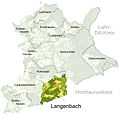
Langenbach Lageplan.jpg 868 × 834; 113 KB
-
Weimar (Lahn) - Ortsteile.jpg 228 × 260; 11 KB
-
Weimar (Lahn) - Wenkbach.jpg 228 × 260; 9 KB
-
Westhessische Senke mit Relief.svg 615 × 933; 2.57 MB
-
Westhessische senke.svg 414 × 912; 126 KB
-
ZMRN.jpg 1,196 × 849; 690 KB
-
Übersichtskarte Odenwald.png 414 × 377; 270 KB
-
Übersichtskarte Rothaargebirge.png 556 × 424; 513 KB


