Category:Maps of Hauts-de-France
Appearance
Administrative regions and territorial collectivity of Metropolitan France (‡ since start of 2016):
Auvergne-Rhône-Alpes‡ · Bourgogne-Franche-Comté‡ · Brittany · Centre-Val de Loire · Corsica · Grand Est‡ · Hauts-de-France‡ · Île-de-France · Normandy‡ · Nouvelle-Aquitaine‡ · Occitania‡ · Pays de la Loire · Provence-Alpes-Côte d'Azur
Former administrative regions of Metropolitan France (until end of 2015):
Alsace · Aquitaine · Auvergne · Burgundy · Champagne-Ardenne · Franche-Comté · Languedoc-Roussillon · Limousin · Lorraine · Midi-Pyrénées · Nord-Pas-de-Calais · Lower Normandy · Upper Normandy · Picardy · Poitou-Charentes · Rhône-Alpes
Overseas departments and regions: Guadeloupe · Martinique · French Guiana · Réunion · Mayotte
Overseas collectivities: Saint Barthélemy · Saint-Martin · Saint Pierre and Miquelon · French Polynesia · Wallis and Futuna · French Southern and Antarctic Lands+
Sui generis territories: New Caledonia · Clipperton Island+
Wikimedia category | |||||
| Upload media | |||||
| Instance of | |||||
|---|---|---|---|---|---|
| Category combines topics | |||||
| Hauts-de-France | |||||
administrative region of France | |||||
| Instance of | |||||
| Part of | |||||
| Location | Metropolitan France, France | ||||
| Capital | |||||
| Legislative body | |||||
| Head of government |
| ||||
| Headquarters location | |||||
| Start time |
| ||||
| Highest point | |||||
| Population |
| ||||
| Area |
| ||||
| Replaces |
| ||||
| official website | |||||
 | |||||
Subcategories
This category has the following 19 subcategories, out of 19 total.
!
*
R
~
Media in category "Maps of Hauts-de-France"
The following 18 files are in this category, out of 18 total.
-
1789 + 2022 Hauts-de-France + Île, noms.png 866 × 1,378; 136 KB
-
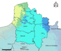
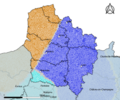
32-Hauts-de-France-climat2010.png 3,519 × 2,930; 2.77 MB
-
32-Hauts-de-France-climat29R.png 3,519 × 2,930; 4.79 MB
-
32-Hauts-de-France-climat5Z.png 3,519 × 2,930; 2.65 MB
-
Carte de Picardie.svg 1,371 × 1,232; 1.09 MB
-
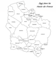
Carte des pagi des Hauts-de-France.png 8,116 × 8,644; 3.47 MB
-
Carte des pagi des Hauts-de-France2.png 8,116 × 8,644; 3.71 MB
-
Carte du Calaisis.svg 91 × 70; 757 KB
-
Carte ferro Fra N.png 1,526 × 1,275; 299 KB
-
Carte Hauts-de-France régions culturelles.png 2,188 × 1,805; 346 KB
-
Carte Nord-Pas-de-Calais Arras - Picardie.png 5,830 × 3,737; 1.41 MB
-
Carte-hauts-de-france-1024x684.png 1,024 × 684; 233 KB
-
CartePicardiePaysPicards.svg 712 × 387; 967 KB
-
Opera Momentaufnahme 2019-07-19 145706 www.stadtplan.de Opalküste.png 449 × 569; 322 KB
-
Pays traditionnels des Hauts-de-France.svg 2,268 × 3,024; 1.25 MB
-
Pays traditionnels des Hauts-de-Francewikipedia.png 8,116 × 8,644; 19.75 MB
-
PaysBasFR.svg 731 × 505; 2.18 MB
-
The names of the coasts in Normandy.JPG 853 × 658; 78 KB


