
Category:Maps of Centre-Val de Loire
Administrative regions and territorial collectivity of Metropolitan France (‡ since start of 2016):
Auvergne-Rhône-Alpes‡ · Bourgogne-Franche-Comté‡ · Brittany · Centre-Val de Loire · Corsica · Grand Est‡ · Hauts-de-France‡ · Île-de-France · Normandy‡ · Nouvelle-Aquitaine‡ · Occitania‡ · Pays de la Loire · Provence-Alpes-Côte d'Azur
Former administrative regions of Metropolitan France (until end of 2015):
Alsace · Aquitaine · Auvergne · Burgundy · Champagne-Ardenne · Franche-Comté · Languedoc-Roussillon · Limousin · Lorraine · Midi-Pyrénées · Nord-Pas-de-Calais · Lower Normandy · Upper Normandy · Picardy · Poitou-Charentes · Rhône-Alpes
Overseas departments and regions: Guadeloupe · Martinique · French Guiana · Réunion · Mayotte
Overseas collectivities: Saint Barthélemy · Saint-Martin · Saint Pierre and Miquelon · French Polynesia · Wallis and Futuna · French Southern and Antarctic Lands+
Sui generis territories: New Caledonia · Clipperton Island+
Use the appropriate category for maps showing all or a large part of Centre-Val de Loire. See subcategories for smaller areas:
| If the map shows | Category to use |
|---|---|
| Centre-Val de Loire on a recently created map | Category:Maps of Centre-Val de Loire or its subcategories |
| Centre-Val de Loire on a map created more than 70 years ago | Category:Old maps of Centre-Val de Loire or its subcategories |
| the history of Centre-Val de Loire on a recently created map | Category:Maps of the history of Centre-Val de Loire or its subcategories |
| the history of Centre-Val de Loire on a map created more than 70 years ago | Category:Old maps of the history of Centre-Val de Loire or its subcategories |

Wikimedia category | |||||
| Upload media | |||||
| Instance of | |||||
|---|---|---|---|---|---|
| Category combines topics | |||||
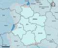
| Centre-Val de Loire | |||||
French administrative region     | |||||
| Instance of | |||||
| Part of |
| ||||
| Location | Metropolitan France, France | ||||
| Capital | |||||
| Legislative body | |||||
| Head of government |
| ||||
| Start time |
| ||||
| Inception |
| ||||
| Population |
| ||||
| Area |
| ||||
 | |||||
Subcategories
This category has the following 18 subcategories, out of 18 total.
!
*
M
R
Media in category "Maps of Centre-Val de Loire"
The following 12 files are in this category, out of 12 total.
-
 -20 ans par cantons-1999-Centre.jpg 500 × 500; 130 KB
-
 -20ans1999-canton legende.jpg 190 × 148; 7 KB
-
 1789 et 2022, Centre-Val de Loire et Île-de-France, noms.png 1,200 × 1,368; 188 KB
-
 24-Centre-Val de Loire-climat2010.png 3,519 × 2,930; 3.06 MB
-
 24-Centre-Val de Loire-climat29R.png 3,519 × 2,930; 5.36 MB
-
 24-Centre-Val de Loire-climat5Z.png 3,519 × 2,930; 2.66 MB
-
 A 85.jpg 570 × 310; 32 KB
-
 CARTE DE LA RÉGION NATURELLE DU PERCHE.png 3,508 × 2,481; 396 KB
-
 Extrait de la carte de Cassini XVIIIème Siècle.png 1,532 × 1,020; 2.68 MB
-
 Sologne Region Centre-Val-de-Loire topo.jpg 2,519 × 2,480; 1.88 MB
-
 TER Centre, carte du réseau.png 1,263 × 1,481; 3.81 MB
-
 TER Centre, fréquences de la desserte.png 1,263 × 1,478; 594 KB


