Category:Maps of France in the 16th century
Jump to navigation
Jump to search
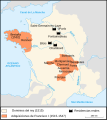
English: This category is about the subject of  France 1501-15600 CE: History maps showing all or a substantial part of the territory of France as it was in the 16th century.
Contemporary old maps belong into: Category:16th-century maps of France and its subcategories.
Contemporary old maps belong into: Category:16th-century maps of France and its subcategories.
Maps of the history of France: (BCE) 1st century · (CE) 1st century · 2nd century · 3rd century · 4th century · 5th century · 6th century · 7th century · 8th century · 9th century · 10th century · 11th century · 12th century · 13th century · 14th century · 15th century · 16th century · 17th century · 18th century · 19th century · 20th century · 21st century ·
Subcategories
This category has the following 4 subcategories, out of 4 total.
*
L
Media in category "Maps of France in the 16th century"
The following 13 files are in this category, out of 13 total.
-
087 - Guerres de Religion en France - Géographie historique. Leçons en regard des cartes.jpg 2,194 × 2,185; 1.06 MB
-
France language map 1550.jpg 1,559 × 1,726; 630 KB
-
C. 1560 France.jpg 1,131 × 1,112; 1.06 MB
-
392 of 'La France Illustrée- géographie générale ... Par F. J' (11292231994).jpg 1,177 × 1,167; 375 KB
-
France1911dev.png 2,046 × 2,780; 3.94 MB
-
Provinces of France 1322-1789.png 2,388 × 2,452; 10.31 MB
-
Le Verdunois XIIIe-XVIe siecle.jpg 1,475 × 1,023; 496 KB
-
Map of France under Francis I (1515-1547)-es.svg 723 × 809; 79 KB
-
Map of France under Francis I (1515-1547)-fr.svg 723 × 809; 377 KB
-
Metallurgie1500.jpg 419 × 579; 66 KB
-
Spruner-Menke Handatlas 1880 Karte 54.jpg 3,556 × 3,006; 1.31 MB


