Category:Maps of Dantumadiel
Jump to navigation
Jump to search
Wikimedia category | |||||
| Upload media | |||||
| Instance of | |||||
|---|---|---|---|---|---|
| Category combines topics | |||||
| Dantumadiel | |||||
municipality in Friesland, the Netherlands | |||||
| Instance of |
| ||||
| Location | Friesland, Netherlands | ||||
| Population |
| ||||
| Area |
| ||||
| Elevation above sea level |
| ||||
| official website | |||||
 | |||||
Subcategories
This category has only the following subcategory.
Media in category "Maps of Dantumadiel"
The following 17 files are in this category, out of 17 total.
-
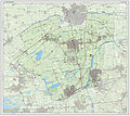
2013-Dantumadiel.jpg 2,428 × 2,170; 3.17 MB
-
Atlas Schoemaker-FRIESLAND-DEEL3-3103-Friesland, Dantumadeel.jpeg 1,504 × 1,195; 390 KB
-
BAG woonplaatsen - Gemeente Dantumadiel.png 2,419 × 2,419; 641 KB
-
Dantumadiel location map municipality NL.png 760 × 598; 97 KB
-
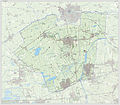
Gem-Dantumadiel-2014Q1.jpg 4,874 × 4,259; 8.7 MB
-
Gem-Dantumadiel-OpenTopo.jpg 4,687 × 4,022; 2.28 MB
-
Map - NL - Dantumadeel (2009).svg 625 × 575; 1.36 MB
-
Map NL Dantumadiel Broeksterwâld.png 800 × 500; 54 KB
-
Map NL Dantumadiel Damwâld.png 800 × 500; 54 KB
-
Map NL Dantumadiel De Falom.png 800 × 500; 57 KB
-
Map NL Dantumadiel De Westerein.png 800 × 500; 54 KB
-
Map NL Dantumadiel Driezum.png 800 × 500; 54 KB
-
Map NL Dantumadiel Feanwâlden.png 800 × 500; 54 KB
-
Map NL Dantumadiel Readtsjerk.png 800 × 500; 57 KB
-
Map NL Dantumadiel Rinsumageast.png 800 × 500; 54 KB
-
Map NL Dantumadiel Sibrandahûs.png 800 × 500; 57 KB
-
Map NL Dantumadiel Wâlterswâld.png 800 × 500; 54 KB


