Category:Maps of Ameland
Jump to navigation
Jump to search
Ameland · Amrum · Baltrum · Borkum · Föhr · Heligoland · Juist · Langeoog · Norderney · Rottumeroog · Schiermonnikoog · Spiekeroog · Sylt · Terschelling · Texel · Vlieland · Wangerooge ·
Wikimedia category | |||||
| Upload media | |||||
| Instance of | |||||
|---|---|---|---|---|---|
| Category combines topics | |||||
| Ameland | |||||
municipality in Friesland, the Netherlands | |||||
| Pronunciation audio | |||||
| Instance of |
| ||||
| Location | Ameland, Friesland, Netherlands | ||||
| Located in or next to body of water | |||||
| Population |
| ||||
| Area |
| ||||
| Elevation above sea level |
| ||||
| Different from | |||||
| official website | |||||
 | |||||
Subcategories
This category has only the following subcategory.
Media in category "Maps of Ameland"
The following 28 files are in this category, out of 28 total.
-
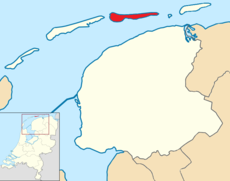
LocatieAmeland.png 280 × 130; 10 KB
-
Map - NL - Municipality code 0060 (2009).svg 300 × 160; 530 KB
-
14 of 'Het eiland Ameland en zijne bewoners, etc. (With a map.)' (11053114334).jpg 2,656 × 1,556; 1.13 MB
-
2013-Ameland.jpg 4,660 × 2,700; 2.86 MB
-
2013-Top33-Ameland.jpg 3,590 × 1,200; 1.14 MB
-
Ameland (OSM).svg 1,188 × 270; 3.24 MB
-
Ameland - Hattinga - De la Rive.jpg 12,960 × 6,032; 18.11 MB
-
Ameland 1854.jpg 12,996 × 8,064; 43 MB
-
Ameland 1907.jpg 16,363 × 5,504; 30.01 MB
-
Ameland locator map municipality NL 2018.png 760 × 598; 93 KB
-
Ameland map.jpg 1,078 × 588; 72 KB
-
Ameland-natuur-OpenTopo.jpg 9,856 × 2,648; 5.16 MB
-
BAG woonplaatsen - Gemeente Ameland.png 2,419 × 2,419; 571 KB
-
Ballumermieden 1854.jpg 1,195 × 915; 261 KB
-
Dam Holwerd-Ameland 1872 kaart 2019.jpg 5,192 × 4,912; 4.54 MB
-
Gem-Ameland-2014Q1.jpg 9,868 × 6,142; 14.18 MB
-
Gem-Ameland-OpenTopo.jpg 10,197 × 6,796; 3.36 MB
-
Hollum-Ameland Ruiverkaveling Hollumer mieden oude toestand, Bestanddeelnr 253-7244.jpg 3,412 × 2,471; 1.84 MB
-
Lânkaart lokaasje Amelânsk.PNG 805 × 570; 21 KB
-
Map - NL - Ameland (2009).svg 625 × 575; 517 KB
-
Map - NL - Municipality code 0060 (2014).png 2,000 × 1,067; 97 KB
-
Natuur-Ameland-2014Q1.jpg 7,445 × 2,118; 2.92 MB
-
Rijksbeschermd stads- of dorpsgezicht - Nes.png 2,016 × 2,267; 92 KB
-
Wadden - Ameland.PNG 921 × 512; 29 KB


