Category:Maps of County Londonderry
Jump to navigation
Jump to search
Wikimedia category | |||||
| Upload media | |||||
| Instance of | |||||
|---|---|---|---|---|---|
| Category combines topics | |||||
| County Londonderry | |||||
county of Northern Ireland | |||||
| Instance of | |||||
| Part of | |||||
| Location | Northern Ireland | ||||
| Located in or next to body of water |
| ||||
| Capital | |||||
| Inception |
| ||||
| Population |
| ||||
| Area |
| ||||
 | |||||
Subcategories
This category has only the following subcategory.
Media in category "Maps of County Londonderry"
The following 59 files are in this category, out of 59 total.
-
100 of '(Our own country. Descriptive, historical, pictorial.)' (11175981394).jpg 1,879 × 1,523; 805 KB
-
1837Londonderry.jpg 1,156 × 1,496; 167 KB
-
A plot of the lands belonging to the Company of Mercers (27449185420).jpg 5,584 × 4,396; 9.17 MB
-
Admiralty Chart No 2499 Lough Foyle, Published 1885.jpg 16,304 × 10,902; 68.63 MB
-
Ballinderry.png 487 × 494; 15 KB
-
Baronies of Londonderry.jpg 2,227 × 3,142; 1.07 MB
-
Brackaghlislea.png 487 × 494; 15 KB
-
Calmore.png 487 × 494; 15 KB
-
Clooney.png 487 × 494; 15 KB
-
Coleraine barony.png 741 × 611; 104 KB
-
Coolsaragh.png 487 × 494; 15 KB
-
CountyLondonderry.png 443 × 535; 59 KB
-
DesertmartinParish.png 400 × 420; 18 KB
-
Detail from 1853 map, showing printed map which has been overpainted (31365749214).jpg 3,456 × 4,608; 9.59 MB
-
Detail of bottom right of 1853 map, showing Ballynascreen (31831250780).jpg 4,608 × 3,456; 7.77 MB
-
Drumballyhagan Clarke.png 487 × 494; 15 KB
-
Drumballyhagan.png 487 × 494; 15 KB
-
Drumcrow.png 487 × 494; 15 KB
-
Drumsamney.png 487 × 494; 15 KB
-
Dungiven Town Plan, 1740 (32057803242).jpg 4,608 × 3,456; 10.03 MB
-
Early Years of the Ordnance Survey Close (1926) 12.jpg 3,720 × 5,824; 3.13 MB
-
Gortahurk.png 487 × 494; 15 KB
-
Gortamney.png 487 × 494; 15 KB
-
Granny townland.png 487 × 494; 15 KB
-
Keenaght barony.png 741 × 611; 104 KB
-
Keenaght townland.png 487 × 494; 15 KB
-
KilcronaghanParish.png 400 × 420; 20 KB
-
Killynumber.png 487 × 494; 15 KB
-
Killytoney.png 487 × 494; 15 KB
-
Location map Northern Ireland County Londonderry.png 610 × 640; 341 KB
-
Londonderry - British Isles.svg 1,250 × 1,835; 1,024 KB
-
Londonderry Brit Isles Sect 2.svg 915 × 841; 1,012 KB
-
Londonderry Brit Isles Sect 3.svg 939 × 677; 1,012 KB
-
Londonderry Brit Isles Sect 4.svg 627 × 643; 1,012 KB
-
Londonderry Brit Isles Sect 7.svg 584 × 712; 1,012 KB
-
LondonderryAllIreland.PNG 500 × 586; 24 KB
-
LondonderryBrit3.PNG 698 × 491; 28 KB
-
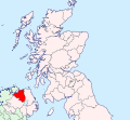
LondonderryBrit4.PNG 468 × 487; 15 KB
-
LondonderryBrit4b.PNG 468 × 487; 15 KB
-
LondonderryShape.gif 532 × 405; 10 KB
-
Loughinsholin.png 741 × 611; 103 KB
-
Map showing the Divisions of the Manor of Pellipar, in Londonderry, Ireland.jpg 4,226 × 2,563; 2.92 MB
-
Map viewed from right hand side (31365190024).jpg 4,608 × 3,456; 5.74 MB
-
Moneyshanere.png 487 × 494; 15 KB
-
Moybeg Kirley.png 487 × 494; 15 KB
-
Moyesset.png 487 × 494; 15 KB
-
NI County Londonderry.png 532 × 405; 22 KB
-
NorthEastLiberties barony.png 741 × 611; 103 KB
-
NorthernIrelandDerry.png 200 × 249; 30 KB
-
NorthWestLiberties barony.png 741 × 611; 103 KB
-
Ordnance Survey One-Inch Sheet 1 North Coast (Northern Ireland), Published 1961.jpg 16,924 × 7,967; 9.96 MB
-
Ordnance Survey One-Inch Sheet 2 Londonderry, Published 1962.jpg 16,132 × 11,902; 83.45 MB
-
Reference giving details of tenements in Dungiven Town Plan, 1740 (32057818882).jpg 4,608 × 3,456; 5.92 MB
-
Tamnyaskey.png 487 × 494; 15 KB
-
Tirkeeran barony.png 741 × 611; 103 KB
-
Tullyroan.png 487 × 494; 15 KB
