Category:Maps of Central Europe in the 14th century
Jump to navigation
Jump to search
English: 
Approximate extent of Central Europe
Contemporary old maps belong into: Category:Old maps of Central Europe and its subcategories.

Contemporary old maps belong into: Category:Old maps of Central Europe and its subcategories.
Maps of the history of Central Europe: (BCE) (CE) 4th century · 5th century · 6th century · 7th century · 8th century · 9th century · 10th century · 11th century · 12th century · 13th century · 14th century · 15th century · 16th century · 17th century · 18th century · 19th century · 20th century ·
Subcategories
This category has the following 2 subcategories, out of 2 total.
M
- Maps of Ostsiedlung (16 F)
Media in category "Maps of Central Europe in the 14th century"
The following 13 files are in this category, out of 13 total.
-
C. 1350 Northeastern Europe.jpg 2,495 × 2,095; 3.55 MB
-
C. 1360 France and Holy Roman Empire.jpg 1,890 × 1,276; 1.52 MB
-
C. 1400 Europe (Northeastern).jpg 1,013 × 1,337; 1.58 MB
-
C. 1400 Germany Ecclesiastical.jpg 3,879 × 3,031; 5.34 MB
-
Map of bohemia 1301.png 1,024 × 1,040; 287 KB
-
Největší rozmach české moci na rozhraní století XIII. a XIV.jpg 1,472 × 1,467; 534 KB
-
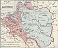
Poland at the end of the 14th century.jpg 575 × 480; 78 KB
-
Spruner-Menke Handatlas 1880 Karte 41.jpg 10,433 × 8,737; 20.57 MB
-
Česká velmoc v druhé polovici století XIV.jpg 1,477 × 1,357; 459 KB
-
Карта Богемии при Карле IV ру.png 1,646 × 1,642; 285 KB
-
查理四世时期的波西米亚地图.png 823 × 821; 224 KB


