Category:Maps of Bahia
Jump to navigation
Jump to search
States of Brazil: Acre · Alagoas · Amapá · Amazonas · Bahia · Ceará · Espírito Santo · Goiás · Maranhão · Mato Grosso · Mato Grosso do Sul · Minas Gerais · Pará · Paraíba · Paraná · Pernambuco · Piauí · Rio de Janeiro · Rio Grande do Norte · Rio Grande do Sul · Rondônia · Roraima · Santa Catarina · São Paulo · Sergipe · Tocantins · Distrito Federal
Use the appropriate category for maps showing all or a large part of Bahia. See subcategories for smaller areas:
| If the map shows | Category to use |
|---|---|
| Bahia on a recently created map | Category:Maps of Bahia or its subcategories |
| Bahia on a map created more than 70 years ago | Category:Old maps of Bahia or its subcategories |
| the history of Bahia on a recently created map | Category:Maps of the history of Bahia or its subcategories |
| the history of Bahia on a map created more than 70 years ago | Category:Old maps of the history of Bahia or its subcategories |
Wikimedia category | |||||
| Upload media | |||||
| Instance of | |||||
|---|---|---|---|---|---|
| Category combines topics | |||||
| Category contains | |||||
| Bahia | |||||
state in the Northeast Region of Brazil | |||||
| Pronunciation audio | |||||
| Instance of | |||||
| Part of | |||||
| Named after | |||||
| Culture | |||||
| Location | Brazil | ||||
| Capital | |||||
| Legislative body | |||||
| Executive body | |||||
| Highest judicial authority | |||||
| Official language | |||||
| Anthem |
| ||||
| Head of government |
| ||||
| Inception |
| ||||
| Highest point |
| ||||
| Population |
| ||||
| Area |
| ||||
| Elevation above sea level |
| ||||
| Follows |
| ||||
| Replaces |
| ||||
| Electorate |
| ||||
| official website | |||||
 | |||||
Subcategories
This category has the following 18 subcategories, out of 18 total.
B
D
E
H
L
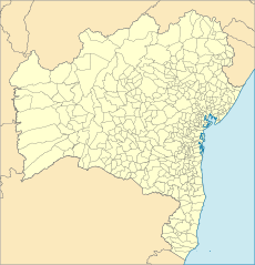
- Location maps of Bahia (2 F)
M
- Maps of education in Bahia (12 F)
O
P
S
- SVG maps of Bahia (72 F)
T
Media in category "Maps of Bahia"
The following 55 files are in this category, out of 55 total.
-
Aceleração Sísmica Mutuípe 2020.jpg 807 × 911; 314 KB
-
Admiralty Chart No 540 Baia de Todos os Santos, Published 1964.jpg 11,068 × 16,294; 28.29 MB
-
Atlantic dry forests wwf.png 3,193 × 3,156; 1.98 MB
-
Bahia coastal forests WWF.png 2,611 × 2,581; 1.41 MB
-
Bahia satélite landsat.jpg 346 × 346; 8 KB
-
Bahia satélite strm.png 346 × 346; 83 KB
-
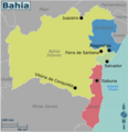
Bahia travel map en.png 3,157 × 3,285; 929 KB
-
Bahia travel map en.voy.png 3,000 × 3,108; 774 KB
-
Baia de Todos os Santos.png 685 × 529; 70 KB
-
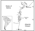
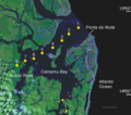
Camamu Bay, state of Bahia, Brazil.png 942 × 850; 195 KB
-
Chapada Diamantina show in map.png 873 × 933; 917 KB
-
Classificação.de.köppen-Geiger.estado.da.Bahia.jpg 4,040 × 4,253; 2.15 MB
-
Cnn oh.jpg 600 × 631; 48 KB
-
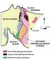
Cráton do São Francisco Bahia.png 314 × 355; 86 KB
-
District of Monte Gordo in the municipality of Camaçari–Bahia–Brazil.tif 2,553 × 1,268; 509 KB
-
Estado-da-Bahia-Mapa-Escolar-IBGE-Brasil.pdf 1,752 × 1,239; 1.21 MB
-
Geographic distribution of Phyllodytes magnus.png 2,000 × 1,545; 4.74 MB
-
Hipsometria do Sudoeste Baiano por Município.jpg 3,507 × 2,480; 943 KB
-
Hipsometria do Sudoeste Baiano.jpg 3,507 × 2,480; 925 KB
-
Ile d Itaparica.png 927 × 587; 2.08 MB
-
Ilha de Itaparica na Baía de Todos os Santos.png 685 × 529; 95 KB
-
Ilha de Itaparica.png 927 × 587; 124 KB
-
Ilha do Medo.png 421 × 671; 55 KB
-
Localização do PNCD no Brasil e Bahia.jpg 2,481 × 3,506; 505 KB
-
Location of the sampling stations (yellow) in Camamu Bay, Bahia, Brazil.png 1,004 × 889; 1.47 MB
-
Macrorregiões de saúde do Estado da Bahia.jpg 1,299 × 1,179; 260 KB
-
Mapa Caetité 1986-2012.jpg 679 × 781; 69 KB
-
Mapa da Violência na Bahia.PNG 722 × 545; 397 KB
-
Mapa de Maiquinique.png 320 × 250; 28 KB
-
Mapa de Nova Viçosa com Distritos.svg 680 × 333; 10 KB
-
Mapa de quijingue 2.png 1,676 × 992; 127 KB
-
Mapa de quijingue 3-1.png 1,676 × 992; 133 KB
-
Mapa do Recôncavo da Bahia.tif 9,281 × 8,922; 129.46 MB
-
Mapa h.jpg 600 × 631; 71 KB
-
Mapa localização Alto Sertão Baiano.png 1,974 × 2,048; 562 KB
-
Mapa Pojuca.jpg 934 × 725; 632 KB
-
Mean-wind-speed-map-bahia-global-wind-atlas.pdf 2,479 × 1,752; 2.33 MB
-
Monte Gordo. Camaçari, Bahia..png 708 × 861; 725 KB
-
Municípios do sudoeste Baiano.jpg 3,507 × 2,480; 392 KB
-
Orography-map-bahia-global-wind-atlas.pdf 2,479 × 1,752; 2 MB
-
Pluviometric Map of Bahia State (Bahia, 2003) (Adapted).jpg 481 × 518; 53 KB
-
PN da Chapada Diamantina.jpg 123 × 125; 5 KB
-
Recifes de coral do nordeste da Bahia.tif 2,001 × 1,397; 692 KB
-
Regiaoindustrial.jpg 3,254 × 2,331; 428 KB
-
Região Sudoeste x Territórios de Identidade.jpg 3,507 × 2,480; 466 KB
-
Serra Geral Bahia.png 2,103 × 2,219; 746 KB
-
Serra Geral cidades.png 903 × 589; 306 KB
-
Siliciclastic caves, Chapada Diamantina (portuguese version).png 1,500 × 939; 420 KB
-
Siliciclastic caves, Chapada Diamantina.png 1,508 × 1,008; 556 KB
-
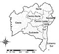
Territórios de Identidade do Estado da Bahia.jpg 925 × 654; 112 KB
-
The location of the coral reefs of northern Bahia (After Leão et al., 1997).tif 2,034 × 1,666; 963 KB
-
Tiros de Guerra do Cmdo da 6ª R M.jpg 4,206 × 3,057; 1.24 MB
-
Tiros de Guerra do Cmdo da 6ª R M.png 4,206 × 3,057; 2.02 MB
-
Área do Rio São Francisco (proposta de unidade federativa).png 977 × 1,024; 371 KB


