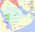
Category:Maps of Arabia in the 19th century
Jump to navigation
Jump to search

English: History maps about the subject of the Arabian Peninsula 1801-1900 CE (roughly AH 1215-AH 1317), as it was in the 19th century.
Not to be confused with genuinely old maps, those belong into: Category:Old maps of the Arabian Peninsula and its subcategories.
The modern states of Arabia were founded in the 20th century. Please sort maps accordingly.
Not to be confused with genuinely old maps, those belong into: Category:Old maps of the Arabian Peninsula and its subcategories.
The modern states of Arabia were founded in the 20th century. Please sort maps accordingly.
Subcategories
This category has the following 3 subcategories, out of 3 total.
1
M
- Maps of Muhammad Ali dynasty (24 F)
Media in category "Maps of Arabia in the 19th century"
The following 34 files are in this category, out of 34 total.
-
The First Saudi State Greatest Extent.png 3,366 × 3,135; 14.72 MB
-
Map of North and West Africa in 1815 AD.png 7,816 × 3,960; 1.71 MB
-
Battle Of AL Radhima (Arabic).jpg 1,080 × 601; 71 KB
-
خريطة الإمارة الخالدية الثانية.jpg 1,080 × 604; 138 KB
-
سلطنة عمان 1856.jpg 428 × 599; 130 KB
-
Emirate of Jabal Shammar.png 528 × 615; 7 KB
-
Ottoman Empire - Basra Vilayet.png 4,455 × 4,840; 1.71 MB
-
Alrasheed hail english.png 608 × 596; 185 KB
-
Bani Khalid Invades Diriyah (Arabic).jpg 1,080 × 601; 85 KB
-
Banu Khalid-ar.png 2,225 × 1,495; 882 KB
-
Banu Khalid.png 2,225 × 1,495; 733 KB
-
Diriyah Invades Bani Khalid (Arabic).jpg 1,080 × 599; 87 KB
-
Empire of Oman-es.svg 750 × 1,450; 198 KB
-
Empire of Oman-hu.svg 750 × 1,450; 195 KB
-
Empire of Oman.png 2,700 × 3,264; 3.79 MB
-
Empire of Oman.svg 750 × 1,450; 224 KB
-
Empire of Oman2-es.svg 959 × 1,340; 443 KB
-
Imamate of Ibn Mu'ammar (Mu'ammarids in Dir'iyyah).png 3,292 × 2,143; 1.27 MB
-
Map of Al Qawasim.jpg 1,080 × 1,308; 39 KB
-
Map of Emirate of Jabal Shammar.jpg 1,080 × 1,107; 77 KB
-
Muhemet Ali Empire 1805 - 1953 (AD).png 821 × 440; 36 KB
-
Ottoman Egypt.png 4,986 × 5,975; 20.92 MB
-
Ottoman Empire Administrative Divisions.png 4,455 × 4,840; 2.1 MB
-
Result of Qajar-Wahhabi War.png 1,587 × 1,080; 295 KB
-
Sa mapa3.png 226 × 288; 13 KB
-
Sa mapa4.png 228 × 288; 14 KB
-
Tihama-asir.png 611 × 1,200; 150 KB
-
Wahhab map.jpg 1,257 × 1,164; 454 KB
-
الدولة العثمانية تقسيمات.png 4,455 × 4,840; 2.21 MB
-
بدون اسم78 20221220183422.png 2,048 × 2,048; 498 KB
-
خرائط الدولة السعودية التاريخية 16.jpg 2,900 × 2,256; 208 KB
-
خرائط الدولة السعودية التاريخية 17.jpg 2,868 × 2,160; 188 KB
-
خريطة وادي سرحان التي تسكنه قيلة الشرارات لرحاله مستشرقين لاكثر من 300 عام1.jpg 743 × 1,034; 159 KB
-
وادي سرحان بالخرائط العثمانيه1.jpg 899 × 699; 143 KB


