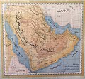
Category:Old maps of the Arabian Peninsula
Jump to navigation
Jump to search
Use the appropriate category for maps showing all or a large part of the Arabian Peninsula. See subcategories for smaller areas:
| If the map shows | Category to use |
|---|---|
| the Arabian Peninsula on a recently created map | Category:Maps of the Arabian Peninsula or its subcategories |
| the Arabian Peninsula on a map created more than 70 years ago | Category:Old maps of the Arabian Peninsula or its subcategories |
| the history of the Arabian Peninsula on a recently created map | Category:Maps of the history of the Arabian Peninsula or its subcategories |
| the history of the Arabian Peninsula on a map created more than 70 years ago | Category:Old maps of the history of the Arabian Peninsula or its subcategories |
Subcategories
This category has the following 15 subcategories, out of 15 total.
Media in category "Old maps of the Arabian Peninsula"
The following 20 files are in this category, out of 20 total.
-
A large draught of the coast of ARABIA from Maculla to Dofar NYPL1640651.tiff 7,230 × 5,428; 112.28 MB
-
Carte d'une partie de l'Arabie Septentrionale (33745434744).jpg 5,762 × 4,479; 14.54 MB
-
Central Asia- Afghanistan and Her Relation to British and Russian Territories WDL11751.png 1,556 × 1,024; 3.18 MB
-
General Map of Central Asia- II WDL11775.png 1,403 × 1,024; 2.37 MB
-
General Map of Central Asia- Schematic View WDL11786.png 1,255 × 1,024; 2.09 MB
-
Gulf11..JPG 3,072 × 2,304; 2.8 MB
-
Gulf20..JPG 3,072 × 2,304; 2.95 MB
-
Gulf28..JPG 3,072 × 2,304; 3.03 MB
-
The Eastern Question in Europe and Asia WDL11691.png 2,121 × 1,551; 4.42 MB
-
Sur les chevaux orientaux et provenants des races orientales. T. 3 (5596132).jpg 8,544 × 11,172; 21.3 MB
-
Sur les chevaux orientaux et provenants des races orientales. T. 3 (5596621).jpg 11,168 × 8,592; 20.89 MB
-
Sur les chevaux orientaux et provenants des races orientales. T. 3 (5596659).jpg 11,168 × 8,592; 21.62 MB
-
الشرارات في الخرائط العثمانية1.jpg 913 × 751; 516 KB
-
خريطة من الأرشيف العربي القديم للمنطقة.jpg 1,024 × 947; 204 KB
-
وادي سرحان بالخرائط العثمانيه.jpg 888 × 681; 104 KB
-
وادي سرحان والشرارات بخريطة اردنية.jpg 478 × 767; 108 KB
-
وادي سرحان وكتاب آثآر المملكة العربية السعودية قديم.jpg 1,271 × 944; 221 KB


