Category:Maps of Aleppo Governorate
Jump to navigation
Jump to search
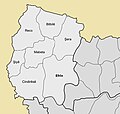
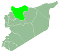
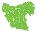
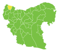
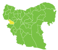
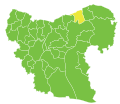
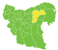
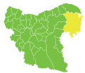
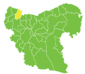
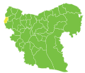
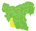
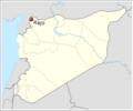
English: Maps of the Governorate of Aleppo — located in northwestern Syria.
- The city and district of Aleppo are within the Aleppo Governorate.
Wikimedia category | |||||
| Upload media | |||||
| Instance of | |||||
|---|---|---|---|---|---|
| Category combines topics | |||||
| Aleppo Governorate | |||||
governorate of Syria | |||||
| Instance of | |||||
| Location | Syria | ||||
| Capital | |||||
| Population |
| ||||
| Area |
| ||||
| Different from | |||||
| official website | |||||
 | |||||
Subcategories
This category has the following 2 subcategories, out of 2 total.
M
- Maps of Afrin District (17 F)
Media in category "Maps of Aleppo Governorate"
The following 69 files are in this category, out of 69 total.
-
Aleppo in Syria.svg 922 × 762; 390 KB
-
Aleppo Governorate with Districts.png 725 × 600; 79 KB
-
SyriaAleppo.PNG 672 × 594; 18 KB
-
A'zaz blank subdistricts.png 2,000 × 1,730; 340 KB
-
Afrin District ar.jpg 1,350 × 1,288; 190 KB
-
Afrin District.jpg 1,350 × 1,288; 180 KB
-
Aleppo 2.jpeg 6,979 × 4,918; 11.32 MB
-
Aleppo and Kuweires offensives (digital rendering).jpg 5,000 × 3,523; 2.22 MB
-
Aleppo blank districts 2009.png 720 × 672; 20 KB
-
Aleppo blank subdistricts.svg 370 × 320; 60 KB
-
Aleppo districts (ku).PNG 793 × 599; 91 KB
-
Aleppo governorate map.png 939 × 806; 1.7 MB
-
Aleppo-map.png 672 × 594; 11 KB
-
Aleppo blank districts 2009-HE.png 720 × 672; 31 KB
-
Northern Aleppo Governorate on 1 January 2013.png 1,998 × 905; 60 KB
-
Operation Euphrates Shield.svg 6,407 × 4,151; 9.54 MB
-
Western al-Bab offensive (2016) (within Northern Syria).svg 3,317 × 2,300; 9.47 MB
-
Aleppo blank districts.png 620 × 541; 51 KB
-
Aleppo districts.png 1,007 × 761; 20 KB
-
A'zaz District.png 620 × 541; 52 KB
-
Afrin District.png 621 × 542; 98 KB
-
Atarib District.png 620 × 541; 51 KB
-
Ayn Al Arab District.png 620 × 541; 51 KB
-
Jarabulus District.png 620 × 541; 52 KB
-
Mount Simeon District.png 620 × 541; 52 KB
-
Abu Qilqil nahiyah.svg 370 × 320; 60 KB
-
Afrin nahiyah.svg 370 × 320; 60 KB
-
Akhtarin nahiyah.svg 370 × 320; 60 KB
-
Al-Bab nahiyah.svg 370 × 320; 60 KB
-
Al-Hajib nahiyah.svg 370 × 320; 60 KB
-
Al-Khafsah nahiyah.svg 370 × 320; 60 KB
-
Al-Rayi nahiyah.svg 370 × 320; 60 KB
-
Al-Safira nahiyah.svg 370 × 320; 60 KB
-
Arima nahiyah.svg 370 × 320; 60 KB
-
Atarib nahiyah.svg 370 × 320; 60 KB
-
Az-Zirbeh nahiyah.svg 370 × 320; 60 KB
-
Azaz nahiyah.svg 370 × 320; 60 KB
-
Banan nahiyah.svg 370 × 320; 60 KB
-
Bulbul nahiyah.svg 370 × 320; 60 KB
-
Darat Izza nahiyah.svg 370 × 320; 60 KB
-
Dayr Hafir District.png 620 × 541; 52 KB
-
Dayr Hafir nahiyah.svg 370 × 320; 60 KB
-
Ghandoura nahiyah.svg 370 × 320; 60 KB
-
Hader nahiyah.svg 370 × 320; 60 KB
-
Huraytan nahiyah.svg 370 × 320; 60 KB
-
Jarabulus nahiyah.svg 370 × 320; 60 KB
-
Jindires nahiyah.svg 370 × 320; 60 KB
-
Khanasir nahiyah.svg 370 × 320; 60 KB
-
Kobane nahiyah.svg 370 × 320; 60 KB
-
Kuwayris Sharqi nahiyah.svg 370 × 320; 60 KB
-
Maabatli nahiyah.svg 370 × 320; 60 KB
-
Manbij nahiyah.svg 370 × 320; 60 KB
-
Mare' nahiyah.svg 370 × 320; 60 KB
-
Markaz Jabal Semaan nahiya.svg 370 × 320; 60 KB
-
Maskanah nahiyah.svg 370 × 320; 60 KB
-
Nubl nahiyah.svg 370 × 320; 60 KB
-
Nubl Sub-District.png 2,000 × 1,730; 341 KB
-
Rajo nahiyah.svg 370 × 320; 60 KB
-
Rasm Harmil al-Imam nahiyah.svg 370 × 320; 60 KB
-
Sarrin nahiyah.svg 370 × 320; 60 KB
-
Sawran nahiyah.svg 370 × 320; 60 KB
-
Sawran Sub-District.png 2,000 × 1,730; 341 KB
-
Sharran nahiyah.svg 370 × 320; 60 KB
-
Shaykh al-Hadid nahiyah.svg 370 × 320; 60 KB
-
Sheyukh Tahtani nahiyah.svg 370 × 320; 60 KB
-
Tedef nahiyah.svg 370 × 320; 60 KB
-
Tell al-Daman nahiyah.svg 370 × 320; 60 KB
-
Tell Rifaat nahiyah.svg 370 × 320; 60 KB


