Category:Maps of Afrin District
Jump to navigation
Jump to search
Media in category "Maps of Afrin District"
The following 17 files are in this category, out of 17 total.
-
Afrin District Administrative Map.png 1,350 × 1,288; 32 KB
-
Afrin District ar.jpg 1,350 × 1,288; 190 KB
-
Afrin District.jpg 1,350 × 1,288; 180 KB
-
Afrin District.png 621 × 542; 98 KB
-
Demographic map of Afrin District - With Legend.png 1,350 × 1,288; 68 KB
-
Demographic map of Afrin District ar.jpg 1,350 × 1,288; 294 KB
-
Demographic map of Afrin District.png 1,350 × 1,288; 55 KB
-
Map of Location of Settlement of Refugees of Afrin District.png 1,648 × 1,288; 74 KB
-
Siege Of Afrin.svg 437 × 600; 137 KB
-
The situation in Afrin district.svg 437 × 600; 127 KB
-
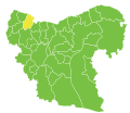
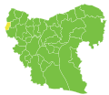
Afrin nahiyah.svg 370 × 320; 60 KB
-
Bulbul nahiyah.svg 370 × 320; 60 KB
-
Jindires nahiyah.svg 370 × 320; 60 KB
-
Maabatli nahiyah.svg 370 × 320; 60 KB
-
Rajo nahiyah.svg 370 × 320; 60 KB
-
Sharran nahiyah.svg 370 × 320; 60 KB
-
Shaykh al-Hadid nahiyah.svg 370 × 320; 60 KB
