Category:Maps of Aboriginal Australia
Jump to navigation
Jump to search
This category shall contain maps relating to the Indigenous people of Australia and the surrounding isles.
Subcategories
This category has the following 3 subcategories, out of 3 total.
Media in category "Maps of Aboriginal Australia"
The following 75 files are in this category, out of 75 total.
-
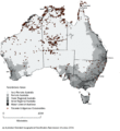
Aboriginal Australians Distribution.jpg 376 × 408; 32 KB
-
Aboriginal regions.png 1,425 × 1,278; 1.14 MB
-
Aboriginal Tasmania Map.png 442 × 437; 26 KB
-
Aboriginal Tribes near Adelaide.png 480 × 730; 40 KB
-
Aboriginal Tribes of Riverena.png 318 × 305; 15 KB
-
Aborigines Regionen.png 1,425 × 1,278; 854 KB
-
Aborigines-Regionen.png 1,425 × 1,278; 858 KB
-
Aborigènes d'Australie.png 500 × 472; 39 KB
-
Arnhemland tribes3.png 375 × 335; 17 KB
-
Australian languages.png 350 × 350; 118 KB
-
Badjari Map.png 510 × 478; 15 KB
-
Barranbinya Lands.png 300 × 191; 5 KB
-
Bassian plain 14000 BP.jpg 500 × 517; 60 KB
-
Bassian plain 14000 BP.svg 469 × 485; 163 KB
-
Carpentaria Gulf tribes1.png 571 × 355; 22 KB
-
Carpentaria Gulf tribes2.png 423 × 334; 20 KB
-
Câmpia Bassiană 14.000 BP.png 469 × 485; 65 KB
-
Dharag-Neighbors1.png 549 × 330; 17 KB
-
Djagaraga-Gudang territory in Cape York, Queensland, Australia.png 2,572 × 2,168; 103 KB
-
Djirbalgan map.png 500 × 360; 124 KB
-
Gunnawingu Tribe.png 725 × 576; 47 KB
-
Guugu Yimithirr country.png 246 × 222; 19 KB
-
Indigene Territorien Australiens 2022.jpg 2,776 × 2,481; 2.75 MB
-
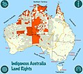
Indigenous Land Rights in Australia 2022.jpg 2,776 × 2,481; 3.24 MB
-
Indigenous Native Titles in Australia 2022.jpg 2,776 × 2,481; 2.99 MB
-
Karte Kulturareal Desert.png 1,218 × 977; 682 KB
-
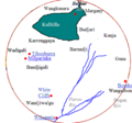
Kulltilla Map.png 511 × 479; 24 KB
-
LAAL map site Jan2015.JPG 504 × 833; 57 KB
-
Leibhéal Bassian 14000 BP.jpg 500 × 517; 128 KB
-
Lenguas australianas.png 375 × 325; 67 KB
-
Map of Karrenggapa Traditional Lands.png 514 × 492; 32 KB
-
Map of New South Wales as occupied by the native tribes.jpg 2,000 × 1,750; 834 KB
-
Map of South Australian native title claims and determinations, September 2023.pdf 3,506 × 4,964; 1.47 MB
-
Map of the traditional lands of the Gulidjan people.png 336 × 325; 2 KB
-
Map of the traditional lands of the Gundangurra people.png 314 × 310; 5 KB
-
Map of Wanjiwalku Lands.png 326 × 307; 6 KB
-
Map Victoria Aboriginal tribes (colourmap).jpg 3,523 × 2,447; 440 KB
-
Murtu aboriginal people lands.png 551 × 488; 11 KB
-
MuruwariLands.png 307 × 315; 1 KB
-
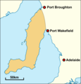
Narunggaland.png 541 × 564; 50 KB
-
Native Title Determinations 2022 map.jpg 3,308 × 2,339; 618 KB
-
Ngunawal Lands.png 243 × 191; 3 KB
-
Nla.obj-234332820.tif 9,104 × 6,814; 177.5 MB
-
Noongar regions map.svg 1,026 × 872; 181 KB
-
Noongar1 es.jpg 960 × 720; 279 KB
-
Noongar1 gl.jpg 960 × 720; 272 KB
-
Noongar1 hi.jpg 960 × 720; 283 KB
-
Noongar1 jv.jpg 960 × 720; 273 KB
-
Noongar1 ml.jpg 960 × 720; 276 KB
-
Noongar1 nl.jpg 960 × 720; 166 KB
-
Noongar1 pt.jpg 960 × 720; 273 KB
-
Noongar1.jpg 960 × 720; 278 KB
-
Nukunu.JPG 292 × 247; 11 KB
-
Pintupi country.png 1,226 × 800; 247 KB
-
Roper River tribes, Northern Territory.png 247 × 215; 11 KB
-
Tasmanian tribes fr.png 800 × 1,000; 1.09 MB
-
Tasmanian tribes.JPG 799 × 965; 117 KB
-
Tharrgari aboriginal people lands.png 551 × 488; 9 KB
-
Traditional lands of Aboriginal tribes in Central NSW.png 312 × 320; 19 KB
-
Traditional lands of Australian Aboriginal Tribes around Derby.png 549 × 330; 19 KB
-
Traditional lands of the Gadubanud people.png 321 × 313; 5 KB
-
Tribes around Gladstone1.png 972 × 949; 40 KB
-
Warlpiri map.png 500 × 269; 120 KB
-
Watson map tribes of south east Queensland.jpg 3,598 × 5,471; 940 KB


