
Category:Maps by the United States Army Map Service
Subcategories
This category has the following 48 subcategories, out of 48 total.
B
C
G
I
J
M
N
P
- Poland maps by U.S. Army Map Service (1 P, 5 F)
S
- Series P502 (32 F)
- Series T722 (4 F)
T
U
Media in category "Maps by the United States Army Map Service"
The following 28 files are in this category, out of 28 total.
-
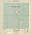 5303 Vanuatu Melanesia Eromanga Island 500K SE59-4.jpg 6,299 × 6,976; 25.33 MB
-

-
 Balearic Islands. Special Special strategic map - btv1b53189524k.jpg 9,070 × 7,908; 4.62 MB
-
 Ca. 1905 - 7 Sheet Military Map of Part of Southern Manchuria.jpg 4,117 × 3,800; 3.56 MB
-
 Dili 1943.jpg 1,611 × 1,075; 552 KB
-
 Dili 1965 scale.jpg 1,136 × 228; 46 KB
-
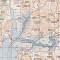
 Dili 1965.jpg 1,185 × 1,523; 415 KB
-
 India. Special strategic map - btv1b53189310m (1 of 2).jpg 11,892 × 7,424; 14.4 MB
-
 India. Special strategic map - btv1b53189310m (2 of 2).jpg 10,116 × 7,120; 8.01 MB
-

-
 Northern Europe, Series M515, U.S. Army Map Service, index.jpg 2,717 × 1,908; 1.45 MB
-
 Panama - Canal Zone and vicinity.jpg 1,162 × 828; 922 KB
-
 Plano-de-la-Ciudad-de-Ceuta-1943.jpg 7,948 × 4,771; 7.13 MB
-
 Santiago 1969 1-12,500, U.S. Army Topographic Command, Series J901, Sheet 2.jpg 9,500 × 6,447; 11.74 MB
-
 Santiago 1969 1-12,500, U.S. Army Topographic Command, Series J901, Sheet 3.jpg 9,500 × 6,757; 13.54 MB
-
 Sorae Salt Field 1946.png 2,000 × 2,000; 9.16 MB
-
 Sorong-txu-oclc-6558822-sa52-3.jpg 4,113 × 4,741; 5.57 MB
-

-
-
-
 The Near East - WDL - LOC.png 1,254 × 1,024; 1.85 MB
-
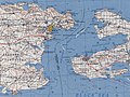
 Timor strategic 1943.jpg 1,885 × 1,355; 281 KB
-
 Txu-pclmaps-oclc-6583553-island-of-madeira.jpg 7,936 × 5,770; 13.04 MB
-
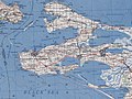
 Txu-pclmaps-oclc-6595558-Dilly-1943.jpg 3,261 × 3,591; 3.74 MB
-
 UdSSR-Karte NO 34-9 Rigaer Bucht - Haapsalu.jpg 5,727 × 4,349; 5.79 MB
-
 UdSSR-Karte NO 34-9 Rigaer Bucht Ausschnitt.jpg 1,748 × 2,114; 899 KB
-
 USSR map NL 37-7 Kerch'.jpg 5,743 × 4,366; 8.41 MB
-
 Western Europe US Army map index.jpg 4,396 × 2,880; 2.22 MB

._G8000_1961_.U5._LCCN_map64000315..jpg)


.jpg)
.jpg)
.jpg)


.jpg)
.jpg)
.jpg)


