
Category:Japan maps by U.S. Army Map Service
-
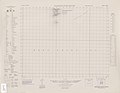
 Index Map

Media in category "Japan maps by U.S. Army Map Service"
The following 44 files are in this category, out of 44 total.
-
Japan by U.S. Army Map Service Index Map.jpg 1,166 × 988; 283 KB
-
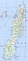
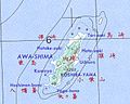 Awashima (Niigata prefecture) map.jpg 374 × 300; 41 KB
-
 Chichijima-retto.png 457 × 559; 651 KB
-
 Daito-shoto.png 489 × 507; 543 KB
-
 Hahajima-retto.png 619 × 605; 977 KB
-
 Iki-no-shima map.jpg 662 × 677; 144 KB
-
 Iwo Jima.png 505 × 383; 431 KB
-
 Keise-shima map.jpg 330 × 169; 24 KB
-
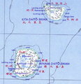
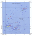
 Kerama Islands map.jpg 872 × 551; 191 KB
-
 Kitaiojima.png 305 × 243; 169 KB
-
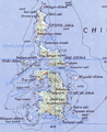
 Koshikijima-rettō map.jpg 1,122 × 955; 428 KB
-
 Kume-jima map.jpg 724 × 392; 115 KB
-
 Map of Kashiwazaki, Niigata Prefecture, Japan by U.S. Army Map Service in 1945.jpg 3,500 × 2,949; 7.47 MB
-
 Map of Nagaoka, Niigata Prefecture, Japan by U.S. Army Map Service 1944.jpg 4,990 × 4,220; 6.56 MB
-
 Map of Nagaoka, Niigata Prefecture, Japan by U.S. Army Map Service in 1945.jpg 3,375 × 5,000; 2.97 MB
-
 Map of Naoetsu, Niigata Prefecture, Japan by U.S. Army Map Service in 1945.jpg 2,700 × 2,183; 4.21 MB
-
 Map of Niigata, Niigata Prefecture, Japan by U.S. Army Map Service in 1945.jpg 5,000 × 4,288; 3.74 MB
-
 Map of Takada, Niigata Prefecture, Japan by U.S. Army Map Service in 1945.jpg 2,266 × 2,500; 2.31 MB
-
 Marcus Island.png 425 × 241; 218 KB
-
 Minamiiojima.png 397 × 291; 254 KB
-
 Miyake-jima-map.jpg 824 × 636; 410 KB
-
 Mukojima-retto.png 589 × 837; 1.14 MB
-
 Nanatsushima map.jpg 370 × 178; 26 KB
-
 Nishino-shima.png 208 × 154; 78 KB
-
 Okidaitojima.png 301 × 161; 98 KB
-
 Series L506, U.S. Army Map Service, 1958 (Haha-Jima NG 54-3).jpg 3,766 × 5,000; 5.74 MB
-
 Series L771, U.S. Army Map Service, 1945 (Muko Shima Sheet 6530 III).jpg 5,148 × 3,690; 2.38 MB
-
 Series L771, U.S. Army Map Service, 1945 (Nakodo Shima Sheet 6529 IV).jpg 4,162 × 3,719; 1.81 MB
-
 Series L771, U.S. Army Map Service, 1945 (Yome Shima Sheet 6529 III).jpg 4,169 × 3,679; 1.61 MB
-
 Tanegashima txu-oclc-6900707-nh52-8.jpg 805 × 1,730; 447 KB
-
 Txu-oclc-6525883.jpg 4,996 × 5,000; 3.78 MB
-
 Txu-oclc-6546163.jpg 2,700 × 2,691; 5.13 MB
-
 Txu-oclc-6551467.jpg 5,000 × 4,086; 3.58 MB
-
 Txu-oclc-6552008.jpg 2,490 × 2,500; 1.09 MB
-
 Txu-oclc-6560392.jpg 2,279 × 2,250; 633 KB
-
 Txu-oclc-6565545.jpg 3,933 × 5,000; 4.03 MB
-
 Txu-oclc-6900707-ng51-15 Uotsuri.png 903 × 1,037; 1.78 MB
-
 Txu-oclc-6900707-ng51-15.jpg 5,000 × 3,777; 5.31 MB
-
 Txu-oclc-6900707-ng51-16.jpg 5,000 × 3,797; 4.83 MB
-
 Txu-oclc-6900707-ng52-12.jpg 5,000 × 3,793; 3.71 MB
-
 Txu-pclmaps-oclc-6618306-senkaku-gunto-13.jpg 3,911 × 4,376; 1.81 MB
-
 USAMS Japan Map Series L506 NI 52-14 Fukue-Jima.jpg 5,000 × 3,844; 2.81 MB
-
 USAMS Japan Map Series L772 Danjo Gunto, North.jpg 5,414 × 4,204; 2.54 MB
-
 USAMS Japan Map Series L772 Danjo Gunto, South.jpg 5,414 × 4,204; 2.29 MB


.jpg)


_map.jpg)
.jpg)
.jpg)
.jpg)