Category:Maps by Oliva family
Jump to navigation
Jump to search
Subcategories
This category has the following 4 subcategories, out of 4 total.
A
O
Media in category "Maps by Oliva family"
The following 47 files are in this category, out of 47 total.
-

-

-
 1617 Portolan Chart of the Mediterranean.jpg 22,514 × 15,928; 90.81 MB
-
 1643 Portolan chart of the World by Giovane Oliva.png 8,750 × 6,540; 115.49 MB
-
 17th-century Portolan chart of the Mediterranean Sea by a member of the Oliva family.jpg 17,316 × 11,126; 44.7 MB
-
 17th-century Portolan chart of the Mediterranean Sea by a member of the Oliva family.png 17,316 × 11,126; 386.59 MB
-
 Adriatic Sea RMG F1951.tiff 7,154 × 4,969; 101.7 MB
-
 Adriatic Sea RMG F2038.tiff 7,382 × 3,925; 82.9 MB
-

-
 Brazil and Central Atlantic RMG F1797.tiff 7,605 × 4,665; 101.5 MB
-
 Caribbean and coasts of America RMG F1796.tiff 7,701 × 4,658; 102.63 MB
-
 Caribbean and coasts of America RMG S0014.jpg 1,280 × 803; 1.38 MB
-
 Central Atlantic RMG F1404.tiff 6,739 × 5,213; 100.51 MB
-
 Central Mediterranean RMG C4567 3.tiff 3,238 × 4,341; 40.22 MB
-
 Central Mediterranean RMG F1401.tiff 6,732 × 5,217; 100.48 MB
-
 East Mediterranean and Black Sea RMG C4567 2.tiff 4,285 × 3,309; 40.57 MB
-
 East Mediterranean and Black Sea RMG F1400.tiff 6,837 × 5,236; 102.42 MB
-
 Eastern Mediterranean RMG F1772.tiff 7,251 × 4,886; 101.36 MB
-
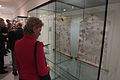 Exhibition Temple of Sciences and Muses, Museum of Arts in Olomouc 07.jpg 2,304 × 1,536; 1.78 MB
-
 Fransesc Oliva - Mediterrania occidental.jpg 1,878 × 1,442; 834 KB
-
 Greek Archipelago RMG F1770.tiff 7,208 × 4,974; 102.58 MB
-
 Greek Archipelago RMG F1801.tiff 7,675 × 4,686; 102.9 MB
-
 Greek Archipelago RMG F1950.tiff 7,238 × 4,936; 102.22 MB
-
 Greek Archipelago RMG S0018.jpg 1,280 × 811; 1.43 MB
-
 Mediterranean RMG F1800.tiff 7,677 × 4,620; 101.47 MB
-
 Mediterranean RMG F1948.tiff 7,191 × 4,937; 101.57 MB
-
 Mediterranean RMG S0017.jpg 1,280 × 801; 1.43 MB
-
 NE Atlantic and W Mediterranean RMG F1799.tiff 7,676 × 4,685; 102.89 MB
-
 NE Atlantic and W Mediterranean RMG S0016.jpg 1,280 × 798; 1.37 MB
-
 NE Atlantic, British Isles to Cape Verde RMG F1949.tiff 7,250 × 4,916; 101.97 MB
-
 NE Atlantic, Lisbon to Cape Verde RMG F1798.tiff 7,711 × 4,684; 103.34 MB
-
 NE Atlantic, Lisbon to Cape Verde RMG S0015.jpg 1,280 × 807; 1.35 MB
-
 NE Atlantic, Spain to Iceland RMG C4567 5.tiff 4,369 × 3,315; 41.44 MB
-
 NE Atlantic, Spain to Iceland RMG F1403.tiff 6,746 × 5,219; 100.73 MB
-
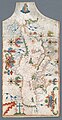
 Península Ibérica no atlas portolano de Joan Oliva (c. 1590-1615).jpg 3,391 × 2,244; 3.28 MB
-
 Península Ibérica no portolano de Joan Oliva (1563).jpg 1,303 × 1,095; 898 KB
-
 Península Ibérica num atlas de Joan Oliva.jpg 2,467 × 2,753; 4.9 MB
-
 Portolan Atlas of the Mediterranean Sea, Western Europe, and the Northwest Coast of Africa WDL3200.pdf 900 × 1,285, 5 pages; 254 KB
-

-

-
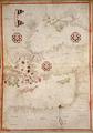
 Portolan Mediterranean detail Greece ca 1600.jpg 9,547 × 6,966; 6.73 MB
-
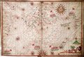
 Portolan Mediterranean Sea ca 1600.jpg 7,036 × 13,644; 11.25 MB
-
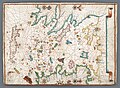
 Portolano de Joannes Oliva (1602).jpg 6,000 × 3,912; 3.49 MB
-
 Western Mediterranean and eastern Atlantic RMG C4567 4.tiff 3,440 × 2,680; 26.38 MB
-
 Western Mediterranean and eastern Atlantic RMG F1402.tiff 6,737 × 5,289; 101.94 MB
-
 World planisphere RMG C4567 1.tiff 3,334 × 4,260; 40.63 MB
-
 World planisphere RMG F1399.tiff 5,326 × 6,707; 102.2 MB


.jpg)


.jpg)
.jpg)


.jpg)
_by_Joan_Oliva._Original_from_Library_of_Congress._Digitally_enhanced_by_rawpixel._(50623611251).jpg)