Category:Maps by Christian Advs Sltg
Jump to navigation
Jump to search
Maps by Christian Advs Sltg
Subcategories
This category has the following 18 subcategories, out of 18 total.
C
Media in category "Maps by Christian Advs Sltg"
The following 200 files are in this category, out of 674 total.
(previous page) (next page)-
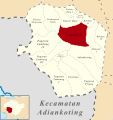
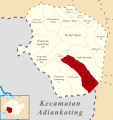
 (Peta Lokasi) Desa Adiankoting, Adiankoting, Taput.svg 512 × 542; 320 KB
-
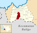 (Peta Lokasi) Desa Aek Bolon Jae, Balige, Tobasa.svg 512 × 469; 384 KB
-
 (Peta Lokasi) Desa Aek Bolon Julu, Balige, Tobasa.svg 512 × 469; 384 KB
-
 (Peta Lokasi) Desa Aek Natolu Jaya, Lumban Julu, Tobasa.svg 512 × 427; 158 KB
-
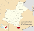
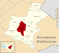
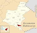 (Peta Lokasi) Desa Aek Ulok, Habinsaran, Tobasa.svg 512 × 461; 233 KB
-
 (Peta Lokasi) Desa Aek Unsim, Borbor, Tobasa.svg 512 × 372; 167 KB
-
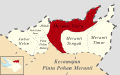
 (Peta Lokasi) Desa Ambar Halim, Pintu Pohan Meranti, Tobasa.svg 512 × 320; 96 KB
-
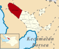 (Peta Lokasi) Desa Amborgang, Porsea, Tobasa.svg 512 × 419; 162 KB
-

-

-
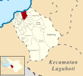
 (Peta Lokasi) Desa Aruan, Laguboti, Tobasa.svg 512 × 465; 258 KB
-
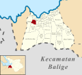
 (Peta Lokasi) Desa Balige II, Balige, Tobasa.svg 512 × 469; 384 KB
-

-
 (Peta Lokasi) Desa Banjar Ganjang, Parmaksian, Tobasa.svg 512 × 398; 166 KB
-
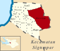
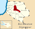 (Peta Lokasi) Desa Banua Huta, Sigumpar, Tobasa.svg 512 × 433; 98 KB
-
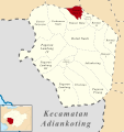
 (Peta Lokasi) Desa Banuaji I, Adiankoting, Taput.svg 512 × 542; 320 KB
-
 (Peta Lokasi) Desa Banuaji II, Adiankoting, Taput.svg 512 × 542; 320 KB
-
 (Peta Lokasi) Desa Banuaji IV, Adiankoting, Taput.svg 512 × 542; 320 KB
-
 (Peta Lokasi) Desa Baruara, Balige, Tobasa.svg 512 × 469; 384 KB
-
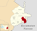
 (Peta Lokasi) Desa Batu Manumpak, Nassau, Tobasa.svg 512 × 439; 142 KB
-
 (Peta Lokasi) Desa Batu Nabolon, Habinsaran, Tobasa.svg 512 × 461; 233 KB
-
 (Peta Lokasi) Desa Bius Gu Barat, Parmaksian, Tobasa.svg 512 × 398; 166 KB
-
 (Peta Lokasi) Desa Boangmanalu Salak, Salak, Pakpak Bharat.svg 512 × 455; 207 KB
-
 (Peta Lokasi) Desa Bonan Dolok I, Balige, Tobasa.svg 512 × 469; 384 KB
-
 (Peta Lokasi) Desa Bonan Dolok II, Balige, Tobasa.svg 512 × 469; 384 KB
-
 (Peta Lokasi) Desa Bonan Dolok III, Balige, Tobasa.svg 512 × 469; 384 KB
-
 (Peta Lokasi) Desa Buluh Tellang, Tinada, Pakpak Bharat.svg 512 × 366; 77 KB
-

-
 (Peta Lokasi) Desa Cinta Damai, Nassau, Tobasa.svg 512 × 439; 142 KB
-
 (Peta Lokasi) Desa Dalihan Natolu, Silaen, Tobasa.svg 512 × 410; 233 KB
-
 (Peta Lokasi) Desa Dolok Jior, Sigumpar, Tobasa.svg 512 × 433; 98 KB
-
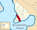
 (Peta Lokasi) Desa Dolok Nagodang, Uluan, Tobasa.svg 512 × 419; 203 KB
-
 (Peta Lokasi) Desa Dolok Nauli, Adiankoting, Taput.svg 512 × 542; 320 KB
-
 (Peta Lokasi) Desa Dolok Nauli, Parmaksian, Tobasa.svg 512 × 398; 166 KB
-
 (Peta Lokasi) Desa Dolok Saribu Janji Matogu, Uluan, Tobasa.svg 512 × 419; 203 KB
-
 (Peta Lokasi) Desa Dolok Saribu Lumban Nabolon, Uluan, Tobasa.svg 512 × 419; 214 KB
-
 (Peta Lokasi) Desa Galagala Pangkailan, Porsea, Tobasa.svg 512 × 419; 162 KB
-
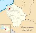
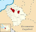
 (Peta Lokasi) Desa Gasaribu, Laguboti, Tobasa.svg 512 × 465; 258 KB
-
 (Peta Lokasi) Desa Gurgur Aek Raja, Tampahan, Tobasa.svg 512 × 455; 90 KB
-
 (Peta Lokasi) Desa Halado, Pintu Pohan Meranti, Tobasa.svg 512 × 320; 96 KB
-
 (Peta Lokasi) Desa Harungguan, Bonatua Lunasi, Tobasa.svg 512 × 455; 141 KB
-
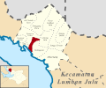
 (Peta Lokasi) Desa Hatinggian, Lumban Julu, Tobasa.svg 512 × 427; 158 KB
-
 (Peta Lokasi) Desa Haunatas I, Laguboti, Tobasa.svg 512 × 465; 257 KB
-
 (Peta Lokasi) Desa Haunatas II, Laguboti, Tobasa.svg 512 × 465; 257 KB
-
 (Peta Lokasi) Desa Hinalang Bagasan, Balige, Tobasa.svg 512 × 469; 384 KB
-
 (Peta Lokasi) Desa Hitetano, Habinsaran, Tobasa.svg 512 × 461; 233 KB
-
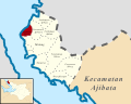
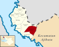
 (Peta Lokasi) Desa Horsik, Ajibata, Tobasa.svg 512 × 410; 137 KB
-
 (Peta Lokasi) Desa Huta Bulu Mejan, Balige, Tobasa.svg 512 × 469; 384 KB
-
 (Peta Lokasi) Desa Huta Dame, Balige, Tobasa.svg 512 × 469; 384 KB
-
 (Peta Lokasi) Desa Huta Gurgur I, Silaen, Tobasa.svg 512 × 384; 297 KB
-
 (Peta Lokasi) Desa Huta Gurgur II, Silaen, Tobasa.svg 512 × 384; 297 KB
-
 (Peta Lokasi) Desa Huta Gurgur, Borbor, Tobasa.svg 512 × 372; 167 KB
-
 (Peta Lokasi) Desa Huta Namora, Balige, Tobasa.svg 512 × 469; 384 KB
-
 (Peta Lokasi) Desa Huta Namora, Lumban Julu, Tobasa.svg 512 × 427; 158 KB
-
 (Peta Lokasi) Desa Huta Namora, Silaen, Tobasa.svg 512 × 384; 297 KB
-
 (Peta Lokasi) Desa Hutagaol Peatalun, Balige, Tobasa.svg 512 × 469; 384 KB
-
 (Peta Lokasi) Desa Hutagaol Sihujur, Silaen, Tobasa.svg 512 × 384; 297 KB
-
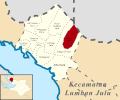 (Peta Lokasi) Desa Jangga Dolok, Lumban Julu, Tobasa.svg 512 × 427; 158 KB
-
 (Peta Lokasi) Desa Jangga Toruan, Lumban Julu, Tobasa.svg 512 × 427; 158 KB
-
 (Peta Lokasi) Desa Janji Maria, Borbor, Tobasa.svg 512 × 372; 167 KB
-
 (Peta Lokasi) Desa Jonggi Manulus, Parmaksian, Tobasa.svg 512 × 398; 166 KB
-
 (Peta Lokasi) Desa Jonggi Nihuta, Lumban Julu, Tobasa.svg 512 × 427; 158 KB
-

-

-

-
 (Peta Lokasi) Desa Kuta Babo, Tinada, Pakpak Bharat.svg 512 × 366; 77 KB
-
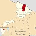
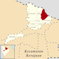 (Peta Lokasi) Desa Kuta Dame, Kerajaan, Pakpak Bharat.svg 512 × 512; 129 KB
-
 (Peta Lokasi) Desa Kuta Jungak, Siempat Rube, Pakpak Bharat.svg 512 × 512; 86 KB
-
 (Peta Lokasi) Desa Kuta Meriah, Kerajaan, Pakpak Bharat.svg 512 × 512; 129 KB
-
 (Peta Lokasi) Desa Kuta Saga, Kerajaan, Pakpak Bharat.svg 512 × 512; 129 KB
-
 (Peta Lokasi) Desa Kuta Tinggi, Salak, Pakpak Bharat.svg 512 × 455; 207 KB
-
-
 (Peta Lokasi) Desa Lae Mbentar, Pagindar, Pakpak Bharat.svg 512 × 461; 186 KB
-
 (Peta Lokasi) Desa Liat Tondung, Nassau, Tobasa.svg 512 × 439; 142 KB
-
 (Peta Lokasi) Desa Lintong Julu, Lumban Julu, Tobasa.svg 512 × 427; 158 KB
-
 (Peta Lokasi) Desa Lintong Nihuta, Tampahan, Tobasa.svg 512 × 455; 90 KB
-
 (Peta Lokasi) Desa Lintong, Borbor, Tobasa.svg 512 × 372; 167 KB
-
 (Peta Lokasi) Desa Lobu Hole, Habinsaran, Tobasa.svg 512 × 461; 233 KB
-
 (Peta Lokasi) Desa Longat, Balige, Tobasa.svg 512 × 469; 384 KB
-
 (Peta Lokasi) Desa Lumban Bagasan, Laguboti, Tobasa.svg 512 × 465; 258 KB
-
 (Peta Lokasi) Desa Lumban Balik, Habinsaran, Tobasa.svg 512 × 461; 233 KB
-
 (Peta Lokasi) Desa Lumban Binanga, Laguboti, Tobasa.svg 512 × 465; 258 KB
-
 (Peta Lokasi) Desa Lumban Binanga, Uluan, Tobasa.svg 512 × 419; 203 KB
-
 (Peta Lokasi) Desa Lumban Bulbul, Balige, Tobasa.svg 512 × 469; 384 KB
-
 (Peta Lokasi) Desa Lumban Dolok, Silaen, Tobasa.svg 512 × 384; 297 KB
-
 (Peta Lokasi) Desa Lumban Gaol, Balige, Tobasa.svg 512 × 469; 384 KB
-
 (Peta Lokasi) Desa Lumban Gaol, Habinsaran, Tobasa.svg 512 × 461; 233 KB
-
 (Peta Lokasi) Desa Lumban Gorat, Balige, Tobasa.svg 512 × 469; 384 KB
-
 (Peta Lokasi) Desa Lumban Gurning, Porsea, Tobasa.svg 512 × 419; 162 KB
-
 (Peta Lokasi) Desa Lumban Holbung, Uluan, Tobasa.svg 512 × 419; 203 KB
-
 (Peta Lokasi) Desa Lumban Huala, Parmaksian, Tobasa.svg 512 × 398; 166 KB
-
 (Peta Lokasi) Desa Lumban Lintong, Habinsaran, Tobasa.svg 512 × 461; 233 KB
-
 (Peta Lokasi) Desa Lumban Lobu, Bonatua Lunasi, Tobasa.svg 512 × 455; 141 KB
-
 (Peta Lokasi) Desa Lumban Manurung, Parmaksian, Tobasa.svg 512 × 398; 166 KB
-
 (Peta Lokasi) Desa Lumban Nabolon, Uluan, Tobasa.svg 512 × 419; 203 KB
-
 (Peta Lokasi) Desa Lumban Pea Timur, Balige, Tobasa.svg 512 × 469; 384 KB
-
 (Peta Lokasi) Desa Lumban Pea, Balige, Tobasa.svg 512 × 469; 384 KB
-
 (Peta Lokasi) Desa Lumban Pea, Habinsaran, Tobasa.svg 512 × 461; 233 KB
-
 (Peta Lokasi) Desa Lumban Pinasa Saroha, Habinsaran, Tobasa.svg 512 × 461; 233 KB
-
 (Peta Lokasi) Desa Lumban Pinasa, Habinsaran, Tobasa.svg 512 × 461; 233 KB
-
 (Peta Lokasi) Desa Lumban Rau Barat, Habinsaran, Tobasa.svg 512 × 461; 233 KB
-
 (Peta Lokasi) Desa Lumban Rau Selatan, Habinsaran, Tobasa.svg 512 × 461; 233 KB
-
 (Peta Lokasi) Desa Lumban Rau Tengah, Nassau, Tobasa.svg 512 × 439; 142 KB
-
 (Peta Lokasi) Desa Lumban Rau Tenggara, Nassau, Tobasa.svg 512 × 439; 142 KB
-
 (Peta Lokasi) Desa Lumban Rau Timur, Nassau, Tobasa.svg 512 × 439; 142 KB
-
 (Peta Lokasi) Desa Lumban Rau Utara, Nassau, Tobasa.svg 512 × 439; 142 KB
-
 (Peta Lokasi) Desa Lumban Ruhap, Habinsaran, Tobasa.svg 512 × 461; 233 KB
-
 (Peta Lokasi) Desa Lumban Sangkalan, Bonatua Lunasi, Tobasa.svg 512 × 455; 141 KB
-
 (Peta Lokasi) Desa Lumban Sewa, Borbor, Tobasa.svg 512 × 372; 167 KB
-
 (Peta Lokasi) Desa Lumban Silintong, Balige, Tobasa.svg 512 × 469; 384 KB
-
 (Peta Lokasi) Desa Lumban Sitorus, Parmaksian, Tobasa.svg 512 × 398; 166 KB
-
 (Peta Lokasi) Desa Mahala, Tinada, Pakpak Bharat.svg 512 × 366; 77 KB
-
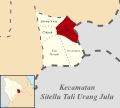
 (Peta Lokasi) Desa Maholida, Sitellu Tali Urang Jehe, Pakpak Bharat.svg 512 × 602; 140 KB
-
 (Peta Lokasi) Desa Majanggut I, Kerajaan, Pakpak Bharat.svg 512 × 512; 129 KB
-
 (Peta Lokasi) Desa Majanggut II, Kerajaan, Pakpak Bharat.svg 512 × 512; 129 KB
-
 (Peta Lokasi) Desa Maju, Sigumpar, Tobasa.svg 512 × 433; 98 KB
-
 (Peta Lokasi) Desa Malum, Sitellu Tali Urang Jehe, Pakpak Bharat.svg 512 × 602; 140 KB
-
 (Peta Lokasi) Desa Marbulang, Silaen, Tobasa.svg 512 × 410; 233 KB
-
 (Peta Lokasi) Desa Marom, Uluan, Tobasa.svg 512 × 419; 203 KB
-
 (Peta Lokasi) Desa Marsangap, Sigumpar, Tobasa.svg 512 × 433; 98 KB
-
 (Peta Lokasi) Desa Matio, Balige, Tobasa.svg 512 × 469; 384 KB
-
 (Peta Lokasi) Desa Mbinalun, Sitellu Tali Urang Jehe, Pakpak Bharat.svg 512 × 602; 140 KB
-
 (Peta Lokasi) Desa Meat, Tampahan, Tobasa.svg 512 × 455; 90 KB
-
 (Peta Lokasi) Desa Meranti Barat, Silaen, Tobasa.svg 512 × 384; 297 KB
-
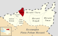
 (Peta Lokasi) Desa Meranti Tengah, Pintu Pohan Meranti, Tobasa.svg 512 × 320; 96 KB
-
 (Peta Lokasi) Desa Meranti Timur, Pintu Pohan Meranti, Tobasa.svg 512 × 320; 96 KB
-
 (Peta Lokasi) Desa Meranti Utara, Pintu Pohan Meranti, Tobasa.svg 512 × 320; 96 KB
-
 (Peta Lokasi) Desa Motung, Ajibata, Tobasa.svg 512 × 410; 137 KB
-
 (Peta Lokasi) Desa Mungkur, Siempat Rube, Pakpak Bharat.svg 512 × 512; 86 KB
-
 (Peta Lokasi) Desa Naga Timbul Timur, Bonatua Lunasi, Tobasa.svg 512 × 455; 141 KB
-
 (Peta Lokasi) Desa Naga Timbul, Bonatua Lunasi, Tobasa.svg 512 × 455; 141 KB
-
 (Peta Lokasi) Desa Nalela, Porsea, Tobasa.svg 512 × 419; 162 KB
-
 (Peta Lokasi) Desa Napajoring, Nassau, Tobasa.svg 512 × 439; 142 KB
-
 (Peta Lokasi) Desa Napatalun Perlambukan, Pagindar, Pakpak Bharat.svg 512 × 461; 186 KB
-
 (Peta Lokasi) Desa Napitupulu, Silaen, Tobasa.svg 512 × 384; 297 KB
-
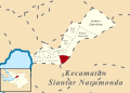
 (Peta Lokasi) Desa Narumonda I, Siantar Narumonda, Tobasa.svg 512 × 363; 280 KB
-
 (Peta Lokasi) Desa Narumonda II, Siantar Narumonda, Tobasa.svg 512 × 363; 280 KB
-
 (Peta Lokasi) Desa Narumonda III, Siantar Narumonda, Tobasa.svg 512 × 363; 280 KB
-
 (Peta Lokasi) Desa Narumonda IV, Siantar Narumonda, Tobasa.svg 512 × 363; 280 KB
-
 (Peta Lokasi) Desa Narumonda V, Siantar Narumonda, Tobasa.svg 512 × 363; 280 KB
-
 (Peta Lokasi) Desa Narumonda VI, Siantar Narumonda, Tobasa.svg 512 × 363; 280 KB
-
 (Peta Lokasi) Desa Narumonda VII, Siantar Narumonda, Tobasa.svg 512 × 363; 280 KB
-
 (Peta Lokasi) Desa Narumonda VIII, Siantar Narumonda, Tobasa.svg 512 × 363; 283 KB
-
 (Peta Lokasi) Desa Natolutali, Silaen, Tobasa.svg 512 × 384; 297 KB
-
 (Peta Lokasi) Desa Natumingka, Borbor, Tobasa.svg 512 × 372; 167 KB
-
 (Peta Lokasi) Desa Nauli, Sigumpar, Tobasa.svg 512 × 433; 98 KB
-
 (Peta Lokasi) Desa Ombur, Silaen, Tobasa.svg 512 × 384; 297 KB
-
 (Peta Lokasi) Desa Ompu Raja Hatulian, Laguboti, Tobasa.svg 512 × 465; 258 KB
-
 (Peta Lokasi) Desa Ompu Raja Hutapea Timur, Laguboti, Tobasa.svg 512 × 465; 258 KB
-
 (Peta Lokasi) Desa Ompu Raja Hutapea, Laguboti, Tobasa.svg 512 × 465; 258 KB
-
 (Peta Lokasi) Desa Pagar Batu, Habinsaran, Tobasa.svg 512 × 461; 233 KB
-
 (Peta Lokasi) Desa Pagaran Lambung I, Adiankoting, Taput.svg 512 × 542; 320 KB
-
 (Peta Lokasi) Desa Pagaran Lambung II, Adiankoting, Taput.svg 512 × 542; 320 KB
-
 (Peta Lokasi) Desa Pagaran Lambung III, Adiankoting, Taput.svg 512 × 542; 320 KB
-
 (Peta Lokasi) Desa Pagaran Lambung IV, Adiankoting, Taput.svg 512 × 542; 320 KB
-
 (Peta Lokasi) Desa Pagaran Pisang, Adiankoting, Taput.svg 512 × 542; 320 KB
-
 (Peta Lokasi) Desa Pagindar, Pagindar, Pakpak Bharat.svg 512 × 461; 186 KB
-
 (Peta Lokasi) Desa Paindoan, Balige, Tobasa.svg 512 × 469; 384 KB
-
 (Peta Lokasi) Desa Panamparan, Habinsaran, Tobasa.svg 512 × 461; 233 KB
-
 (Peta Lokasi) Desa Pangombusan, Parmaksian, Tobasa.svg 512 × 398; 166 KB
-
 (Peta Lokasi) Desa Pangujungan, Habinsaran, Tobasa.svg 512 × 461; 233 KB
-
 (Peta Lokasi) Desa Pangururan II, Borbor, Tobasa.svg 512 × 372; 167 KB
-
 (Peta Lokasi) Desa Pangururan III, Borbor, Tobasa.svg 512 × 372; 167 KB
-
 (Peta Lokasi) Desa Pangururan, Borbor, Tobasa.svg 512 × 372; 167 KB
-
 (Peta Lokasi) Desa Panindii, Silaen, Tobasa.svg 512 × 384; 297 KB
-
 (Peta Lokasi) Desa Pansur Batu I, Adiankoting, Taput.svg 512 × 542; 320 KB
-
 (Peta Lokasi) Desa Pansur Batu II, Adiankoting, Taput.svg 512 × 542; 320 KB
-
 (Peta Lokasi) Desa Pansur Batu, Adiankoting, Taput.svg 512 × 542; 320 KB
-
 (Peta Lokasi) Desa Pararungan, Habinsaran, Tobasa.svg 512 × 461; 233 KB
-
 (Peta Lokasi) Desa Parbagasan Janji Matogu, Uluan, Tobasa.svg 512 × 419; 203 KB
-
 (Peta Lokasi) Desa Pardamean Ajibata, Ajibata, Tobasa.svg 512 × 410; 137 KB
-
 (Peta Lokasi) Desa Pardamean Sibisa, Ajibata, Tobasa.svg 512 × 410; 137 KB
-
 (Peta Lokasi) Desa Pardinggaran, Laguboti, Tobasa.svg 512 × 465; 258 KB
-
 (Peta Lokasi) Desa Pardolok Lumban Lobu, Bonatua Lunasi, Tobasa.svg 512 × 455; 141 KB
-
 (Peta Lokasi) Desa Pardomuan Ajibata, Ajibata, Tobasa.svg 512 × 410; 137 KB
-
 (Peta Lokasi) Desa Pardomuan Motung, Ajibata, Tobasa.svg 512 × 410; 137 KB
-
 (Peta Lokasi) Desa Pardomuan Nauli, Adiankoting, Taput.svg 512 × 542; 320 KB
-
 (Peta Lokasi) Desa Pardomuan Nauli, Borbor, Tobasa.svg 512 × 372; 167 KB
-
 (Peta Lokasi) Desa Pardomuan Nauli, Laguboti, Tobasa.svg 512 × 465; 258 KB
-
 (Peta Lokasi) Desa Pardomuan, Kerajaan, Pakpak Bharat.svg 512 × 512; 129 KB
-
 (Peta Lokasi) Desa Pardomuan, Silaen, Tobasa.svg 512 × 384; 297 KB
-

-
 (Peta Lokasi) Desa Parhabinsaran Janji Matogu, Uluan, Tobasa.svg 512 × 419; 203 KB
-
 (Peta Lokasi) Desa Parik, Uluan, Tobasa.svg 512 × 419; 203 KB
-
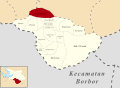
 (Peta Lokasi) Desa Parparean I, Porsea, Tobasa.svg 512 × 419; 162 KB
-
 (Peta Lokasi) Desa Parparean II, Porsea, Tobasa.svg 512 × 419; 162 KB
-
 (Peta Lokasi) Desa Parparean IV, Porsea, Tobasa.svg 512 × 419; 162 KB
-
 (Peta Lokasi) Desa Parpulungan, Kerajaan, Pakpak Bharat.svg 512 × 512; 129 KB
-
 (Peta Lokasi) Desa Parsambilan, Silaen, Tobasa.svg 512 × 384; 297 KB
-
 (Peta Lokasi) Desa Parsaoran Sibisa, Ajibata, Tobasa.svg 512 × 410; 137 KB
-
 (Peta Lokasi) Desa Parsoburan Barat, Habinsaran, Tobasa.svg 512 × 461; 233 KB
-
 (Peta Lokasi) Desa Parsuratan, Balige, Tobasa.svg 512 × 469; 384 KB
-
 (Peta Lokasi) Desa Partor Janji Matogu, Uluan, Tobasa.svg 512 × 419; 203 KB
-
 (Peta Lokasi) Desa Partoruan Janji Matogu, Uluan, Tobasa.svg 512 × 419; 214 KB
-
 (Peta Lokasi) Desa Partoruan Lumban Lobu, Bonatua Lunasi, Tobasa.svg 512 × 455; 141 KB
-
 (Peta Lokasi) Desa Pasar Borbor, Borbor, Tobasa.svg 512 × 372; 167 KB
-
 (Peta Lokasi) Desa Pasar Lumban Julu, Lumban Julu, Tobasa.svg 512 × 427; 158 KB
-
 (Peta Lokasi) Desa Patane I, Porsea, Tobasa.svg 512 × 419; 162 KB
-
 (Peta Lokasi) Desa Patane II, Porsea, Tobasa.svg 512 × 419; 162 KB
-
 (Peta Lokasi) Desa Patane IV, Porsea, Tobasa.svg 512 × 419; 162 KB
_Desa_Adiankoting,_Adiankoting,_Taput.svg)
_Desa_Aek_Bolon_Jae,_Balige,_Tobasa.svg)
_Desa_Aek_Bolon_Julu,_Balige,_Tobasa.svg)
_Desa_Aek_Natolu_Jaya,_Lumban_Julu,_Tobasa.svg)
_Desa_Aek_Ulok,_Habinsaran,_Tobasa.svg)
_Desa_Aek_Unsim,_Borbor,_Tobasa.svg)
_Desa_Ambar_Halim,_Pintu_Pohan_Meranti,_Tobasa.svg)
_Desa_Amborgang,_Porsea,_Tobasa.svg)
_Desa_Aornakan_I,_Pergetteng_Getteng_Sengkut,_Pakpak_Bharat.svg)
_Desa_Aornakan_II,_Pergetteng_Getteng_Sengkut,_Pakpak_Bharat.svg)
_Desa_Aruan,_Laguboti,_Tobasa.svg)
_Desa_Balige_II,_Balige,_Tobasa.svg)
_Desa_Bandar_Baru,_Sitellu_Tali_Urang_Jehe,_Pakpak_Bharat.svg)
_Desa_Banjar_Ganjang,_Parmaksian,_Tobasa.svg)
_Desa_Banua_Huta,_Sigumpar,_Tobasa.svg)
_Desa_Banuaji_I,_Adiankoting,_Taput.svg)
_Desa_Banuaji_II,_Adiankoting,_Taput.svg)
_Desa_Banuaji_IV,_Adiankoting,_Taput.svg)
_Desa_Baruara,_Balige,_Tobasa.svg)
_Desa_Batu_Manumpak,_Nassau,_Tobasa.svg)
_Desa_Batu_Nabolon,_Habinsaran,_Tobasa.svg)
_Desa_Bius_Gu_Barat,_Parmaksian,_Tobasa.svg)
_Desa_Boangmanalu_Salak,_Salak,_Pakpak_Bharat.svg)
_Desa_Bonan_Dolok_I,_Balige,_Tobasa.svg)
_Desa_Bonan_Dolok_II,_Balige,_Tobasa.svg)
_Desa_Bonan_Dolok_III,_Balige,_Tobasa.svg)
_Desa_Buluh_Tellang,_Tinada,_Pakpak_Bharat.svg)
_Desa_Cikaok,_Sitellu_Tali_Urang_Julu,_Pakpak_Bharat.svg)
_Desa_Cinta_Damai,_Nassau,_Tobasa.svg)
_Desa_Dalihan_Natolu,_Silaen,_Tobasa.svg)
_Desa_Dolok_Jior,_Sigumpar,_Tobasa.svg)
_Desa_Dolok_Nagodang,_Uluan,_Tobasa.svg)
_Desa_Dolok_Nauli,_Adiankoting,_Taput.svg)
_Desa_Dolok_Nauli,_Parmaksian,_Tobasa.svg)
_Desa_Dolok_Saribu_Janji_Matogu,_Uluan,_Tobasa.svg)
_Desa_Dolok_Saribu_Lumban_Nabolon,_Uluan,_Tobasa.svg)
_Desa_Galagala_Pangkailan,_Porsea,_Tobasa.svg)
_Desa_Gasaribu,_Laguboti,_Tobasa.svg)
_Desa_Gurgur_Aek_Raja,_Tampahan,_Tobasa.svg)
_Desa_Halado,_Pintu_Pohan_Meranti,_Tobasa.svg)
_Desa_Harungguan,_Bonatua_Lunasi,_Tobasa.svg)
_Desa_Hatinggian,_Lumban_Julu,_Tobasa.svg)
_Desa_Haunatas_I,_Laguboti,_Tobasa.svg)
_Desa_Haunatas_II,_Laguboti,_Tobasa.svg)
_Desa_Hinalang_Bagasan,_Balige,_Tobasa.svg)
_Desa_Hitetano,_Habinsaran,_Tobasa.svg)
_Desa_Horsik,_Ajibata,_Tobasa.svg)
_Desa_Huta_Bulu_Mejan,_Balige,_Tobasa.svg)
_Desa_Huta_Dame,_Balige,_Tobasa.svg)
_Desa_Huta_Gurgur_I,_Silaen,_Tobasa.svg)
_Desa_Huta_Gurgur_II,_Silaen,_Tobasa.svg)
_Desa_Huta_Gurgur,_Borbor,_Tobasa.svg)
_Desa_Huta_Namora,_Balige,_Tobasa.svg)
_Desa_Huta_Namora,_Lumban_Julu,_Tobasa.svg)
_Desa_Huta_Namora,_Silaen,_Tobasa.svg)
_Desa_Hutagaol_Peatalun,_Balige,_Tobasa.svg)
_Desa_Hutagaol_Sihujur,_Silaen,_Tobasa.svg)
_Desa_Jangga_Dolok,_Lumban_Julu,_Tobasa.svg)
_Desa_Jangga_Toruan,_Lumban_Julu,_Tobasa.svg)
_Desa_Janji_Maria,_Borbor,_Tobasa.svg)
_Desa_Jonggi_Manulus,_Parmaksian,_Tobasa.svg)
_Desa_Jonggi_Nihuta,_Lumban_Julu,_Tobasa.svg)
_Desa_Kaban_Tengah,_Sitellu_Tali_Urang_Jehe,_Pakpak_Bharat.svg)
_Desa_Kecupak_I,_Pergetteng_Getteng_Sengkut,_Pakpak_Bharat.svg)
_Desa_Kecupak_II,_Pergetteng_Getteng_Sengkut,_Pakpak_Bharat.svg)
_Desa_Kuta_Babo,_Tinada,_Pakpak_Bharat.svg)
_Desa_Kuta_Dame,_Kerajaan,_Pakpak_Bharat.svg)
_Desa_Kuta_Jungak,_Siempat_Rube,_Pakpak_Bharat.svg)
_Desa_Kuta_Meriah,_Kerajaan,_Pakpak_Bharat.svg)
_Desa_Kuta_Saga,_Kerajaan,_Pakpak_Bharat.svg)
_Desa_Kuta_Tinggi,_Salak,_Pakpak_Bharat.svg)
_Desa_Lae_Langge_Namuseng,_Sitellu_Tali_Urang_Julu,_Pakpak_Bharat.svg)
_Desa_Lae_Mbentar,_Pagindar,_Pakpak_Bharat.svg)
_Desa_Liat_Tondung,_Nassau,_Tobasa.svg)
_Desa_Lintong_Julu,_Lumban_Julu,_Tobasa.svg)
_Desa_Lintong_Nihuta,_Tampahan,_Tobasa.svg)
_Desa_Lintong,_Borbor,_Tobasa.svg)
_Desa_Lobu_Hole,_Habinsaran,_Tobasa.svg)
_Desa_Longat,_Balige,_Tobasa.svg)
_Desa_Lumban_Bagasan,_Laguboti,_Tobasa.svg)
_Desa_Lumban_Balik,_Habinsaran,_Tobasa.svg)
_Desa_Lumban_Binanga,_Laguboti,_Tobasa.svg)
_Desa_Lumban_Binanga,_Uluan,_Tobasa.svg)
_Desa_Lumban_Bulbul,_Balige,_Tobasa.svg)
_Desa_Lumban_Dolok,_Silaen,_Tobasa.svg)
_Desa_Lumban_Gaol,_Balige,_Tobasa.svg)
_Desa_Lumban_Gaol,_Habinsaran,_Tobasa.svg)
_Desa_Lumban_Gorat,_Balige,_Tobasa.svg)
_Desa_Lumban_Gurning,_Porsea,_Tobasa.svg)
_Desa_Lumban_Holbung,_Uluan,_Tobasa.svg)
_Desa_Lumban_Huala,_Parmaksian,_Tobasa.svg)
_Desa_Lumban_Lintong,_Habinsaran,_Tobasa.svg)
_Desa_Lumban_Lobu,_Bonatua_Lunasi,_Tobasa.svg)
_Desa_Lumban_Manurung,_Parmaksian,_Tobasa.svg)
_Desa_Lumban_Nabolon,_Uluan,_Tobasa.svg)
_Desa_Lumban_Pea_Timur,_Balige,_Tobasa.svg)
_Desa_Lumban_Pea,_Balige,_Tobasa.svg)
_Desa_Lumban_Pea,_Habinsaran,_Tobasa.svg)
_Desa_Lumban_Pinasa_Saroha,_Habinsaran,_Tobasa.svg)
_Desa_Lumban_Pinasa,_Habinsaran,_Tobasa.svg)
_Desa_Lumban_Rau_Barat,_Habinsaran,_Tobasa.svg)
_Desa_Lumban_Rau_Selatan,_Habinsaran,_Tobasa.svg)
_Desa_Lumban_Rau_Tengah,_Nassau,_Tobasa.svg)
_Desa_Lumban_Rau_Tenggara,_Nassau,_Tobasa.svg)
_Desa_Lumban_Rau_Timur,_Nassau,_Tobasa.svg)
_Desa_Lumban_Rau_Utara,_Nassau,_Tobasa.svg)
_Desa_Lumban_Ruhap,_Habinsaran,_Tobasa.svg)
_Desa_Lumban_Sangkalan,_Bonatua_Lunasi,_Tobasa.svg)
_Desa_Lumban_Sewa,_Borbor,_Tobasa.svg)
_Desa_Lumban_Silintong,_Balige,_Tobasa.svg)
_Desa_Lumban_Sitorus,_Parmaksian,_Tobasa.svg)
_Desa_Mahala,_Tinada,_Pakpak_Bharat.svg)
_Desa_Maholida,_Sitellu_Tali_Urang_Jehe,_Pakpak_Bharat.svg)
_Desa_Majanggut_I,_Kerajaan,_Pakpak_Bharat.svg)
_Desa_Majanggut_II,_Kerajaan,_Pakpak_Bharat.svg)
_Desa_Maju,_Sigumpar,_Tobasa.svg)
_Desa_Malum,_Sitellu_Tali_Urang_Jehe,_Pakpak_Bharat.svg)
_Desa_Marbulang,_Silaen,_Tobasa.svg)
_Desa_Marom,_Uluan,_Tobasa.svg)
_Desa_Marsangap,_Sigumpar,_Tobasa.svg)
_Desa_Matio,_Balige,_Tobasa.svg)
_Desa_Mbinalun,_Sitellu_Tali_Urang_Jehe,_Pakpak_Bharat.svg)
_Desa_Meat,_Tampahan,_Tobasa.svg)
_Desa_Meranti_Barat,_Silaen,_Tobasa.svg)
_Desa_Meranti_Tengah,_Pintu_Pohan_Meranti,_Tobasa.svg)
_Desa_Meranti_Timur,_Pintu_Pohan_Meranti,_Tobasa.svg)
_Desa_Meranti_Utara,_Pintu_Pohan_Meranti,_Tobasa.svg)
_Desa_Motung,_Ajibata,_Tobasa.svg)
_Desa_Mungkur,_Siempat_Rube,_Pakpak_Bharat.svg)
_Desa_Naga_Timbul_Timur,_Bonatua_Lunasi,_Tobasa.svg)
_Desa_Naga_Timbul,_Bonatua_Lunasi,_Tobasa.svg)
_Desa_Nalela,_Porsea,_Tobasa.svg)
_Desa_Napajoring,_Nassau,_Tobasa.svg)
_Desa_Napatalun_Perlambukan,_Pagindar,_Pakpak_Bharat.svg)
_Desa_Napitupulu,_Silaen,_Tobasa.svg)
_Desa_Narumonda_I,_Siantar_Narumonda,_Tobasa.svg)
_Desa_Narumonda_II,_Siantar_Narumonda,_Tobasa.svg)
_Desa_Narumonda_III,_Siantar_Narumonda,_Tobasa.svg)
_Desa_Narumonda_IV,_Siantar_Narumonda,_Tobasa.svg)
_Desa_Narumonda_V,_Siantar_Narumonda,_Tobasa.svg)
_Desa_Narumonda_VI,_Siantar_Narumonda,_Tobasa.svg)
_Desa_Narumonda_VII,_Siantar_Narumonda,_Tobasa.svg)
_Desa_Narumonda_VIII,_Siantar_Narumonda,_Tobasa.svg)
_Desa_Natolutali,_Silaen,_Tobasa.svg)
_Desa_Natumingka,_Borbor,_Tobasa.svg)
_Desa_Nauli,_Sigumpar,_Tobasa.svg)
_Desa_Ombur,_Silaen,_Tobasa.svg)
_Desa_Ompu_Raja_Hatulian,_Laguboti,_Tobasa.svg)
_Desa_Ompu_Raja_Hutapea_Timur,_Laguboti,_Tobasa.svg)
_Desa_Ompu_Raja_Hutapea,_Laguboti,_Tobasa.svg)
_Desa_Pagar_Batu,_Habinsaran,_Tobasa.svg)
_Desa_Pagaran_Lambung_I,_Adiankoting,_Taput.svg)
_Desa_Pagaran_Lambung_II,_Adiankoting,_Taput.svg)
_Desa_Pagaran_Lambung_III,_Adiankoting,_Taput.svg)
_Desa_Pagaran_Lambung_IV,_Adiankoting,_Taput.svg)
_Desa_Pagaran_Pisang,_Adiankoting,_Taput.svg)
_Desa_Pagindar,_Pagindar,_Pakpak_Bharat.svg)
_Desa_Paindoan,_Balige,_Tobasa.svg)
_Desa_Panamparan,_Habinsaran,_Tobasa.svg)
_Desa_Pangombusan,_Parmaksian,_Tobasa.svg)
_Desa_Pangujungan,_Habinsaran,_Tobasa.svg)
_Desa_Pangururan_II,_Borbor,_Tobasa.svg)
_Desa_Pangururan_III,_Borbor,_Tobasa.svg)
_Desa_Pangururan,_Borbor,_Tobasa.svg)
_Desa_Panindii,_Silaen,_Tobasa.svg)
_Desa_Pansur_Batu_I,_Adiankoting,_Taput.svg)
_Desa_Pansur_Batu_II,_Adiankoting,_Taput.svg)
_Desa_Pansur_Batu,_Adiankoting,_Taput.svg)
_Desa_Pararungan,_Habinsaran,_Tobasa.svg)
_Desa_Parbagasan_Janji_Matogu,_Uluan,_Tobasa.svg)
_Desa_Pardamean_Ajibata,_Ajibata,_Tobasa.svg)
_Desa_Pardamean_Sibisa,_Ajibata,_Tobasa.svg)
_Desa_Pardinggaran,_Laguboti,_Tobasa.svg)
_Desa_Pardolok_Lumban_Lobu,_Bonatua_Lunasi,_Tobasa.svg)
_Desa_Pardomuan_Ajibata,_Ajibata,_Tobasa.svg)
_Desa_Pardomuan_Motung,_Ajibata,_Tobasa.svg)
_Desa_Pardomuan_Nauli,_Adiankoting,_Taput.svg)
_Desa_Pardomuan_Nauli,_Borbor,_Tobasa.svg)
_Desa_Pardomuan_Nauli,_Laguboti,_Tobasa.svg)
_Desa_Pardomuan,_Kerajaan,_Pakpak_Bharat.svg)
_Desa_Pardomuan,_Silaen,_Tobasa.svg)
_Desa_Pardomuan,_Sitellu_Tali_Urang_Julu,_Pakpak_Bharat.svg)
_Desa_Parhabinsaran_Janji_Matogu,_Uluan,_Tobasa.svg)
_Desa_Parik,_Uluan,_Tobasa.svg)
_Desa_Parparean_I,_Porsea,_Tobasa.svg)
_Desa_Parparean_II,_Porsea,_Tobasa.svg)
_Desa_Parparean_IV,_Porsea,_Tobasa.svg)
_Desa_Parpulungan,_Kerajaan,_Pakpak_Bharat.svg)
_Desa_Parsambilan,_Silaen,_Tobasa.svg)
_Desa_Parsaoran_Sibisa,_Ajibata,_Tobasa.svg)
_Desa_Parsoburan_Barat,_Habinsaran,_Tobasa.svg)
_Desa_Parsuratan,_Balige,_Tobasa.svg)
_Desa_Partor_Janji_Matogu,_Uluan,_Tobasa.svg)
_Desa_Partoruan_Janji_Matogu,_Uluan,_Tobasa.svg)
_Desa_Partoruan_Lumban_Lobu,_Bonatua_Lunasi,_Tobasa.svg)
_Desa_Pasar_Borbor,_Borbor,_Tobasa.svg)
_Desa_Pasar_Lumban_Julu,_Lumban_Julu,_Tobasa.svg)
_Desa_Patane_I,_Porsea,_Tobasa.svg)
_Desa_Patane_II,_Porsea,_Tobasa.svg)
_Desa_Patane_IV,_Porsea,_Tobasa.svg)