Category:Christian Advs Sltg (Maps of Toba Samosir)
Jump to navigation
Jump to search
Maps of Toba Samosir by Christian Advs Sltg.
Subcategories
This category has the following 16 subcategories, out of 16 total.
C
Media in category "Christian Advs Sltg (Maps of Toba Samosir)"
The following 200 files are in this category, out of 275 total.
(previous page) (next page)-
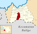 (Peta Lokasi) Desa Aek Bolon Jae, Balige, Tobasa.svg 512 × 469; 384 KB
-
 (Peta Lokasi) Desa Aek Bolon Julu, Balige, Tobasa.svg 512 × 469; 384 KB
-
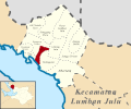
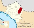
 (Peta Lokasi) Desa Aek Natolu Jaya, Lumban Julu, Tobasa.svg 512 × 427; 158 KB
-
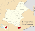
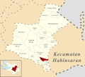 (Peta Lokasi) Desa Aek Ulok, Habinsaran, Tobasa.svg 512 × 461; 233 KB
-
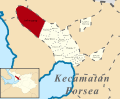
 (Peta Lokasi) Desa Aek Unsim, Borbor, Tobasa.svg 512 × 372; 167 KB
-
 (Peta Lokasi) Desa Ambar Halim, Pintu Pohan Meranti, Tobasa.svg 512 × 320; 96 KB
-
 (Peta Lokasi) Desa Amborgang, Porsea, Tobasa.svg 512 × 419; 162 KB
-
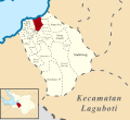
 (Peta Lokasi) Desa Aruan, Laguboti, Tobasa.svg 512 × 465; 258 KB
-
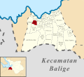
 (Peta Lokasi) Desa Balige II, Balige, Tobasa.svg 512 × 469; 384 KB
-
 (Peta Lokasi) Desa Banjar Ganjang, Parmaksian, Tobasa.svg 512 × 398; 166 KB
-
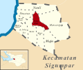 (Peta Lokasi) Desa Banua Huta, Sigumpar, Tobasa.svg 512 × 433; 98 KB
-
 (Peta Lokasi) Desa Baruara, Balige, Tobasa.svg 512 × 469; 384 KB
-
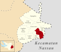
 (Peta Lokasi) Desa Batu Manumpak, Nassau, Tobasa.svg 512 × 439; 142 KB
-
 (Peta Lokasi) Desa Batu Nabolon, Habinsaran, Tobasa.svg 512 × 461; 233 KB
-
 (Peta Lokasi) Desa Bius Gu Barat, Parmaksian, Tobasa.svg 512 × 398; 166 KB
-
 (Peta Lokasi) Desa Bonan Dolok I, Balige, Tobasa.svg 512 × 469; 384 KB
-
 (Peta Lokasi) Desa Bonan Dolok II, Balige, Tobasa.svg 512 × 469; 384 KB
-
 (Peta Lokasi) Desa Bonan Dolok III, Balige, Tobasa.svg 512 × 469; 384 KB
-
 (Peta Lokasi) Desa Cinta Damai, Nassau, Tobasa.svg 512 × 439; 142 KB
-
 (Peta Lokasi) Desa Dalihan Natolu, Silaen, Tobasa.svg 512 × 410; 233 KB
-
 (Peta Lokasi) Desa Dolok Jior, Sigumpar, Tobasa.svg 512 × 433; 98 KB
-
 (Peta Lokasi) Desa Dolok Nagodang, Uluan, Tobasa.svg 512 × 419; 203 KB
-
 (Peta Lokasi) Desa Dolok Nauli, Parmaksian, Tobasa.svg 512 × 398; 166 KB
-
 (Peta Lokasi) Desa Dolok Saribu Janji Matogu, Uluan, Tobasa.svg 512 × 419; 203 KB
-
 (Peta Lokasi) Desa Dolok Saribu Lumban Nabolon, Uluan, Tobasa.svg 512 × 419; 214 KB
-
 (Peta Lokasi) Desa Galagala Pangkailan, Porsea, Tobasa.svg 512 × 419; 162 KB
-
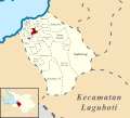
 (Peta Lokasi) Desa Gasaribu, Laguboti, Tobasa.svg 512 × 465; 258 KB
-
 (Peta Lokasi) Desa Gurgur Aek Raja, Tampahan, Tobasa.svg 512 × 455; 90 KB
-
 (Peta Lokasi) Desa Halado, Pintu Pohan Meranti, Tobasa.svg 512 × 320; 96 KB
-
 (Peta Lokasi) Desa Harungguan, Bonatua Lunasi, Tobasa.svg 512 × 455; 141 KB
-
 (Peta Lokasi) Desa Hatinggian, Lumban Julu, Tobasa.svg 512 × 427; 158 KB
-
 (Peta Lokasi) Desa Haunatas I, Laguboti, Tobasa.svg 512 × 465; 257 KB
-
 (Peta Lokasi) Desa Haunatas II, Laguboti, Tobasa.svg 512 × 465; 257 KB
-
 (Peta Lokasi) Desa Hinalang Bagasan, Balige, Tobasa.svg 512 × 469; 384 KB
-
 (Peta Lokasi) Desa Hitetano, Habinsaran, Tobasa.svg 512 × 461; 233 KB
-
 (Peta Lokasi) Desa Horsik, Ajibata, Tobasa.svg 512 × 410; 137 KB
-
 (Peta Lokasi) Desa Huta Bulu Mejan, Balige, Tobasa.svg 512 × 469; 384 KB
-
 (Peta Lokasi) Desa Huta Dame, Balige, Tobasa.svg 512 × 469; 384 KB
-
 (Peta Lokasi) Desa Huta Gurgur I, Silaen, Tobasa.svg 512 × 384; 297 KB
-
 (Peta Lokasi) Desa Huta Gurgur II, Silaen, Tobasa.svg 512 × 384; 297 KB
-
 (Peta Lokasi) Desa Huta Gurgur, Borbor, Tobasa.svg 512 × 372; 167 KB
-
 (Peta Lokasi) Desa Huta Namora, Balige, Tobasa.svg 512 × 469; 384 KB
-
 (Peta Lokasi) Desa Huta Namora, Lumban Julu, Tobasa.svg 512 × 427; 158 KB
-
 (Peta Lokasi) Desa Huta Namora, Silaen, Tobasa.svg 512 × 384; 297 KB
-
 (Peta Lokasi) Desa Hutagaol Peatalun, Balige, Tobasa.svg 512 × 469; 384 KB
-
 (Peta Lokasi) Desa Hutagaol Sihujur, Silaen, Tobasa.svg 512 × 384; 297 KB
-
 (Peta Lokasi) Desa Jangga Dolok, Lumban Julu, Tobasa.svg 512 × 427; 158 KB
-
 (Peta Lokasi) Desa Jangga Toruan, Lumban Julu, Tobasa.svg 512 × 427; 158 KB
-
 (Peta Lokasi) Desa Janji Maria, Borbor, Tobasa.svg 512 × 372; 167 KB
-
 (Peta Lokasi) Desa Jonggi Manulus, Parmaksian, Tobasa.svg 512 × 398; 166 KB
-
 (Peta Lokasi) Desa Jonggi Nihuta, Lumban Julu, Tobasa.svg 512 × 427; 158 KB
-
 (Peta Lokasi) Desa Liat Tondung, Nassau, Tobasa.svg 512 × 439; 142 KB
-
 (Peta Lokasi) Desa Lintong Julu, Lumban Julu, Tobasa.svg 512 × 427; 158 KB
-
 (Peta Lokasi) Desa Lintong Nihuta, Tampahan, Tobasa.svg 512 × 455; 90 KB
-
 (Peta Lokasi) Desa Lintong, Borbor, Tobasa.svg 512 × 372; 167 KB
-
 (Peta Lokasi) Desa Lobu Hole, Habinsaran, Tobasa.svg 512 × 461; 233 KB
-
 (Peta Lokasi) Desa Longat, Balige, Tobasa.svg 512 × 469; 384 KB
-
 (Peta Lokasi) Desa Lumban Bagasan, Laguboti, Tobasa.svg 512 × 465; 258 KB
-
 (Peta Lokasi) Desa Lumban Balik, Habinsaran, Tobasa.svg 512 × 461; 233 KB
-
 (Peta Lokasi) Desa Lumban Binanga, Laguboti, Tobasa.svg 512 × 465; 258 KB
-
 (Peta Lokasi) Desa Lumban Binanga, Uluan, Tobasa.svg 512 × 419; 203 KB
-
 (Peta Lokasi) Desa Lumban Bulbul, Balige, Tobasa.svg 512 × 469; 384 KB
-
 (Peta Lokasi) Desa Lumban Dolok, Silaen, Tobasa.svg 512 × 384; 297 KB
-
 (Peta Lokasi) Desa Lumban Gaol, Balige, Tobasa.svg 512 × 469; 384 KB
-
 (Peta Lokasi) Desa Lumban Gaol, Habinsaran, Tobasa.svg 512 × 461; 233 KB
-
 (Peta Lokasi) Desa Lumban Gorat, Balige, Tobasa.svg 512 × 469; 384 KB
-
 (Peta Lokasi) Desa Lumban Gurning, Porsea, Tobasa.svg 512 × 419; 162 KB
-
 (Peta Lokasi) Desa Lumban Holbung, Uluan, Tobasa.svg 512 × 419; 203 KB
-
 (Peta Lokasi) Desa Lumban Huala, Parmaksian, Tobasa.svg 512 × 398; 166 KB
-
 (Peta Lokasi) Desa Lumban Lintong, Habinsaran, Tobasa.svg 512 × 461; 233 KB
-
 (Peta Lokasi) Desa Lumban Lobu, Bonatua Lunasi, Tobasa.svg 512 × 455; 141 KB
-
 (Peta Lokasi) Desa Lumban Manurung, Parmaksian, Tobasa.svg 512 × 398; 166 KB
-
 (Peta Lokasi) Desa Lumban Nabolon, Uluan, Tobasa.svg 512 × 419; 203 KB
-
 (Peta Lokasi) Desa Lumban Pea Timur, Balige, Tobasa.svg 512 × 469; 384 KB
-
 (Peta Lokasi) Desa Lumban Pea, Balige, Tobasa.svg 512 × 469; 384 KB
-
 (Peta Lokasi) Desa Lumban Pea, Habinsaran, Tobasa.svg 512 × 461; 233 KB
-
 (Peta Lokasi) Desa Lumban Pinasa Saroha, Habinsaran, Tobasa.svg 512 × 461; 233 KB
-
 (Peta Lokasi) Desa Lumban Pinasa, Habinsaran, Tobasa.svg 512 × 461; 233 KB
-
 (Peta Lokasi) Desa Lumban Rau Barat, Habinsaran, Tobasa.svg 512 × 461; 233 KB
-
 (Peta Lokasi) Desa Lumban Rau Selatan, Habinsaran, Tobasa.svg 512 × 461; 233 KB
-
 (Peta Lokasi) Desa Lumban Rau Tengah, Nassau, Tobasa.svg 512 × 439; 142 KB
-
 (Peta Lokasi) Desa Lumban Rau Tenggara, Nassau, Tobasa.svg 512 × 439; 142 KB
-
 (Peta Lokasi) Desa Lumban Rau Timur, Nassau, Tobasa.svg 512 × 439; 142 KB
-
 (Peta Lokasi) Desa Lumban Rau Utara, Nassau, Tobasa.svg 512 × 439; 142 KB
-
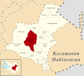 (Peta Lokasi) Desa Lumban Ruhap, Habinsaran, Tobasa.svg 512 × 461; 233 KB
-
 (Peta Lokasi) Desa Lumban Sangkalan, Bonatua Lunasi, Tobasa.svg 512 × 455; 141 KB
-
 (Peta Lokasi) Desa Lumban Sewa, Borbor, Tobasa.svg 512 × 372; 167 KB
-
 (Peta Lokasi) Desa Lumban Silintong, Balige, Tobasa.svg 512 × 469; 384 KB
-
 (Peta Lokasi) Desa Lumban Sitorus, Parmaksian, Tobasa.svg 512 × 398; 166 KB
-
 (Peta Lokasi) Desa Maju, Sigumpar, Tobasa.svg 512 × 433; 98 KB
-
 (Peta Lokasi) Desa Marbulang, Silaen, Tobasa.svg 512 × 410; 233 KB
-
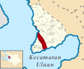 (Peta Lokasi) Desa Marom, Uluan, Tobasa.svg 512 × 419; 203 KB
-
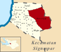 (Peta Lokasi) Desa Marsangap, Sigumpar, Tobasa.svg 512 × 433; 98 KB
-
 (Peta Lokasi) Desa Matio, Balige, Tobasa.svg 512 × 469; 384 KB
-
 (Peta Lokasi) Desa Meat, Tampahan, Tobasa.svg 512 × 455; 90 KB
-
 (Peta Lokasi) Desa Meranti Barat, Silaen, Tobasa.svg 512 × 384; 297 KB
-
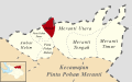
 (Peta Lokasi) Desa Meranti Tengah, Pintu Pohan Meranti, Tobasa.svg 512 × 320; 96 KB
-
 (Peta Lokasi) Desa Meranti Timur, Pintu Pohan Meranti, Tobasa.svg 512 × 320; 96 KB
-
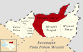 (Peta Lokasi) Desa Meranti Utara, Pintu Pohan Meranti, Tobasa.svg 512 × 320; 96 KB
-
 (Peta Lokasi) Desa Motung, Ajibata, Tobasa.svg 512 × 410; 137 KB
-
 (Peta Lokasi) Desa Naga Timbul Timur, Bonatua Lunasi, Tobasa.svg 512 × 455; 141 KB
-
 (Peta Lokasi) Desa Naga Timbul, Bonatua Lunasi, Tobasa.svg 512 × 455; 141 KB
-
 (Peta Lokasi) Desa Nalela, Porsea, Tobasa.svg 512 × 419; 162 KB
-
 (Peta Lokasi) Desa Napajoring, Nassau, Tobasa.svg 512 × 439; 142 KB
-
 (Peta Lokasi) Desa Napitupulu, Silaen, Tobasa.svg 512 × 384; 297 KB
-
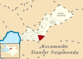
 (Peta Lokasi) Desa Narumonda I, Siantar Narumonda, Tobasa.svg 512 × 363; 280 KB
-
 (Peta Lokasi) Desa Narumonda II, Siantar Narumonda, Tobasa.svg 512 × 363; 280 KB
-
 (Peta Lokasi) Desa Narumonda III, Siantar Narumonda, Tobasa.svg 512 × 363; 280 KB
-
 (Peta Lokasi) Desa Narumonda IV, Siantar Narumonda, Tobasa.svg 512 × 363; 280 KB
-
 (Peta Lokasi) Desa Narumonda V, Siantar Narumonda, Tobasa.svg 512 × 363; 280 KB
-
 (Peta Lokasi) Desa Narumonda VI, Siantar Narumonda, Tobasa.svg 512 × 363; 280 KB
-
 (Peta Lokasi) Desa Narumonda VII, Siantar Narumonda, Tobasa.svg 512 × 363; 280 KB
-
 (Peta Lokasi) Desa Narumonda VIII, Siantar Narumonda, Tobasa.svg 512 × 363; 283 KB
-
 (Peta Lokasi) Desa Natolutali, Silaen, Tobasa.svg 512 × 384; 297 KB
-
 (Peta Lokasi) Desa Natumingka, Borbor, Tobasa.svg 512 × 372; 167 KB
-
 (Peta Lokasi) Desa Nauli, Sigumpar, Tobasa.svg 512 × 433; 98 KB
-
 (Peta Lokasi) Desa Ombur, Silaen, Tobasa.svg 512 × 384; 297 KB
-
 (Peta Lokasi) Desa Ompu Raja Hatulian, Laguboti, Tobasa.svg 512 × 465; 258 KB
-
 (Peta Lokasi) Desa Ompu Raja Hutapea Timur, Laguboti, Tobasa.svg 512 × 465; 258 KB
-
 (Peta Lokasi) Desa Ompu Raja Hutapea, Laguboti, Tobasa.svg 512 × 465; 258 KB
-
 (Peta Lokasi) Desa Pagar Batu, Habinsaran, Tobasa.svg 512 × 461; 233 KB
-
 (Peta Lokasi) Desa Paindoan, Balige, Tobasa.svg 512 × 469; 384 KB
-
 (Peta Lokasi) Desa Panamparan, Habinsaran, Tobasa.svg 512 × 461; 233 KB
-
 (Peta Lokasi) Desa Pangombusan, Parmaksian, Tobasa.svg 512 × 398; 166 KB
-
 (Peta Lokasi) Desa Pangujungan, Habinsaran, Tobasa.svg 512 × 461; 233 KB
-
 (Peta Lokasi) Desa Pangururan II, Borbor, Tobasa.svg 512 × 372; 167 KB
-
 (Peta Lokasi) Desa Pangururan III, Borbor, Tobasa.svg 512 × 372; 167 KB
-
 (Peta Lokasi) Desa Pangururan, Borbor, Tobasa.svg 512 × 372; 167 KB
-
 (Peta Lokasi) Desa Panindii, Silaen, Tobasa.svg 512 × 384; 297 KB
-
 (Peta Lokasi) Desa Pararungan, Habinsaran, Tobasa.svg 512 × 461; 233 KB
-
 (Peta Lokasi) Desa Parbagasan Janji Matogu, Uluan, Tobasa.svg 512 × 419; 203 KB
-
 (Peta Lokasi) Desa Pardamean Ajibata, Ajibata, Tobasa.svg 512 × 410; 137 KB
-
 (Peta Lokasi) Desa Pardamean Sibisa, Ajibata, Tobasa.svg 512 × 410; 137 KB
-
 (Peta Lokasi) Desa Pardinggaran, Laguboti, Tobasa.svg 512 × 465; 258 KB
-
 (Peta Lokasi) Desa Pardolok Lumban Lobu, Bonatua Lunasi, Tobasa.svg 512 × 455; 141 KB
-
 (Peta Lokasi) Desa Pardomuan Ajibata, Ajibata, Tobasa.svg 512 × 410; 137 KB
-
 (Peta Lokasi) Desa Pardomuan Motung, Ajibata, Tobasa.svg 512 × 410; 137 KB
-
 (Peta Lokasi) Desa Pardomuan Nauli, Borbor, Tobasa.svg 512 × 372; 167 KB
-
 (Peta Lokasi) Desa Pardomuan Nauli, Laguboti, Tobasa.svg 512 × 465; 258 KB
-
 (Peta Lokasi) Desa Pardomuan, Silaen, Tobasa.svg 512 × 384; 297 KB
-
 (Peta Lokasi) Desa Parhabinsaran Janji Matogu, Uluan, Tobasa.svg 512 × 419; 203 KB
-
 (Peta Lokasi) Desa Parik, Uluan, Tobasa.svg 512 × 419; 203 KB
-
 (Peta Lokasi) Desa Parparean I, Porsea, Tobasa.svg 512 × 419; 162 KB
-
 (Peta Lokasi) Desa Parparean II, Porsea, Tobasa.svg 512 × 419; 162 KB
-
 (Peta Lokasi) Desa Parparean IV, Porsea, Tobasa.svg 512 × 419; 162 KB
-
 (Peta Lokasi) Desa Parsambilan, Silaen, Tobasa.svg 512 × 384; 297 KB
-
 (Peta Lokasi) Desa Parsaoran Sibisa, Ajibata, Tobasa.svg 512 × 410; 137 KB
-
 (Peta Lokasi) Desa Parsoburan Barat, Habinsaran, Tobasa.svg 512 × 461; 233 KB
-
 (Peta Lokasi) Desa Parsuratan, Balige, Tobasa.svg 512 × 469; 384 KB
-
 (Peta Lokasi) Desa Partor Janji Matogu, Uluan, Tobasa.svg 512 × 419; 203 KB
-
 (Peta Lokasi) Desa Partoruan Janji Matogu, Uluan, Tobasa.svg 512 × 419; 214 KB
-
 (Peta Lokasi) Desa Partoruan Lumban Lobu, Bonatua Lunasi, Tobasa.svg 512 × 455; 141 KB
-
 (Peta Lokasi) Desa Pasar Borbor, Borbor, Tobasa.svg 512 × 372; 167 KB
-
 (Peta Lokasi) Desa Pasar Lumban Julu, Lumban Julu, Tobasa.svg 512 × 427; 158 KB
-
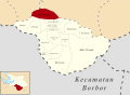
 (Peta Lokasi) Desa Patane I, Porsea, Tobasa.svg 512 × 419; 162 KB
-
 (Peta Lokasi) Desa Patane II, Porsea, Tobasa.svg 512 × 419; 162 KB
-
 (Peta Lokasi) Desa Patane IV, Porsea, Tobasa.svg 512 × 419; 162 KB
-
 (Peta Lokasi) Desa Patane V, Porsea, Tobasa.svg 512 × 419; 162 KB
-
 (Peta Lokasi) Desa Pintu Batu, Silaen, Tobasa.svg 512 × 384; 297 KB
-
 (Peta Lokasi) Desa Pintu Bosi, Laguboti, Tobasa.svg 512 × 465; 258 KB
-
-
 (Peta Lokasi) Desa Pintu Pohan, Pintu Pohan Meranti, Tobasa.svg 512 × 320; 96 KB
-
 (Peta Lokasi) Desa Purbatua, Borbor, Tobasa.svg 512 × 372; 167 KB
-
 (Peta Lokasi) Desa Raut Bosi, Porsea, Tobasa.svg 512 × 419; 162 KB
-
 (Peta Lokasi) Desa Rianiate, Borbor, Tobasa.svg 512 × 372; 167 KB
-
 (Peta Lokasi) Desa Riganjang, Borbor, Tobasa.svg 512 × 372; 167 KB
-
 (Peta Lokasi) Desa Sampuara, Uluan, Tobasa.svg 512 × 419; 203 KB
-
 (Peta Lokasi) Desa Saribu Raja Janji Maria, Balige, Tobasa.svg 512 × 469; 384 KB
-
 (Peta Lokasi) Desa Sianipar Sihailhail, Balige, Tobasa.svg 512 × 469; 384 KB
-
 (Peta Lokasi) Desa Siantar Dangsina, Siantar Narumonda, Tobasa.svg 512 × 363; 280 KB
-
 (Peta Lokasi) Desa Siantar Sigordang, Siantar Narumonda, Tobasa.svg 512 × 363; 280 KB
-
 (Peta Lokasi) Desa Siantar Sitiotio, Siantar Narumonda, Tobasa.svg 512 × 363; 280 KB
-
 (Peta Lokasi) Desa Siantar Tonga-tonga I, Siantar Narumonda, Tobasa.svg 512 × 363; 280 KB
-
 (Peta Lokasi) Desa Siantar Tonga-tonga II, Siantar Narumonda, Tobasa.svg 512 × 363; 280 KB
-
 (Peta Lokasi) Desa Siantar Utara, Parmaksian, Tobasa.svg 512 × 398; 166 KB
-
 (Peta Lokasi) Desa Siantarasa, Nassau, Tobasa.svg 512 × 439; 142 KB
-
 (Peta Lokasi) Desa Sibadihon, Bonatua Lunasi, Tobasa.svg 512 × 455; 141 KB
-
 (Peta Lokasi) Desa Sibarani Nasampulu, Laguboti, Tobasa.svg 512 × 465; 265 KB
-
 (Peta Lokasi) Desa Sibaruang, Lumban Julu, Tobasa.svg 512 × 427; 158 KB
-
 (Peta Lokasi) Desa Sibide Barat, Silaen, Tobasa.svg 512 × 410; 233 KB
-
 (Peta Lokasi) Desa Sibide, Silaen, Tobasa.svg 512 × 384; 297 KB
-
 (Peta Lokasi) Desa Sibolahotang Sas, Balige, Tobasa.svg 512 × 469; 384 KB
-
 (Peta Lokasi) Desa Siboruon, Balige, Tobasa.svg 512 × 469; 384 KB
-
 (Peta Lokasi) Desa Sibuea, Laguboti, Tobasa.svg 512 × 465; 258 KB
-
 (Peta Lokasi) Desa Sibuntuon, Balige, Tobasa.svg 512 × 469; 384 KB
-
 (Peta Lokasi) Desa Sibuntuon, Habinsaran, Tobasa.svg 512 × 461; 233 KB
-
 (Peta Lokasi) Desa Sibuntuon, Uluan, Tobasa.svg 512 × 419; 203 KB
-
 (Peta Lokasi) Desa Sidulang, Laguboti, Tobasa.svg 512 × 465; 258 KB
-
 (Peta Lokasi) Desa Sigaol Barat, Uluan, Tobasa.svg 512 × 419; 203 KB
-
 (Peta Lokasi) Desa Sigaol Timur, Uluan, Tobasa.svg 512 × 419; 203 KB
-
 (Peta Lokasi) Desa Sigapiton, Ajibata, Tobasa.svg 512 × 410; 137 KB
-
 (Peta Lokasi) Desa Sigodang Tua, Silaen, Tobasa.svg 512 × 384; 297 KB
-
 (Peta Lokasi) Desa Sigumpar Barat, Sigumpar, Tobasa.svg 512 × 433; 98 KB
-
 (Peta Lokasi) Desa Sigumpar Dangsina, Sigumpar, Tobasa.svg 512 × 433; 98 KB
-
 (Peta Lokasi) Desa Sigumpar Julu, Sigumpar, Tobasa.svg 512 × 433; 98 KB
-
 (Peta Lokasi) Desa Sigumpar, Sigumpar, Tobasa.svg 512 × 433; 98 KB
-
 (Peta Lokasi) Desa Sihiong, Bonatua Lunasi, Tobasa.svg 512 × 455; 141 KB
-
 (Peta Lokasi) Desa Silaen, Silaen, Tobasa.svg 512 × 384; 297 KB
-
 (Peta Lokasi) Desa Silalahi Pagar Batu, Balige, Tobasa.svg 512 × 469; 384 KB
-
 (Peta Lokasi) Desa Silamosik I, Porsea, Tobasa.svg 512 × 419; 162 KB
_Desa_Aek_Bolon_Jae,_Balige,_Tobasa.svg)
_Desa_Aek_Bolon_Julu,_Balige,_Tobasa.svg)
_Desa_Aek_Natolu_Jaya,_Lumban_Julu,_Tobasa.svg)
_Desa_Aek_Ulok,_Habinsaran,_Tobasa.svg)
_Desa_Aek_Unsim,_Borbor,_Tobasa.svg)
_Desa_Ambar_Halim,_Pintu_Pohan_Meranti,_Tobasa.svg)
_Desa_Amborgang,_Porsea,_Tobasa.svg)
_Desa_Aruan,_Laguboti,_Tobasa.svg)
_Desa_Balige_II,_Balige,_Tobasa.svg)
_Desa_Banjar_Ganjang,_Parmaksian,_Tobasa.svg)
_Desa_Banua_Huta,_Sigumpar,_Tobasa.svg)
_Desa_Baruara,_Balige,_Tobasa.svg)
_Desa_Batu_Manumpak,_Nassau,_Tobasa.svg)
_Desa_Batu_Nabolon,_Habinsaran,_Tobasa.svg)
_Desa_Bius_Gu_Barat,_Parmaksian,_Tobasa.svg)
_Desa_Bonan_Dolok_I,_Balige,_Tobasa.svg)
_Desa_Bonan_Dolok_II,_Balige,_Tobasa.svg)
_Desa_Bonan_Dolok_III,_Balige,_Tobasa.svg)
_Desa_Cinta_Damai,_Nassau,_Tobasa.svg)
_Desa_Dalihan_Natolu,_Silaen,_Tobasa.svg)
_Desa_Dolok_Jior,_Sigumpar,_Tobasa.svg)
_Desa_Dolok_Nagodang,_Uluan,_Tobasa.svg)
_Desa_Dolok_Nauli,_Parmaksian,_Tobasa.svg)
_Desa_Dolok_Saribu_Janji_Matogu,_Uluan,_Tobasa.svg)
_Desa_Dolok_Saribu_Lumban_Nabolon,_Uluan,_Tobasa.svg)
_Desa_Galagala_Pangkailan,_Porsea,_Tobasa.svg)
_Desa_Gasaribu,_Laguboti,_Tobasa.svg)
_Desa_Gurgur_Aek_Raja,_Tampahan,_Tobasa.svg)
_Desa_Halado,_Pintu_Pohan_Meranti,_Tobasa.svg)
_Desa_Harungguan,_Bonatua_Lunasi,_Tobasa.svg)
_Desa_Hatinggian,_Lumban_Julu,_Tobasa.svg)
_Desa_Haunatas_I,_Laguboti,_Tobasa.svg)
_Desa_Haunatas_II,_Laguboti,_Tobasa.svg)
_Desa_Hinalang_Bagasan,_Balige,_Tobasa.svg)
_Desa_Hitetano,_Habinsaran,_Tobasa.svg)
_Desa_Horsik,_Ajibata,_Tobasa.svg)
_Desa_Huta_Bulu_Mejan,_Balige,_Tobasa.svg)
_Desa_Huta_Dame,_Balige,_Tobasa.svg)
_Desa_Huta_Gurgur_I,_Silaen,_Tobasa.svg)
_Desa_Huta_Gurgur_II,_Silaen,_Tobasa.svg)
_Desa_Huta_Gurgur,_Borbor,_Tobasa.svg)
_Desa_Huta_Namora,_Balige,_Tobasa.svg)
_Desa_Huta_Namora,_Lumban_Julu,_Tobasa.svg)
_Desa_Huta_Namora,_Silaen,_Tobasa.svg)
_Desa_Hutagaol_Peatalun,_Balige,_Tobasa.svg)
_Desa_Hutagaol_Sihujur,_Silaen,_Tobasa.svg)
_Desa_Jangga_Dolok,_Lumban_Julu,_Tobasa.svg)
_Desa_Jangga_Toruan,_Lumban_Julu,_Tobasa.svg)
_Desa_Janji_Maria,_Borbor,_Tobasa.svg)
_Desa_Jonggi_Manulus,_Parmaksian,_Tobasa.svg)
_Desa_Jonggi_Nihuta,_Lumban_Julu,_Tobasa.svg)
_Desa_Liat_Tondung,_Nassau,_Tobasa.svg)
_Desa_Lintong_Julu,_Lumban_Julu,_Tobasa.svg)
_Desa_Lintong_Nihuta,_Tampahan,_Tobasa.svg)
_Desa_Lintong,_Borbor,_Tobasa.svg)
_Desa_Lobu_Hole,_Habinsaran,_Tobasa.svg)
_Desa_Longat,_Balige,_Tobasa.svg)
_Desa_Lumban_Bagasan,_Laguboti,_Tobasa.svg)
_Desa_Lumban_Balik,_Habinsaran,_Tobasa.svg)
_Desa_Lumban_Binanga,_Laguboti,_Tobasa.svg)
_Desa_Lumban_Binanga,_Uluan,_Tobasa.svg)
_Desa_Lumban_Bulbul,_Balige,_Tobasa.svg)
_Desa_Lumban_Dolok,_Silaen,_Tobasa.svg)
_Desa_Lumban_Gaol,_Balige,_Tobasa.svg)
_Desa_Lumban_Gaol,_Habinsaran,_Tobasa.svg)
_Desa_Lumban_Gorat,_Balige,_Tobasa.svg)
_Desa_Lumban_Gurning,_Porsea,_Tobasa.svg)
_Desa_Lumban_Holbung,_Uluan,_Tobasa.svg)
_Desa_Lumban_Huala,_Parmaksian,_Tobasa.svg)
_Desa_Lumban_Lintong,_Habinsaran,_Tobasa.svg)
_Desa_Lumban_Lobu,_Bonatua_Lunasi,_Tobasa.svg)
_Desa_Lumban_Manurung,_Parmaksian,_Tobasa.svg)
_Desa_Lumban_Nabolon,_Uluan,_Tobasa.svg)
_Desa_Lumban_Pea_Timur,_Balige,_Tobasa.svg)
_Desa_Lumban_Pea,_Balige,_Tobasa.svg)
_Desa_Lumban_Pea,_Habinsaran,_Tobasa.svg)
_Desa_Lumban_Pinasa_Saroha,_Habinsaran,_Tobasa.svg)
_Desa_Lumban_Pinasa,_Habinsaran,_Tobasa.svg)
_Desa_Lumban_Rau_Barat,_Habinsaran,_Tobasa.svg)
_Desa_Lumban_Rau_Selatan,_Habinsaran,_Tobasa.svg)
_Desa_Lumban_Rau_Tengah,_Nassau,_Tobasa.svg)
_Desa_Lumban_Rau_Tenggara,_Nassau,_Tobasa.svg)
_Desa_Lumban_Rau_Timur,_Nassau,_Tobasa.svg)
_Desa_Lumban_Rau_Utara,_Nassau,_Tobasa.svg)
_Desa_Lumban_Ruhap,_Habinsaran,_Tobasa.svg)
_Desa_Lumban_Sangkalan,_Bonatua_Lunasi,_Tobasa.svg)
_Desa_Lumban_Sewa,_Borbor,_Tobasa.svg)
_Desa_Lumban_Silintong,_Balige,_Tobasa.svg)
_Desa_Lumban_Sitorus,_Parmaksian,_Tobasa.svg)
_Desa_Maju,_Sigumpar,_Tobasa.svg)
_Desa_Marbulang,_Silaen,_Tobasa.svg)
_Desa_Marom,_Uluan,_Tobasa.svg)
_Desa_Marsangap,_Sigumpar,_Tobasa.svg)
_Desa_Matio,_Balige,_Tobasa.svg)
_Desa_Meat,_Tampahan,_Tobasa.svg)
_Desa_Meranti_Barat,_Silaen,_Tobasa.svg)
_Desa_Meranti_Tengah,_Pintu_Pohan_Meranti,_Tobasa.svg)
_Desa_Meranti_Timur,_Pintu_Pohan_Meranti,_Tobasa.svg)
_Desa_Meranti_Utara,_Pintu_Pohan_Meranti,_Tobasa.svg)
_Desa_Motung,_Ajibata,_Tobasa.svg)
_Desa_Naga_Timbul_Timur,_Bonatua_Lunasi,_Tobasa.svg)
_Desa_Naga_Timbul,_Bonatua_Lunasi,_Tobasa.svg)
_Desa_Nalela,_Porsea,_Tobasa.svg)
_Desa_Napajoring,_Nassau,_Tobasa.svg)
_Desa_Napitupulu,_Silaen,_Tobasa.svg)
_Desa_Narumonda_I,_Siantar_Narumonda,_Tobasa.svg)
_Desa_Narumonda_II,_Siantar_Narumonda,_Tobasa.svg)
_Desa_Narumonda_III,_Siantar_Narumonda,_Tobasa.svg)
_Desa_Narumonda_IV,_Siantar_Narumonda,_Tobasa.svg)
_Desa_Narumonda_V,_Siantar_Narumonda,_Tobasa.svg)
_Desa_Narumonda_VI,_Siantar_Narumonda,_Tobasa.svg)
_Desa_Narumonda_VII,_Siantar_Narumonda,_Tobasa.svg)
_Desa_Narumonda_VIII,_Siantar_Narumonda,_Tobasa.svg)
_Desa_Natolutali,_Silaen,_Tobasa.svg)
_Desa_Natumingka,_Borbor,_Tobasa.svg)
_Desa_Nauli,_Sigumpar,_Tobasa.svg)
_Desa_Ombur,_Silaen,_Tobasa.svg)
_Desa_Ompu_Raja_Hatulian,_Laguboti,_Tobasa.svg)
_Desa_Ompu_Raja_Hutapea_Timur,_Laguboti,_Tobasa.svg)
_Desa_Ompu_Raja_Hutapea,_Laguboti,_Tobasa.svg)
_Desa_Pagar_Batu,_Habinsaran,_Tobasa.svg)
_Desa_Paindoan,_Balige,_Tobasa.svg)
_Desa_Panamparan,_Habinsaran,_Tobasa.svg)
_Desa_Pangombusan,_Parmaksian,_Tobasa.svg)
_Desa_Pangujungan,_Habinsaran,_Tobasa.svg)
_Desa_Pangururan_II,_Borbor,_Tobasa.svg)
_Desa_Pangururan_III,_Borbor,_Tobasa.svg)
_Desa_Pangururan,_Borbor,_Tobasa.svg)
_Desa_Panindii,_Silaen,_Tobasa.svg)
_Desa_Pararungan,_Habinsaran,_Tobasa.svg)
_Desa_Parbagasan_Janji_Matogu,_Uluan,_Tobasa.svg)
_Desa_Pardamean_Ajibata,_Ajibata,_Tobasa.svg)
_Desa_Pardamean_Sibisa,_Ajibata,_Tobasa.svg)
_Desa_Pardinggaran,_Laguboti,_Tobasa.svg)
_Desa_Pardolok_Lumban_Lobu,_Bonatua_Lunasi,_Tobasa.svg)
_Desa_Pardomuan_Ajibata,_Ajibata,_Tobasa.svg)
_Desa_Pardomuan_Motung,_Ajibata,_Tobasa.svg)
_Desa_Pardomuan_Nauli,_Borbor,_Tobasa.svg)
_Desa_Pardomuan_Nauli,_Laguboti,_Tobasa.svg)
_Desa_Pardomuan,_Silaen,_Tobasa.svg)
_Desa_Parhabinsaran_Janji_Matogu,_Uluan,_Tobasa.svg)
_Desa_Parik,_Uluan,_Tobasa.svg)
_Desa_Parparean_I,_Porsea,_Tobasa.svg)
_Desa_Parparean_II,_Porsea,_Tobasa.svg)
_Desa_Parparean_IV,_Porsea,_Tobasa.svg)
_Desa_Parsambilan,_Silaen,_Tobasa.svg)
_Desa_Parsaoran_Sibisa,_Ajibata,_Tobasa.svg)
_Desa_Parsoburan_Barat,_Habinsaran,_Tobasa.svg)
_Desa_Parsuratan,_Balige,_Tobasa.svg)
_Desa_Partor_Janji_Matogu,_Uluan,_Tobasa.svg)
_Desa_Partoruan_Janji_Matogu,_Uluan,_Tobasa.svg)
_Desa_Partoruan_Lumban_Lobu,_Bonatua_Lunasi,_Tobasa.svg)
_Desa_Pasar_Borbor,_Borbor,_Tobasa.svg)
_Desa_Pasar_Lumban_Julu,_Lumban_Julu,_Tobasa.svg)
_Desa_Patane_I,_Porsea,_Tobasa.svg)
_Desa_Patane_II,_Porsea,_Tobasa.svg)
_Desa_Patane_IV,_Porsea,_Tobasa.svg)
_Desa_Patane_V,_Porsea,_Tobasa.svg)
_Desa_Pintu_Batu,_Silaen,_Tobasa.svg)
_Desa_Pintu_Bosi,_Laguboti,_Tobasa.svg)
_Desa_Pintu_Pohan_Dolok,_Pintu_Pohan_Meranti,_Tobasa.svg)
_Desa_Pintu_Pohan,_Pintu_Pohan_Meranti,_Tobasa.svg)
_Desa_Purbatua,_Borbor,_Tobasa.svg)
_Desa_Raut_Bosi,_Porsea,_Tobasa.svg)
_Desa_Rianiate,_Borbor,_Tobasa.svg)
_Desa_Riganjang,_Borbor,_Tobasa.svg)
_Desa_Sampuara,_Uluan,_Tobasa.svg)
_Desa_Saribu_Raja_Janji_Maria,_Balige,_Tobasa.svg)
_Desa_Sianipar_Sihailhail,_Balige,_Tobasa.svg)
_Desa_Siantar_Dangsina,_Siantar_Narumonda,_Tobasa.svg)
_Desa_Siantar_Sigordang,_Siantar_Narumonda,_Tobasa.svg)
_Desa_Siantar_Sitiotio,_Siantar_Narumonda,_Tobasa.svg)
_Desa_Siantar_Tonga-tonga_I,_Siantar_Narumonda,_Tobasa.svg)
_Desa_Siantar_Tonga-tonga_II,_Siantar_Narumonda,_Tobasa.svg)
_Desa_Siantar_Utara,_Parmaksian,_Tobasa.svg)
_Desa_Siantarasa,_Nassau,_Tobasa.svg)
_Desa_Sibadihon,_Bonatua_Lunasi,_Tobasa.svg)
_Desa_Sibarani_Nasampulu,_Laguboti,_Tobasa.svg)
_Desa_Sibaruang,_Lumban_Julu,_Tobasa.svg)
_Desa_Sibide_Barat,_Silaen,_Tobasa.svg)
_Desa_Sibide,_Silaen,_Tobasa.svg)
_Desa_Sibolahotang_Sas,_Balige,_Tobasa.svg)
_Desa_Siboruon,_Balige,_Tobasa.svg)
_Desa_Sibuea,_Laguboti,_Tobasa.svg)
_Desa_Sibuntuon,_Balige,_Tobasa.svg)
_Desa_Sibuntuon,_Habinsaran,_Tobasa.svg)
_Desa_Sibuntuon,_Uluan,_Tobasa.svg)
_Desa_Sidulang,_Laguboti,_Tobasa.svg)
_Desa_Sigaol_Barat,_Uluan,_Tobasa.svg)
_Desa_Sigaol_Timur,_Uluan,_Tobasa.svg)
_Desa_Sigapiton,_Ajibata,_Tobasa.svg)
_Desa_Sigodang_Tua,_Silaen,_Tobasa.svg)
_Desa_Sigumpar_Barat,_Sigumpar,_Tobasa.svg)
_Desa_Sigumpar_Dangsina,_Sigumpar,_Tobasa.svg)
_Desa_Sigumpar_Julu,_Sigumpar,_Tobasa.svg)
_Desa_Sigumpar,_Sigumpar,_Tobasa.svg)
_Desa_Sihiong,_Bonatua_Lunasi,_Tobasa.svg)
_Desa_Silaen,_Silaen,_Tobasa.svg)
_Desa_Silalahi_Pagar_Batu,_Balige,_Tobasa.svg)
_Desa_Silamosik_I,_Porsea,_Tobasa.svg)
&filefrom=%28Peta+Lokasi%29+Desa+Silamosik+II%2C+Bonatua+Lunasi%2C+Tobasa.svg#mw-category-media)